vbs - armasuisse bundesamt für landestopografie swisstopo office fédéral de topographie swisstopo...
Post on 21-Dec-2015
220 views
TRANSCRIPT
VBS - armasuisseBundesamt für Landestopografie swisstopoOffice fédéral de topographie swisstopoUfficio federale di topografia swisstopo
The National Spatial Data Infrastructure (NSDI)Die Nationale Geodaten Infrastruktur NGDIL’infrastructure nationale des données géographiques INDG
Swiss Geoscience Meeting 2008A. Buogo, R. Buser, R. Sonney, A. Wiget - swisstopo
2 Federal Office of Topography swisstopo
SGM 2008 (Lugano) - Symposium 12 - NSDI
• Goals
• Definitions
• The National Spatial Data Infrastructure
Agenda
3 Federal Office of Topography swisstopo
SGM 2008 (Lugano) - Symposium 12 - NSDI
To introduce
• the National Spatial Data Infrastructure
To explain
• the components of the NSDI
• the strategy
• the framework, in which it is established
Goals
4 Federal Office of Topography swisstopo
SGM 2008 (Lugano) - Symposium 12 - NSDI
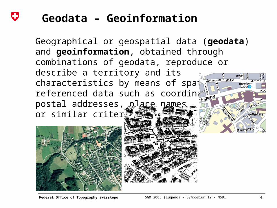
Geodata – Geoinformation
Geographical or geospatial data (geodata) and geoinformation, obtained through combinations of geodata, reproduce or describe a territory and its characteristics by means of spatially referenced data such as coordinates, postal addresses, place namesor similar criteria.
6 Federal Office of Topography swisstopo
SGM 2008 (Lugano) - Symposium 12 - NSDI
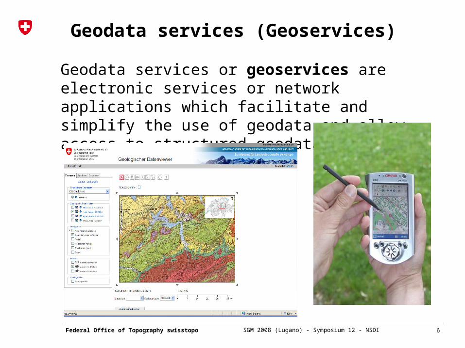
Geodata services (Geoservices)
Geodata services or geoservices are electronic services or network applications which facilitate and simplify the use of geodata and allow access to structured geodata.
8 Federal Office of Topography swisstopo
SGM 2008 (Lugano) - Symposium 12 - NSDI
Spatial Data Infrastructure SDI
• In order to use geo-information effectively, it must be up-to-date, compatible and available on a broad basis.
• Coordinated policies as well as uniform standards and technologies are essential on global, national and local levels.
• A Spatial Data Infrastructure is a public access system
of (political) measures, institutional facilities, technologies, data and people allowing a common exchange and efficient use of geographical information
• The goal of a SDI is to provide users direct access to geodata, geoinformation and geoservices from a variety of suppliers.
9 Federal Office of Topography swisstopo
SGM 2008 (Lugano) - Symposium 12 - NSDI
Spatial Data Infrastructure SDI
• SDIs exist on different levels:
- the Global Spatial Data Infrastructure promotesinternational cooperation since mid 1990’s
- the National Spatial Data Infrastructure includespublic organisations as well as private enterprises on the national level
- the Federal Spatial Data Infrastructure concerns the geodata of the Confederation
- cantons set up Cantonal Spatial DataInfrastructures
10 Federal Office of Topography swisstopo
SGM 2008 (Lugano) - Symposium 12 - NSDI
Federal strategy for geoinformation
Interdepartmental GI&GIS-Coordination Group: • National Spatial Data Infrastructure for the whole
country• Basic geoinformation shall be available easily
and on easy terms• Coordination with the cantons and communities• New legal bases if needed• Personal data protection, copyrights, liability, etc.
are taken into consideration• Standards for data production and data transfer
(metadata, modelling, formats)
11 Federal Office of Topography swisstopo
SGM 2008 (Lugano) - Symposium 12 - NSDI
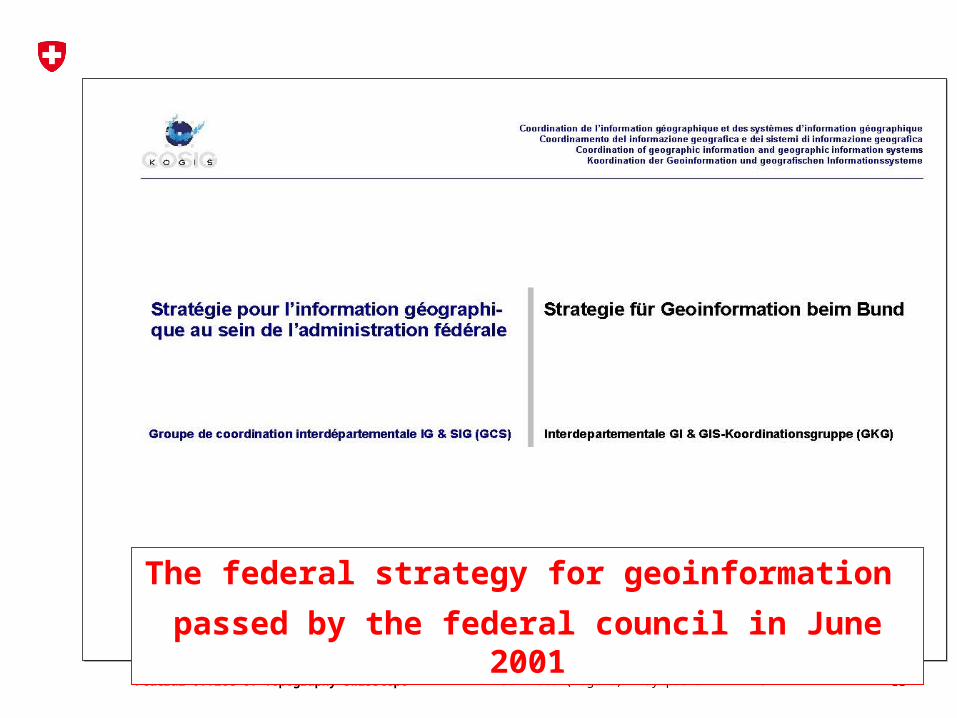
The federal strategy for geoinformation
passed by the federal council in June 2001
13 Federal Office of Topography swisstopo
SGM 2008 (Lugano) - Symposium 12 - NSDI
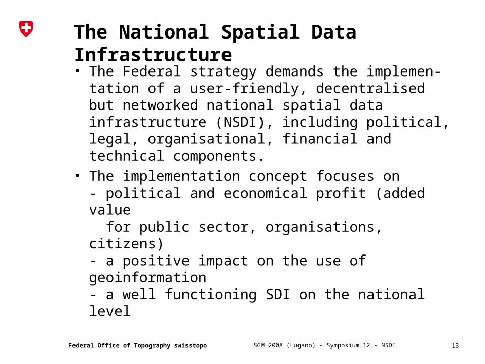
The National Spatial Data Infrastructure
• The Federal strategy demands the implemen-tation of a user-friendly, decentralised but networked national spatial data infrastructure (NSDI), including political, legal, organisational, financial and technical components.
• The implementation concept focuses on - political and economical profit (added value for public sector, organisations, citizens)- a positive impact on the use of geoinformation- a well functioning SDI on the national level
18 Federal Office of Topography swisstopo
SGM 2008 (Lugano) - Symposium 12 - NSDI
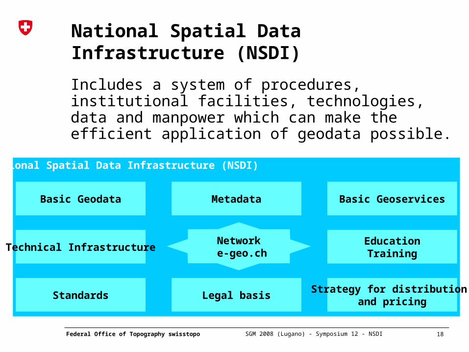
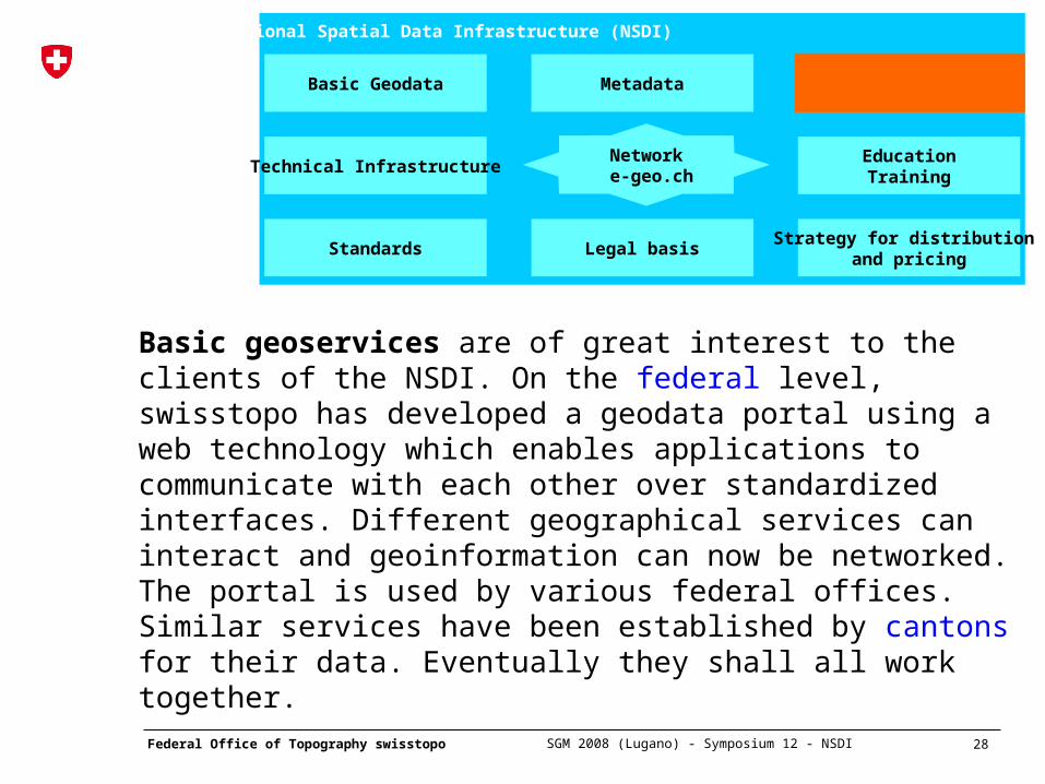
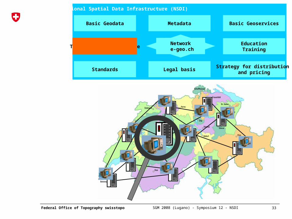
National Spatial Data Infrastructure (NSDI)
Basic Geodata Metadata Basic Geoservices
Technical Infrastructure
Standards Legal basisStrategy for distribution
and pricing
EducationTraining
Network e-geo.ch
National Spatial Data Infrastructure (NSDI)
Includes a system of procedures, institutional facilities, technologies, data and manpower which can make the efficient application of geodata possible.
21 Federal Office of Topography swisstopo
SGM 2008 (Lugano) - Symposium 12 - NSDI
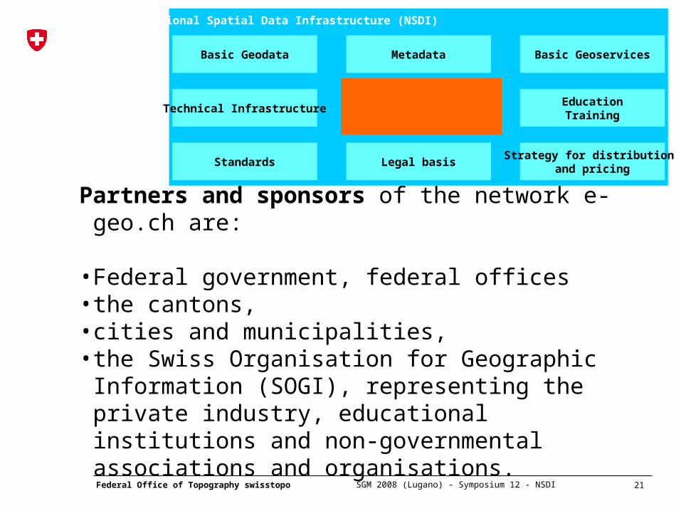
Partners and sponsors of the network e-geo.ch are:
• Federal government, federal offices• the cantons,• cities and municipalities, • the Swiss Organisation for Geographic Information
(SOGI), representing the private industry, educational institutions and non-governmental associations and organisations.
National Spatial Data Infrastructure (NSDI)
Basic Geodata Metadata Basic Geoservices
Technical Infrastructure
Standards Legal basisStrategy for distribution
and pricing
EducationTraining
Network e-geo.ch
24 Federal Office of Topography swisstopo
SGM 2008 (Lugano) - Symposium 12 - NSDI
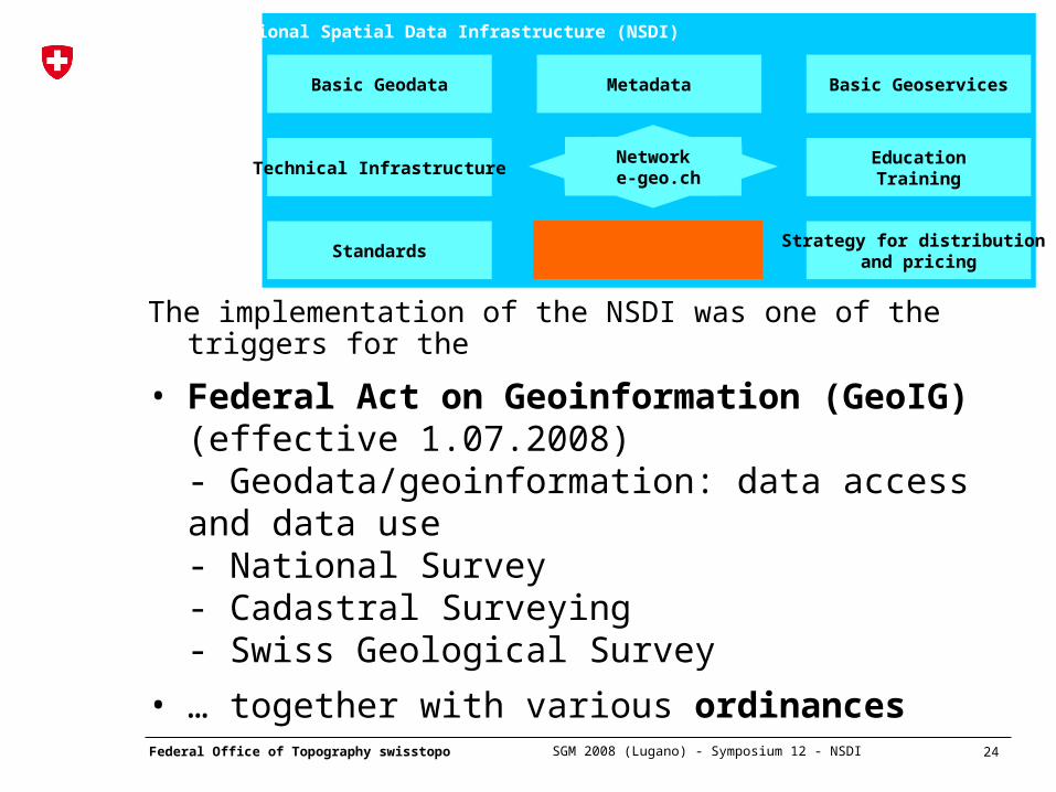
The implementation of the NSDI was one of the triggers for the
• Federal Act on Geoinformation (GeoIG) (effective 1.07.2008)- Geodata/geoinformation: data access and data use- National Survey- Cadastral Surveying- Swiss Geological Survey
• … together with various ordinances
National Spatial Data Infrastructure (NSDI)
Basic Geodata Metadata Basic Geoservices
Technical Infrastructure
Standards Legal basisStrategy for distribution
and pricing
EducationTraining
Network e-geo.ch
25 Federal Office of Topography swisstopo
SGM 2008 (Lugano) - Symposium 12 - NSDI
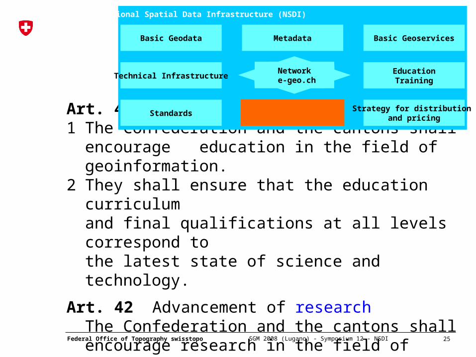
Art. 40 Advancement of education1 The Confederation and the cantons shall encourage
education in the field of geoinformation.2 They shall ensure that the education curriculum
and final qualifications at all levels correspond tothe latest state of science and technology.
Art. 42 Advancement of researchThe Confederation and the cantons shall encourage research in the field of geoinformation.
National Spatial Data Infrastructure (NSDI)
Basic Geodata Metadata Basic Geoservices
Technical Infrastructure
Standards Legal basisStrategy for distribution
and pricing
EducationTraining
Network e-geo.ch
26 Federal Office of Topography swisstopo
SGM 2008 (Lugano) - Symposium 12 - NSDI
National Spatial Data Infrastructure (NSDI)
Basic Geodata Metadata Basic Geoservices
Technical Infrastructure
Standards Legal basisStrategy for distribution
and pricing
EducationTraining
Network e-geo.ch
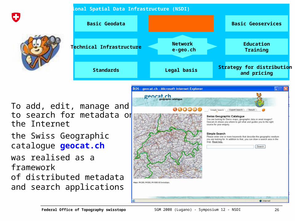
To add, edit, manage and to search for metadata on the Internet
the Swiss Geographic catalogue geocat.ch
was realised as a framework of distributed metadata and search applications
27 Federal Office of Topography swisstopo
SGM 2008 (Lugano) - Symposium 12 - NSDI
National Spatial Data Infrastructure (NSDI)
Basic Geodata Metadata Basic Geoservices
Technical Infrastructure
Standards Legal basisStrategy for distribution
and pricing
EducationTraining
Network e-geo.ch
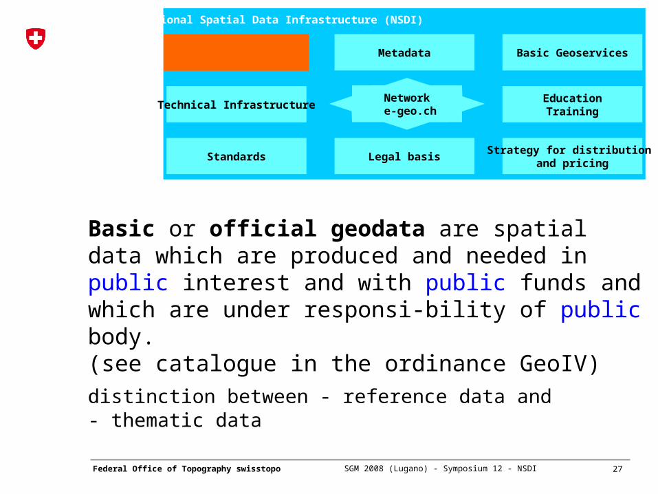
Basic or official geodata are spatial data which are produced and needed in public interest and with public funds and which are under responsi-bility of public body. (see catalogue in the ordinance GeoIV)
distinction between - reference data and - thematic data
28 Federal Office of Topography swisstopo
SGM 2008 (Lugano) - Symposium 12 - NSDI
National Spatial Data Infrastructure (NSDI)
Basic Geodata Metadata Basic Geoservices
Technical Infrastructure
Standards Legal basisStrategy for distribution
and pricing
EducationTraining
Network e-geo.ch
Basic geoservices are of great interest to the clients of the NSDI. On the federal level, swisstopo has developed a geodata portal using a web technology which enables applications to communicate with each other over standardized interfaces. Different geographical services can interact and geoinformation can now be networked. The portal is used by various federal offices. Similar services have been established by cantons for their data. Eventually they shall all work together.
29 Federal Office of Topography swisstopo
SGM 2008 (Lugano) - Symposium 12 - NSDI
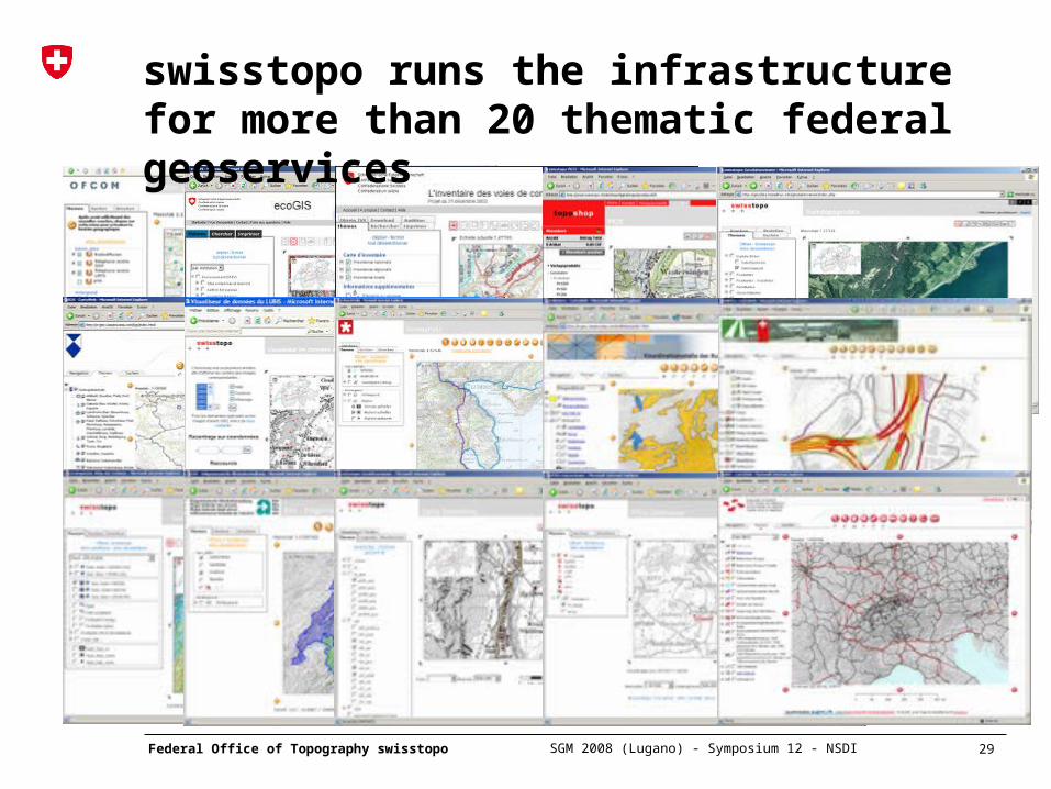
swisstopo runs the infrastructure for more than 20 thematic federal geoservices
30 Federal Office of Topography swisstopo
SGM 2008 (Lugano) - Symposium 12 - NSDI
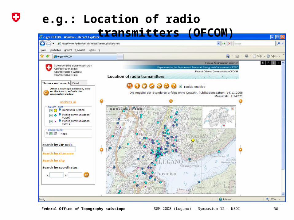
e.g.: Location of radio transmitters (OFCOM)
31 Federal Office of Topography swisstopo
SGM 2008 (Lugano) - Symposium 12 - NSDI
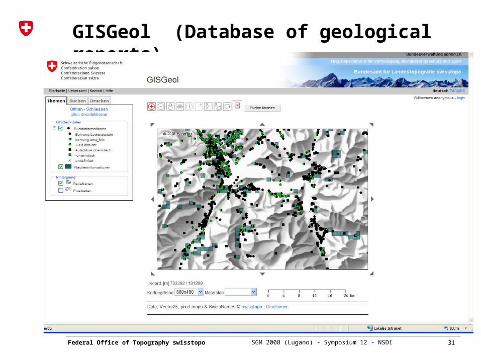
GISGeol (Database of geological reports)
32 Federal Office of Topography swisstopo
SGM 2008 (Lugano) - Symposium 12 - NSDI
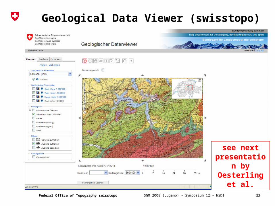
Geological Data Viewer (swisstopo)
see next presentation by Oesterling
et al.
33 Federal Office of Topography swisstopo
SGM 2008 (Lugano) - Symposium 12 - NSDI
National Spatial Data Infrastructure (NSDI)
Basic Geodata Metadata Basic Geoservices
Technical Infrastructure
Standards Legal basisStrategy for distribution
and pricing
EducationTraining
Network e-geo.ch
34 Federal Office of Topography swisstopo
SGM 2008 (Lugano) - Symposium 12 - NSDI
NSDINSDI
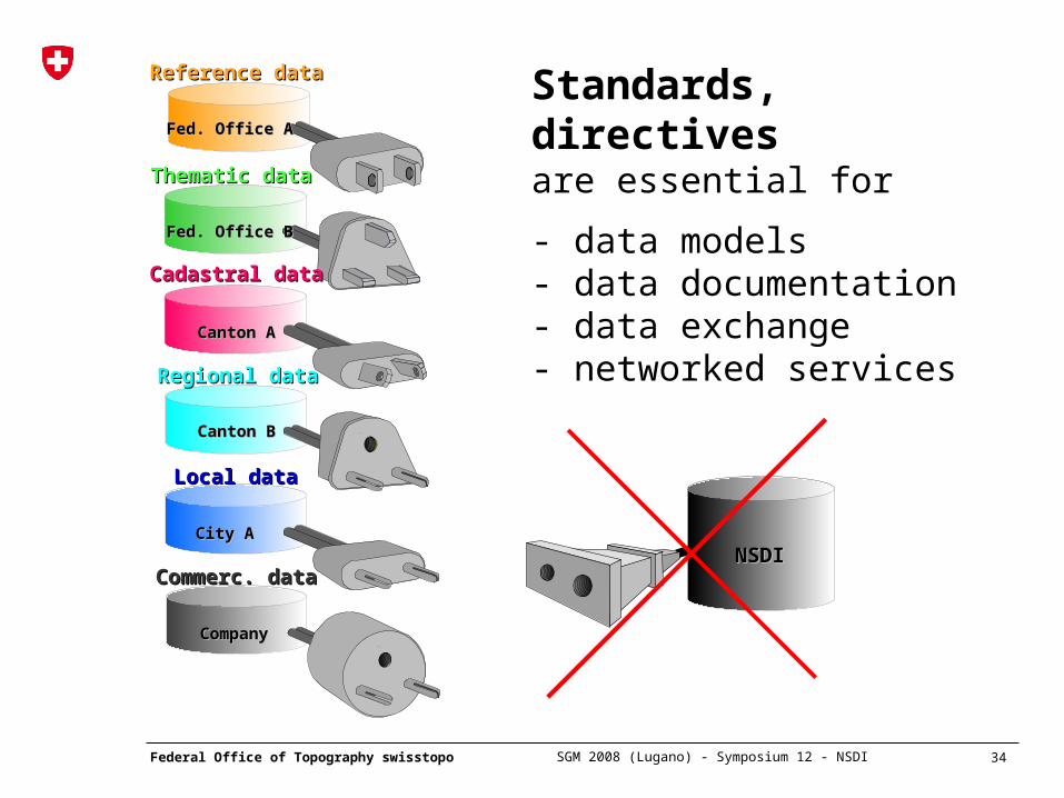
Standards, directives are essential for
- data models- data documentation- data exchange- networked services
Reference dataReference data
Fed. Office AFed. Office A
Thematic dataThematic data
Fed. Office BFed. Office B
Cadastral dataCadastral data
Canton ACanton A
Regional dataRegional data
Canton BCanton B
Local dataLocal data
City ACity A
Commerc. dataCommerc. data
CompanyCompany
35 Federal Office of Topography swisstopo
SGM 2008 (Lugano) - Symposium 12 - NSDI
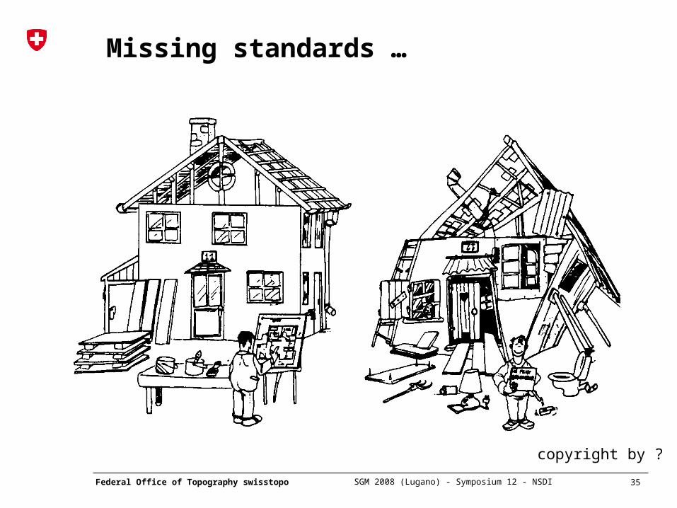
Missing standards …
copyright by ?
37 Federal Office of Topography swisstopo
SGM 2008 (Lugano) - Symposium 12 - NSDI
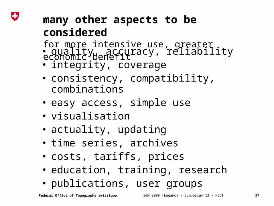
many other aspects to be considered for more intensive use, greater economic benefit
• quality, accuracy, reliability• integrity, coverage• consistency, compatibility, combinations• easy access, simple use• visualisation• actuality, updating• time series, archives• costs, tariffs, prices• education, training, research• publications, user groups
38 Federal Office of Topography swisstopo
SGM 2008 (Lugano) - Symposium 12 - NSDI
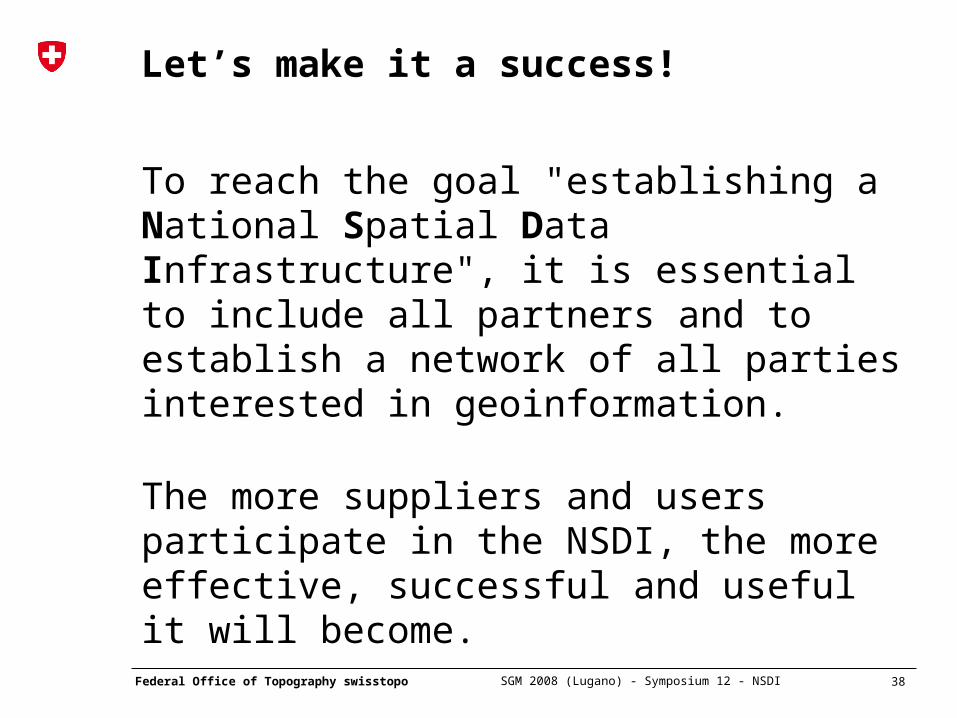
Let’s make it a success!
To reach the goal "establishing a National Spatial Data Infrastructure", it is essential to include all partners and to establish a network of all parties interested in geoinformation.
The more suppliers and users participate in the NSDI, the more effective, successful and useful it will become.
39 Federal Office of Topography swisstopo
SGM 2008 (Lugano) - Symposium 12 - NSDI
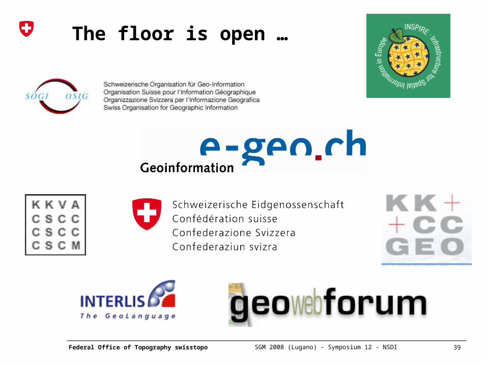
The floor is open …
40 Federal Office of Topography swisstopo
SGM 2008 (Lugano) - Symposium 12 - NSDI
The floor is open …
Thank you for your attention!