题目:XXXXXXXXXXXXXXXX
学科专业:XXXXXXXXX
指导教师:XXX 教授
研 究 生:XXX
天津大学XX毕业答辩
Application of Remote Sensing and GIS on
Flood Monitoring and Assessment in China
Pr. HUANG Shifeng China Institute of Water Resources & Hydropower Research,
Beijing, China
中国水利水电科学研究院 China Institute of Water Resources & Hydropower Research

Main Contents 1. Introduction of flood in China
2.Application of space technology on flood monitoring
3. Application of space technology on flood assessment
4. Integrated operational system of flood monitoring and assessment
5. Case study
6. Conclusion
1. Introduction of flood in China
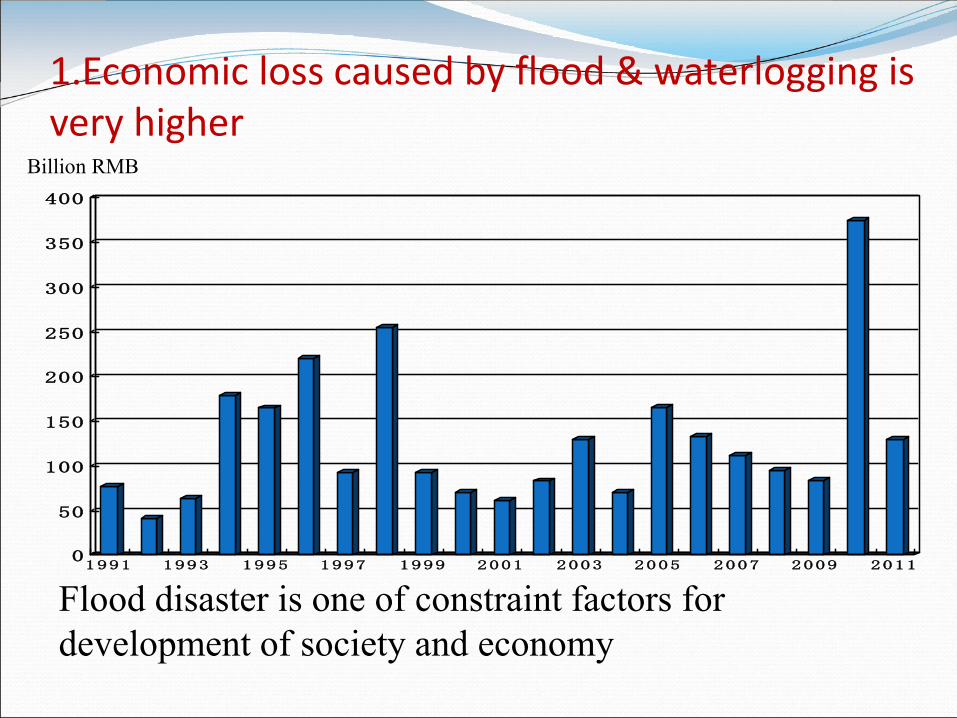
1.Economic loss caused by flood & waterlogging is very higher
Flood disaster is one of constraint factors for development of society and economy
0
50
100
150
200
250
300
350
400
1991 1993 1995 1997 1999 2001 2003 2005 2007 2009 2011
Billion RMB
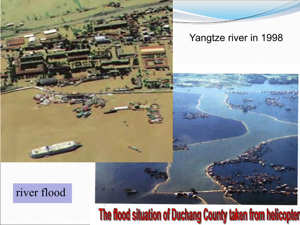
August 10, 1998
Yangtze river in 1998
river flood

Place: Zhouqu county, Gansu province Time: Aug.7, 2010 deaths: more than 1700
flash flood


Place: Fuhe river,
Jiangxi province
Time: June 21, 2010
dam -break flood
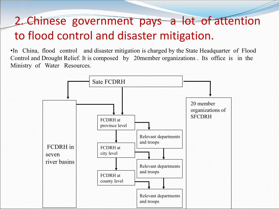
2. Chinese government pays a lot of attention to flood control and disaster mitigation.
•In China, flood control and disaster mitigation is charged by the State Headquarter of Flood Control and Drought Relief. It is composed by 20member organizations . Its office is in the Ministry of Water Resources.
Sate FCDRH
FCDRH at province level
FCDRH in seven river basins
FCDRH at city level
FCDRH at county level
Relevant departments and troops
Relevant departments and troops
Relevant departments and troops
20 member organizations of SFCDRH
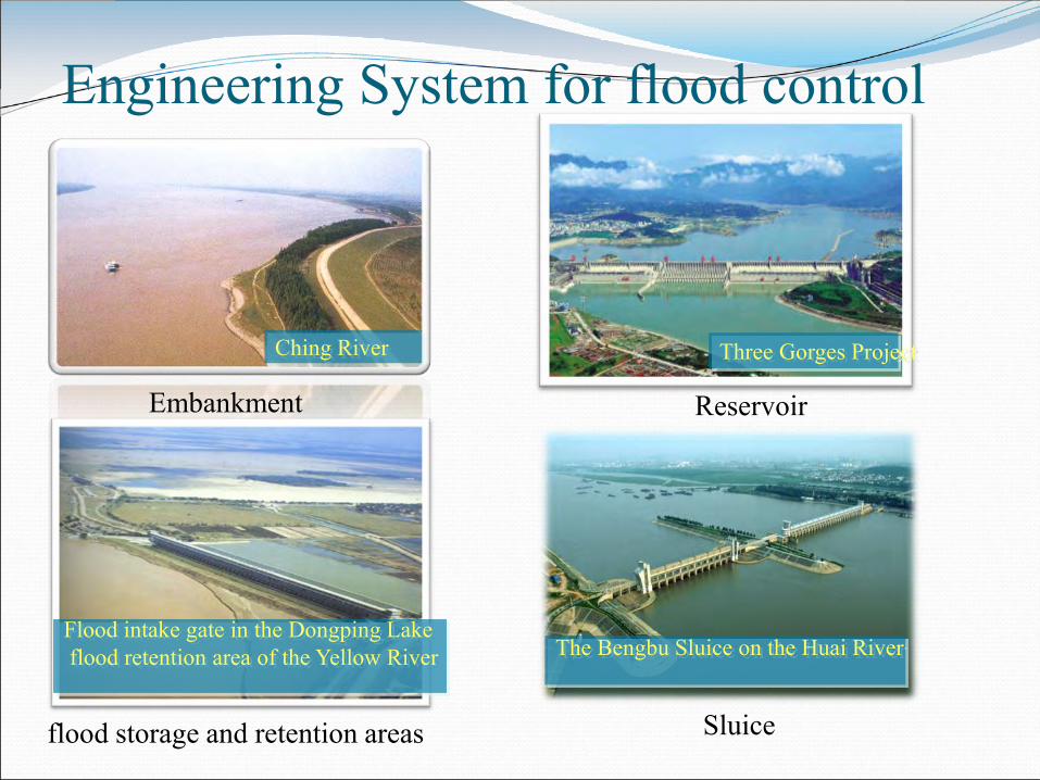
Engineering System for flood control
Ching River
Embankment
Three Gorges Project
Reservoir
Flood intake gate in the Dongping Lake flood retention area of the Yellow River
flood storage and retention areas
The Bengbu Sluice on the Huai River
Sluice
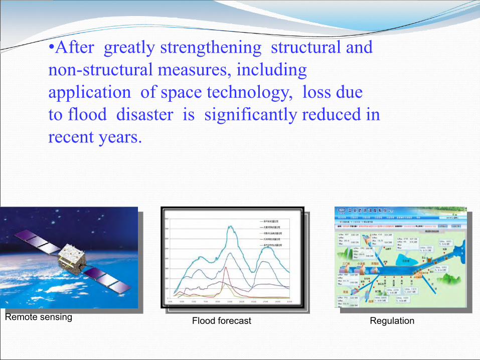
•After greatly strengthening structural and non-structural measures, including application of space technology, loss due to flood disaster is significantly reduced in recent years.
Remote sensing Flood forecast Regulation

3. Application of RS and GIS in flood control
Flood disaster monitoring
Remote sensing ,GPS current water body
difference between baseline is inundated area
Disaster assessment
Overlaying of inundated extent on GIS-based background database ( land use, social and economic database )
2. Flood monitoring based on space
technology

Platform of Flood Monitoring 1.Space-borne sensors:
1) Low resolution: NOAA(AVHRR)、FY-1、FY-2
2) Moderate resolution: EOS/MODIS
3) High resolution: Landsat (TM, ETM+), SPOT, CBERS-1, Radarsat, ERS,
ALOS ,TerraSAR, Cosmo-Skymed
2.Airborne sensors:
1)SAR (10,000~13,000m, all-weathered)
2) Hellicopter ( 900m, weather condition limitation)
3) Unmanned Aerial Vehicle
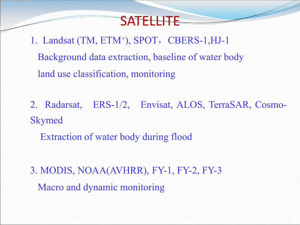
1. Landsat (TM, ETM+), SPOT,CBERS-1,HJ-1
Background data extraction, baseline of water body
land use classification, monitoring
2. Radarsat, ERS-1/2, Envisat, ALOS, TerraSAR, Cosmo-Skymed
Extraction of water body during flood
3. MODIS, NOAA(AVHRR), FY-1, FY-2, FY-3
Macro and dynamic monitoring
SATELLITE
TM image
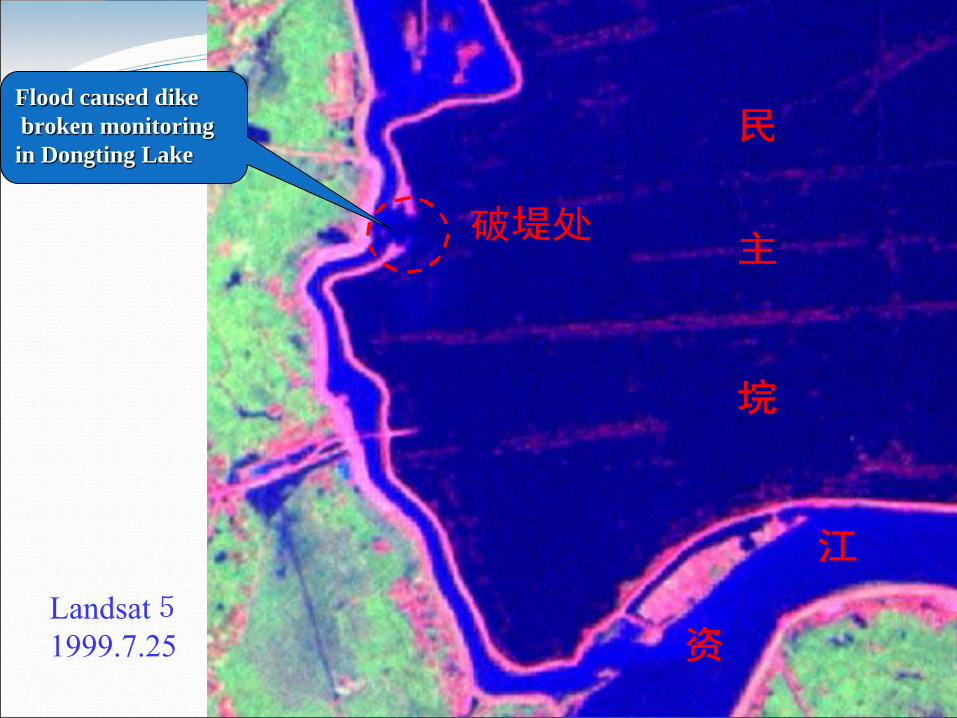
Landsat5 1999.7.25
主
江
资
破堤处
民
垸
Flood caused dike
broken monitoring
in Dongting Lake

RadarSat 1998.8.9
Railway

May 25, 1998 July 7, 1998
August 9, 1998 August 23, 1998
Macro and dynam
ic monitoring based on N
OA
A

Sketch Map of Aeroplane-Satellite-Ground System
Airborne SAR and real-time transmission system

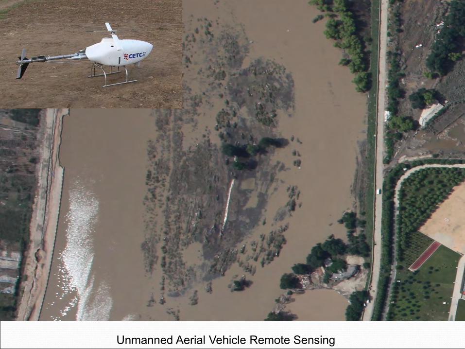
Unmanned Aerial Vehicle Remote Sensing
3. Flood disaster assessment based on space
technology

a
b
c
A : hazard-affected body distribution map
3
2
1
B:Flood intensity distribution map
+
a1
a2 c3
b2 b3
c2
a3
c1
C:Overlay result
Loss due to flood
D:vulnerability
+
Population agriculture estate ……
water conservancy project
Overlay
Type of
land use
Flood
intens
ity
Loss
ratio
a 1 80%
a 2 50%
a 3 10%
b 1 70%
… … …
Sketch map of flood disaster assessment based on GIS platform
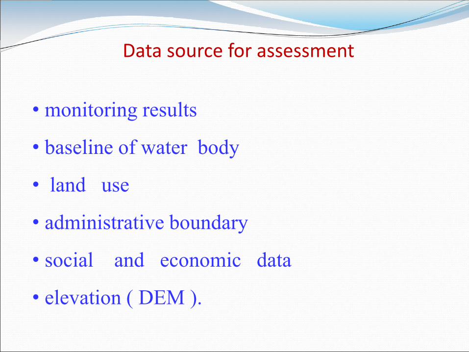
Data source for assessment
• monitoring results
• baseline of water body
• land use
• administrative boundary
• social and economic data
• elevation ( DEM ).
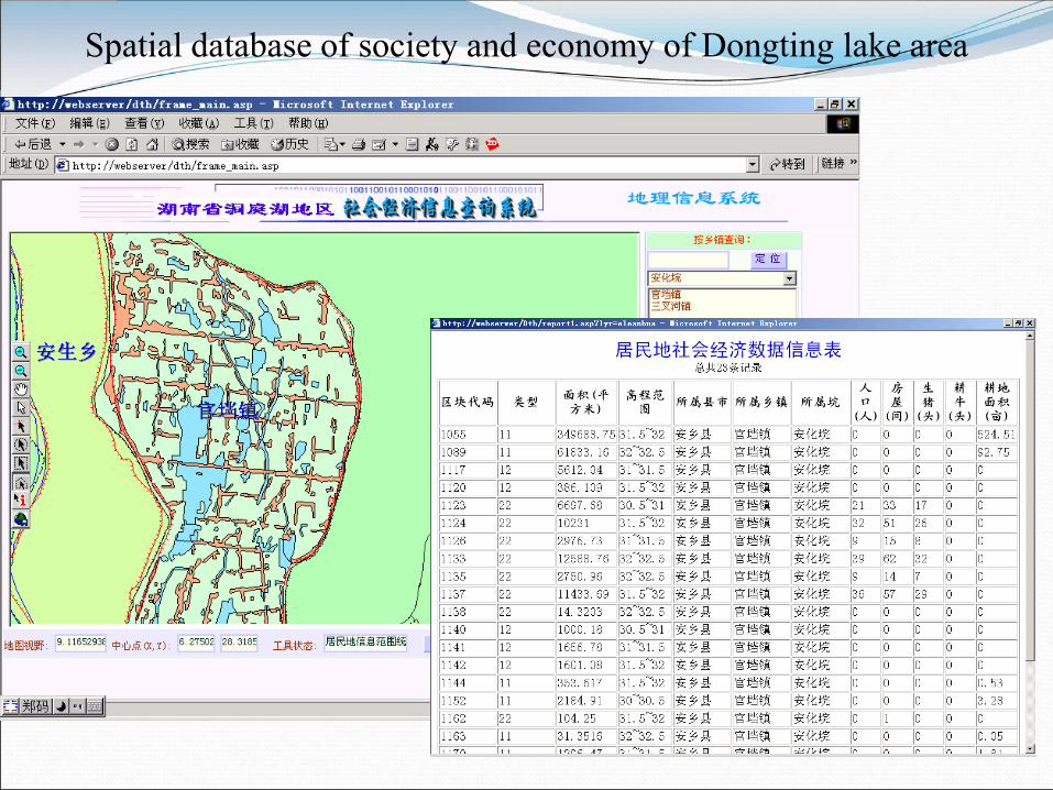
Spatial database of society and economy of Dongting lake area
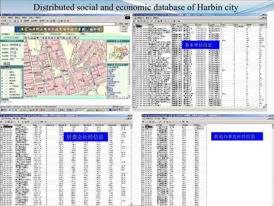
Distributed social and economic database of Harbin city
基本单位信息
居委会社经信息 街道办事处社经信息
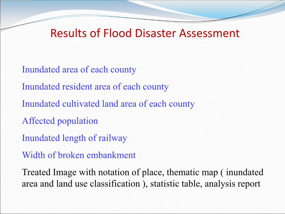
Results of Flood Disaster Assessment
Inundated area of each county
Inundated resident area of each county
Inundated cultivated land area of each county
Affected population
Inundated length of railway
Width of broken embankment
Treated Image with notation of place, thematic map ( inundated area and land use classification ), statistic table, analysis report

Analysis Report
Statistics table
Thematic Map
4. Integrated operational system of flood
monitoring and assessment

Operational system for flood monitoring and assessment is very important for the state. It is totally different with research. It uses mainly space technology for flood management in a routine way.

Interface of integrated operational system of flood monitoring and assessment
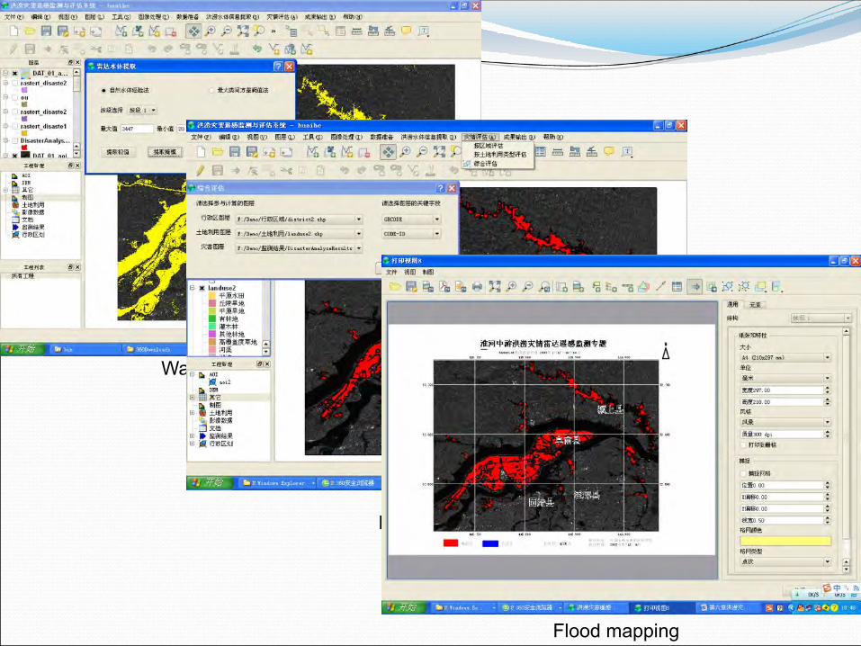
Water body auto extraction
Flood area extraction
Flood mapping

NSMC NRSCC State Council
RSGS RSTAC(MWR )
Air Force SHFCDR
NSMC: National Satellite Meteorology Center
RSGS: China Remote Sensing Satellite Ground Station
RSTAC: Remote Sensing Technology Application Center, MWR
NRSCC: National Remote Sensing Center of China
SHFCDR: State Headquarter of Flood Control & Drought Relief
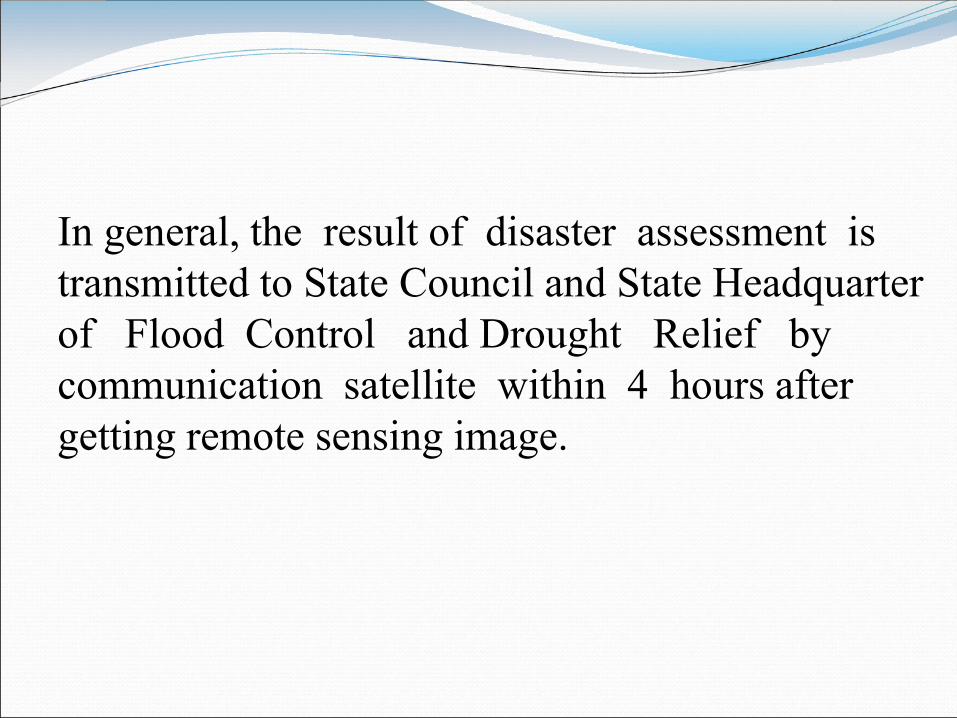
In general, the result of disaster assessment is transmitted to State Council and State Headquarter of Flood Control and Drought Relief by communication satellite within 4 hours after getting remote sensing image.

5. Case Study

1. Flood monitoring and assessment in the middle of Huaihe river in 2003
2. dam -break flood monitoring in Heilongjiang river in 2013
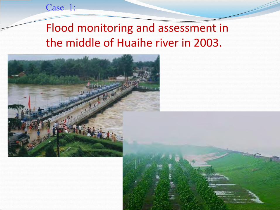
Case 1:
Flood monitoring and assessment in the middle of Huaihe river in 2003.

Five times continuous monitoring had been carried out:
2003.7.5 2003.7.7 2003.7.9 2003.7.12 2003.7.14
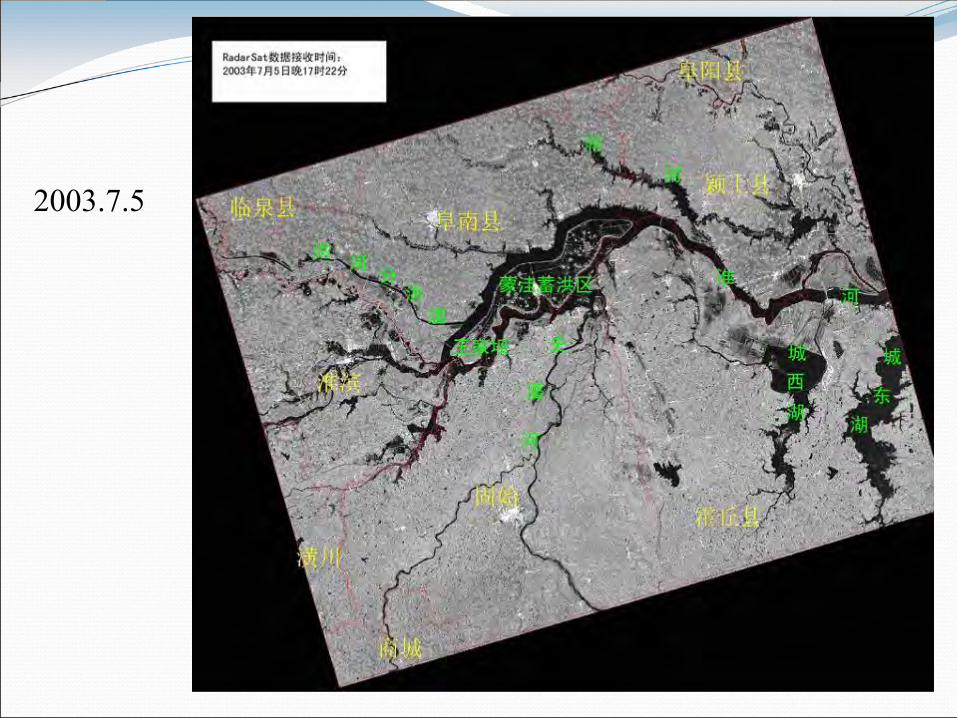
2003.7.5 Menwa flood basin

2003.7.7
Menwa flood retension
flood district

2003.7.9 Waterlogging
area

2003.7.12 Menwa
flood retention
flood district

王家坝 水位:28. 23m
Menwa
2003.7.5(17:22)
王家坝 水位:28. 23m
Menwa
2003.7.7(6:11)
王家坝 水位:28. 69m
Menwa
2003.7.12(18:18)
Menwa flood retention had been put in service twice
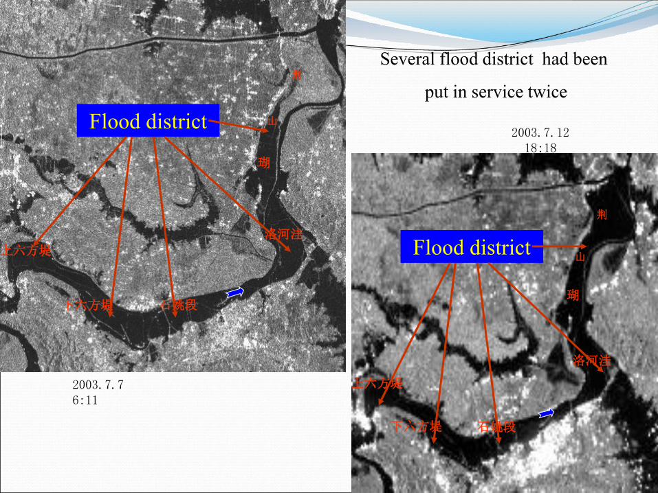
上六方堤
下六方堤
石姚段
荆
山
瑚
洛河洼
上六方堤
下六方堤
石姚段
荆
山
瑚
洛河洼
2003.7.12 18:18
2003.7.7 6:11
Flood district
Flood district
Several flood district had been
put in service twice
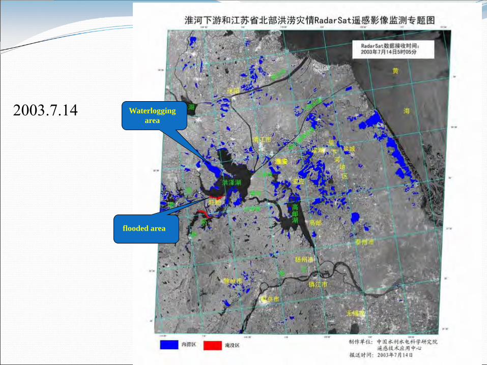
2003.7.14 Waterlogging
area
flooded area

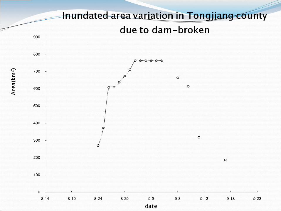
Case 2: dam -break flood monitoring in Heilongjiang river in 2013
Inundated Village in Tongjiang (2013.8.30)
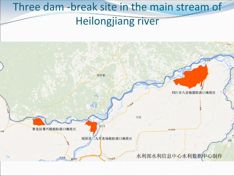
Three dam -break site in the main stream of Heilongjiang river

Date Satellite Data statistics
(Scene) (G) 2013/7/10
GF-1
4 3.97
2013/8/15 1 1.19 2013/8/20 3 2.62 2013/8/27 3 3.78 2013/8/28 9 11.3
2013/8/29 4 5.05
2013/9/1 6 7.53 2013/9/6 3 8.63 2013/9/7 1 0.789 2013/9/9 5 6.49
2013/9/13 3 3.59
2013/9/18 5 6.49 subtotal 52 61.43
2013/8/25
HJ-A/B
1 0.73 2013/8/26 1 0.65
2013/8/27 1 0.90
2013/8/29 1 0.95 subtotal 4 3.24
2013/8/26
RS-1(SAR)
1 0.55 2013/8/27 1 0.75
2013/8/29 3 0.47
2013/8/30 1 0.22 2013/8/31 1 0.20 2013/9/1 3 1.28 2013/9/2 4 0.29
2013/9/3 1 0.42
2013/9/4 2 0.62 2013/9/5 3 1.33 2013/9/6 1 0.44 2013/9/9 1 1.05
2013/9/11 3 1.68
subtotal 25 9.3
2013/8/18 Other satellites
2 2.31 2013/8/24 2 3.21
subtotal 4 5.52
total 80 79.49
Satellite image used in flood monitoring in Heilongjiang river

dam –break flood monitoring in Tongjiang county
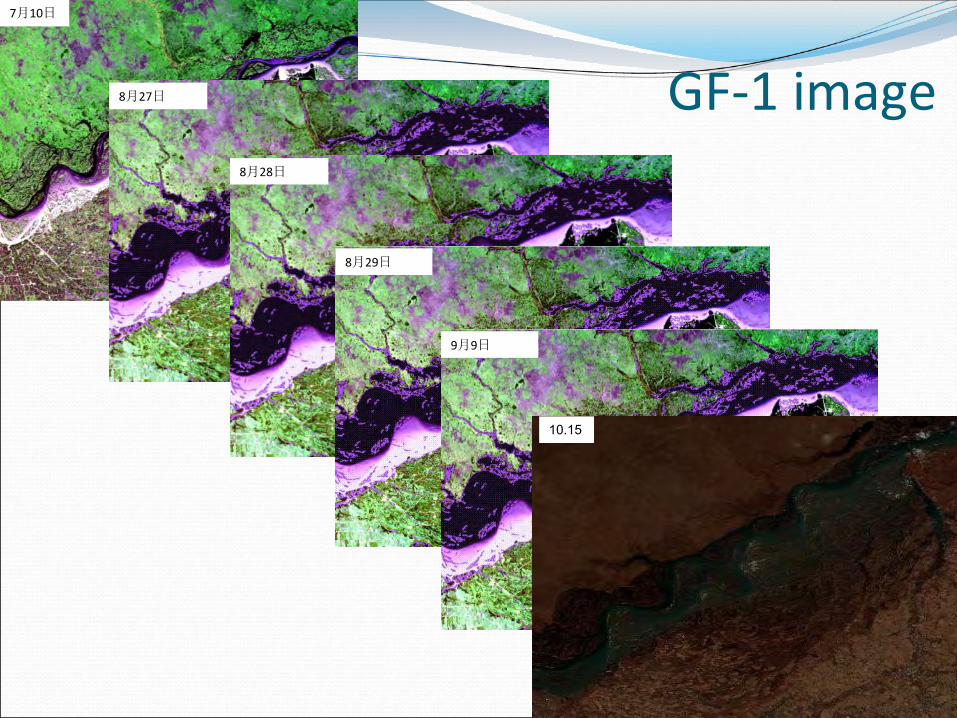
7月10日
GF-1 image 8月27日
8月28日
8月29日
9月9日
10.15

SAR Image 9月9日
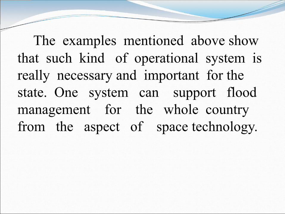
The examples mentioned above show that such kind of operational system is really necessary and important for the state. One system can support flood management for the whole country from the aspect of space technology.
6. CONCLUSION

CONCLUSION
1. Space technology can play important rule to flood
management.
2. Preparedness and assessment before the
occurrence of flood disaster is more important for
disaster mitigation, space technology is still very
useful for that.
3. Integrated system ( software, data ) is extremely
necessary for operational system.

CONCLUSION (continue)
4.Flash floods occur frequently and result in serious
losses recently year, we should pay more attention to
monitoring of flash floods.
5. It is important to exchange and jointly enjoy data and
technology through international cooperation.

Thank you!


