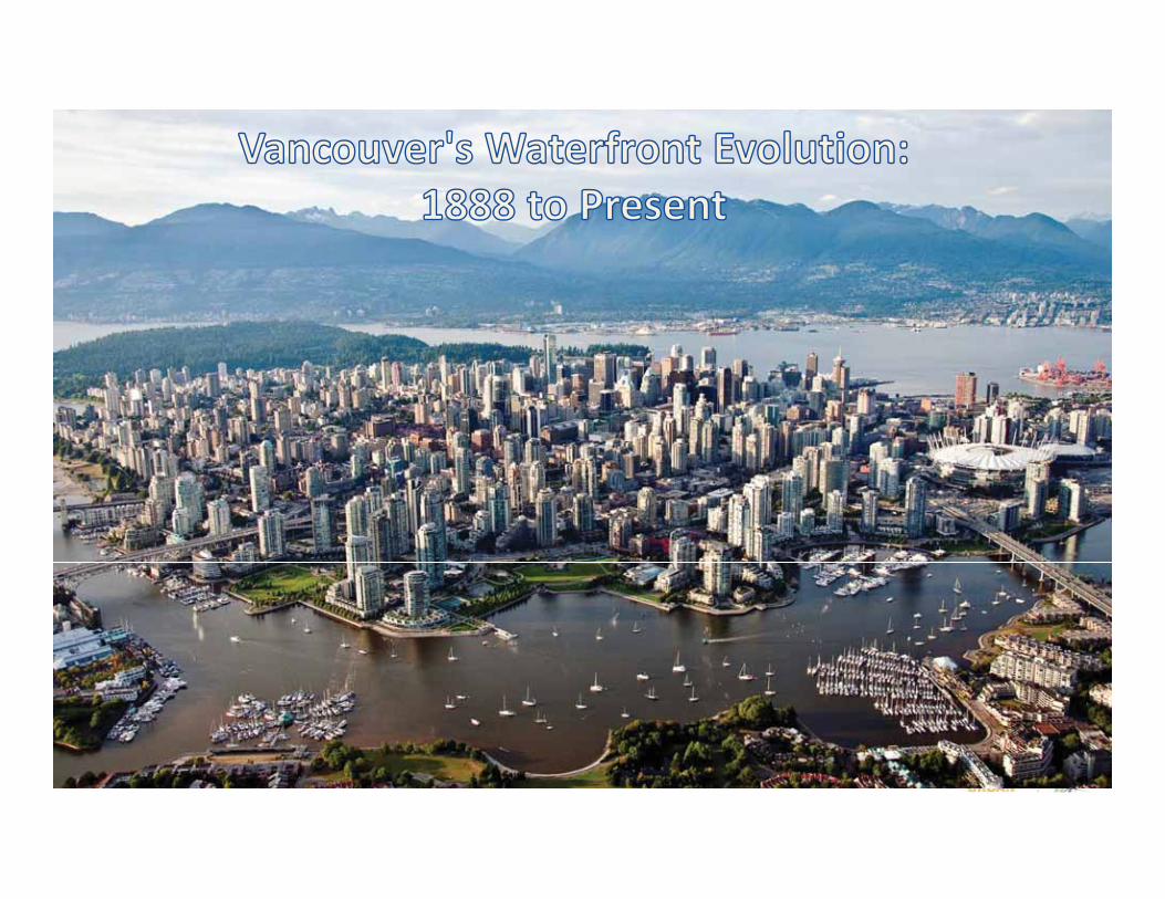
VANCOUVER’S WATERFRONT EVOLUTION: 1888 to Present
VANCOUVER’S WATERFRONT EVOLUTION: 1888 to Present
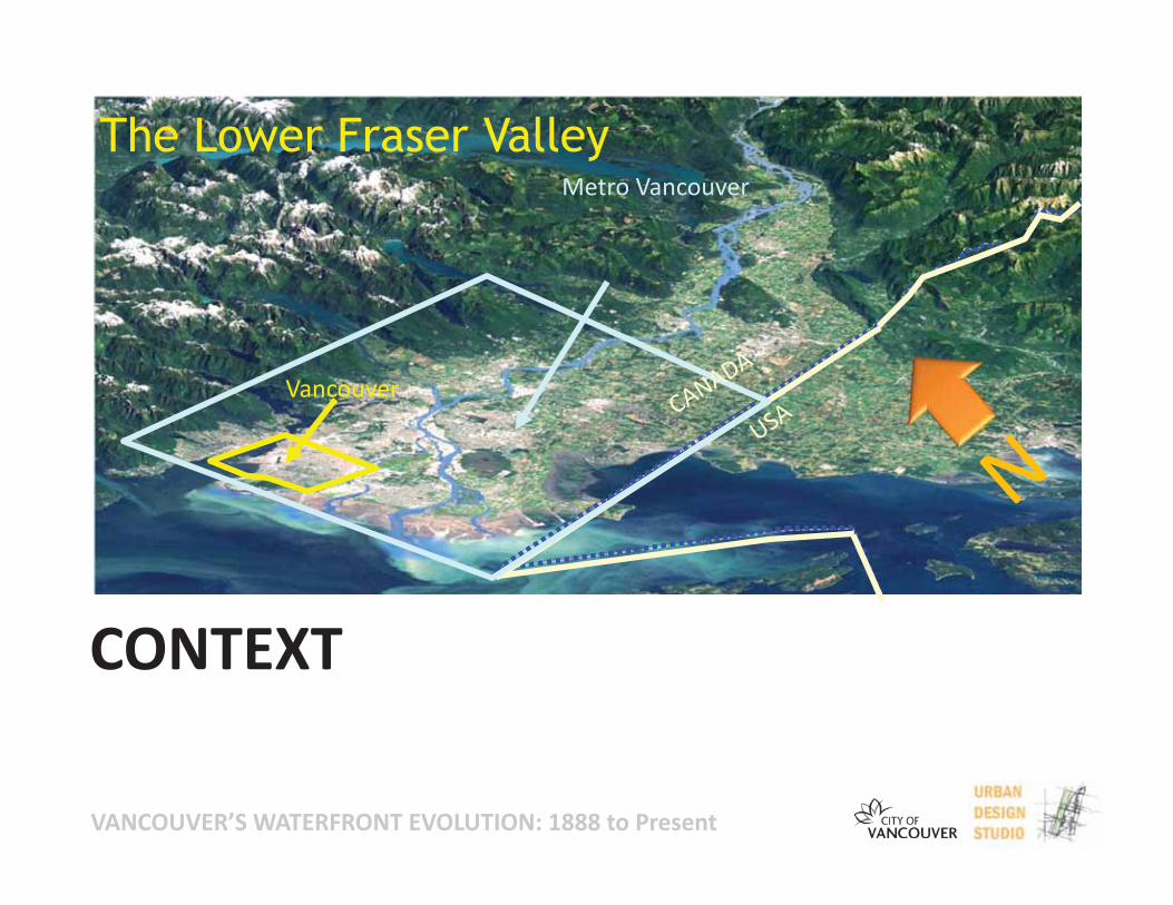
The Lower Fraser ValleyMetro Vancouver
Vancouver
CONTEXT
VANCOUVER’S WATERFRONT EVOLUTION: 1888 to Present
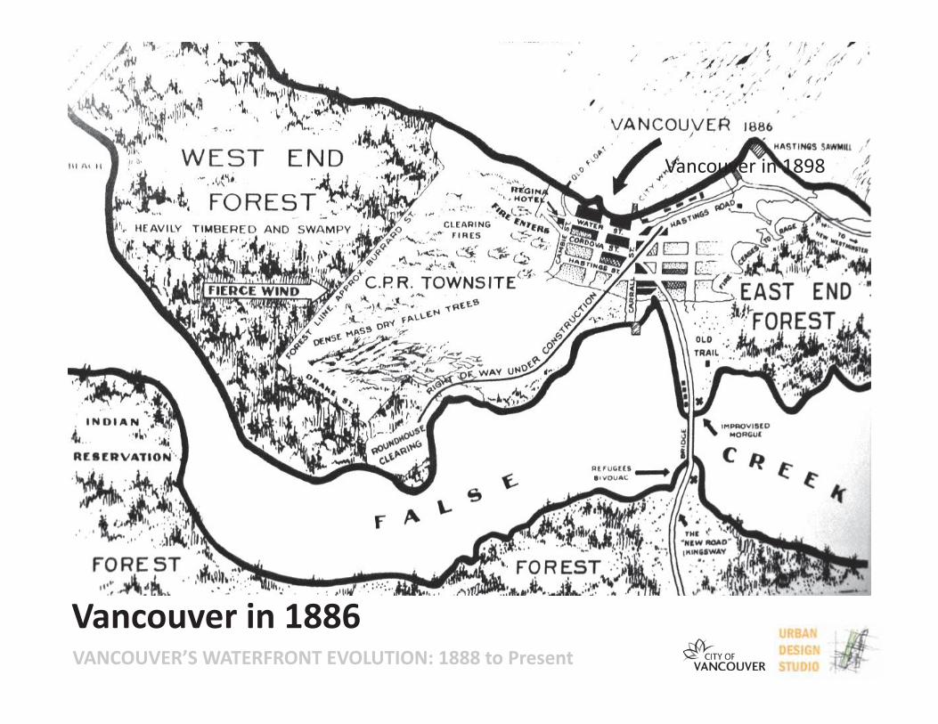
Vancouver in 1898
Vancouver in 1886
VANCOUVER’S WATERFRONT EVOLUTION: 1888 to Present
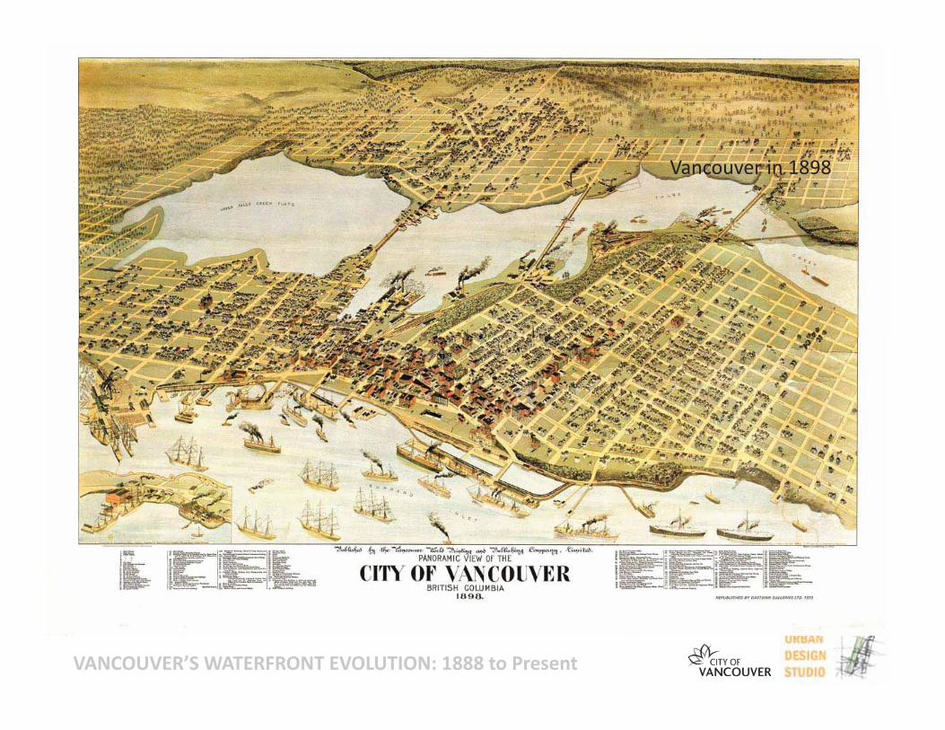
Vancouver in 1898
VANCOUVER’S WATERFRONT EVOLUTION: 1888 to Present
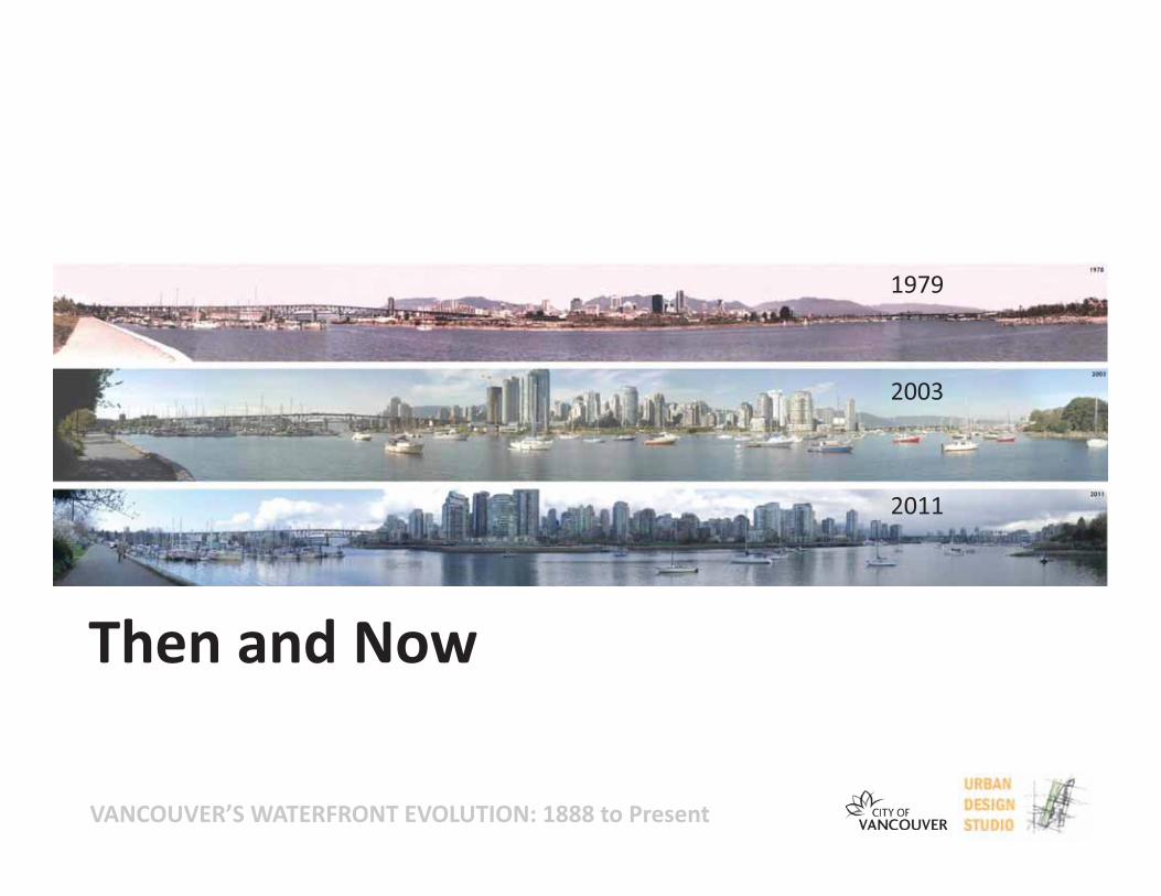
1979
2003
2011
Then and Now
VANCOUVER’S WATERFRONT EVOLUTION: 1888 to Present
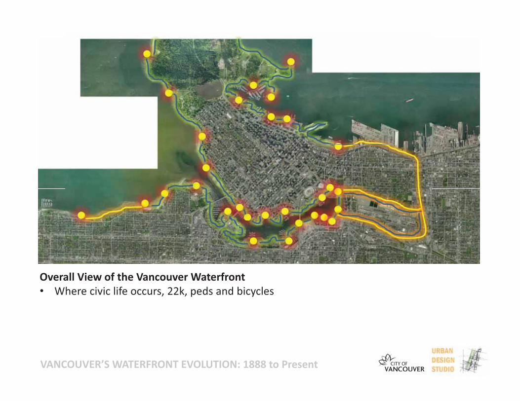
Overall View of the Vancouver Waterfront• Where civic life occurs, 22k, peds and bicycles
VANCOUVER’S WATERFRONT EVOLUTION: 1888 to Present
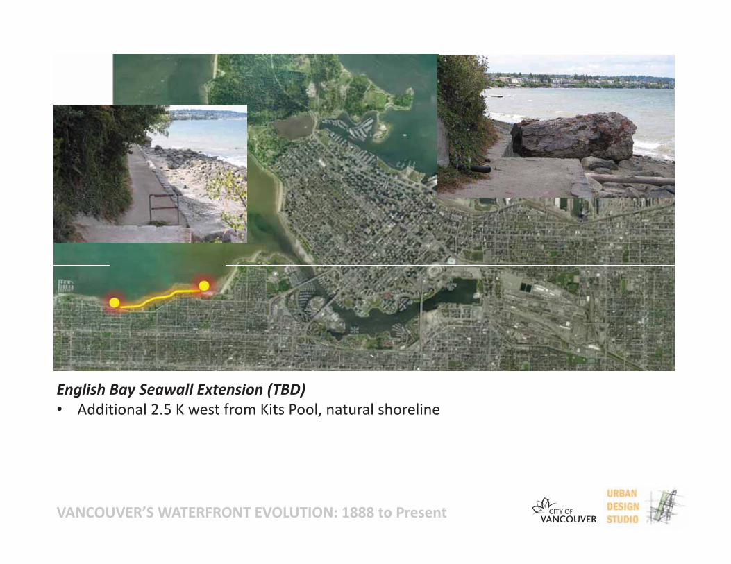
English Bay Seawall Extension (TBD)• Additional 2.5 K west from Kits Pool, natural shoreline
VANCOUVER’S WATERFRONT EVOLUTION: 1888 to Present
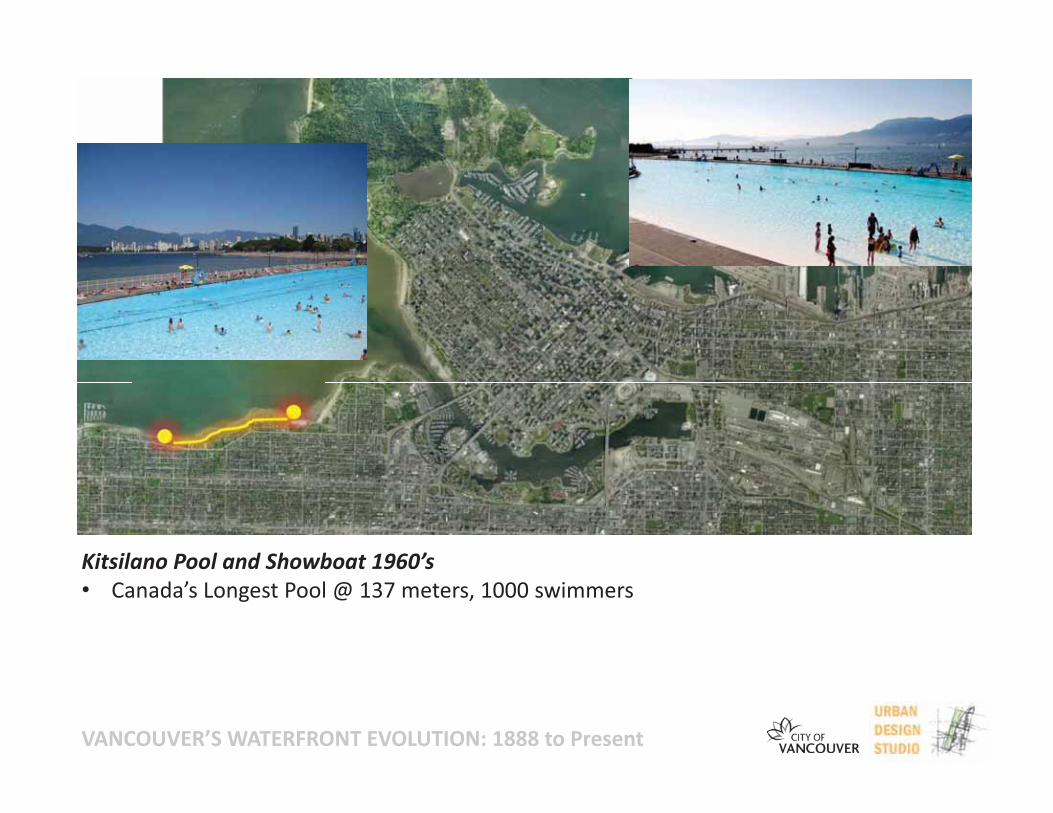
Kitsilano Pool and Showboat 1960’s• Canada’s Longest Pool @ 137 meters, 1000 swimmers
VANCOUVER’S WATERFRONT EVOLUTION: 1888 to Present
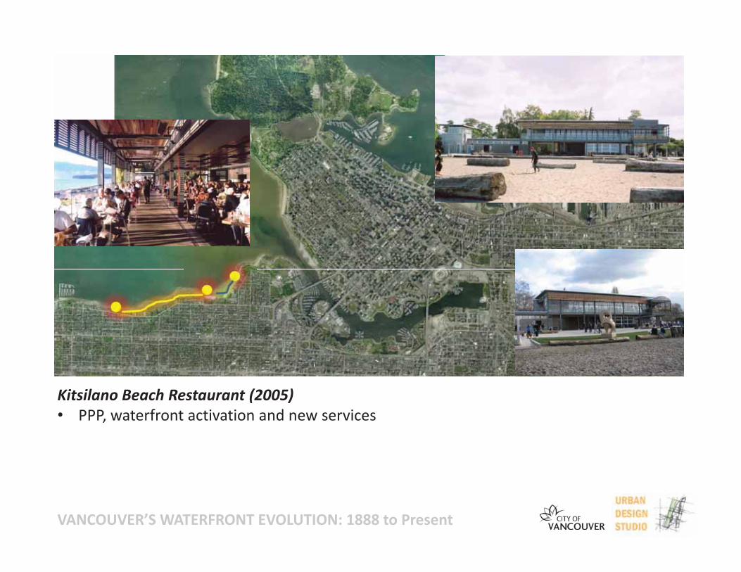
Kitsilano Beach Restaurant (2005)• PPP, waterfront activation and new services
VANCOUVER’S WATERFRONT EVOLUTION: 1888 to Present
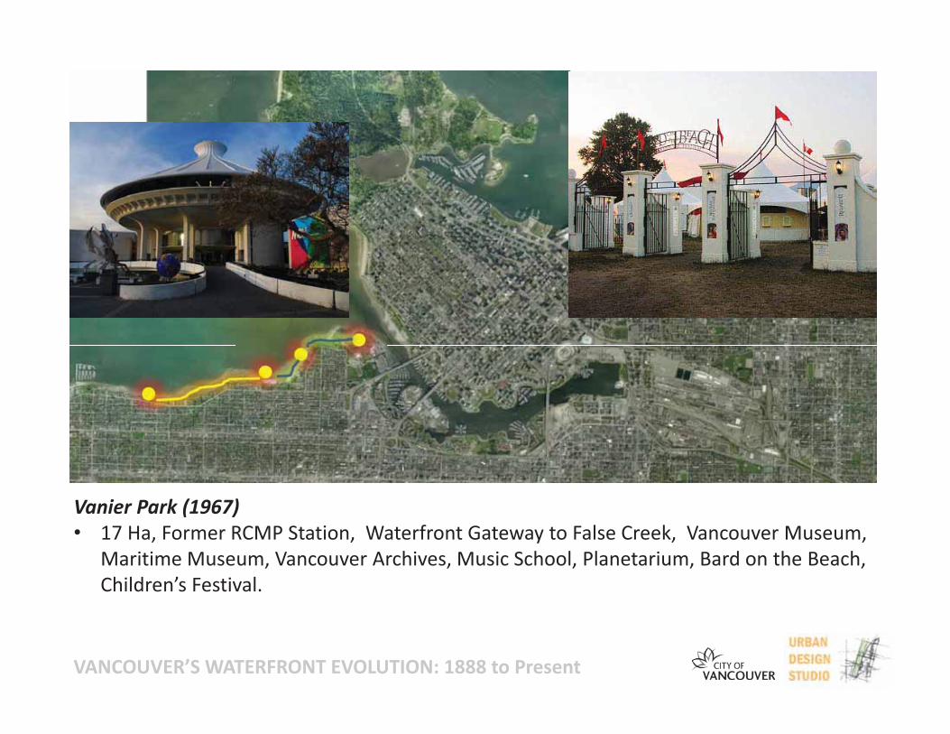
Vanier Park (1967)• 17 Ha, Former RCMP Station, Waterfront Gateway to False Creek, Vancouver Museum,
Maritime Museum, Vancouver Archives, Music School, Planetarium, Bard on the Beach,Children’s Festival.
VANCOUVER’S WATERFRONT EVOLUTION: 1888 to Present
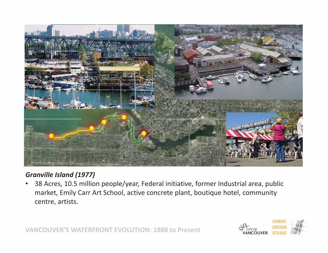
Granville Island (1977)• 38 Acres, 10.5 million people/year, Federal initiative, former Industrial area, public
market, Emily Carr Art School, active concrete plant, boutique hotel, communitycentre, artists.
VANCOUVER’S WATERFRONT EVOLUTION: 1888 to Present
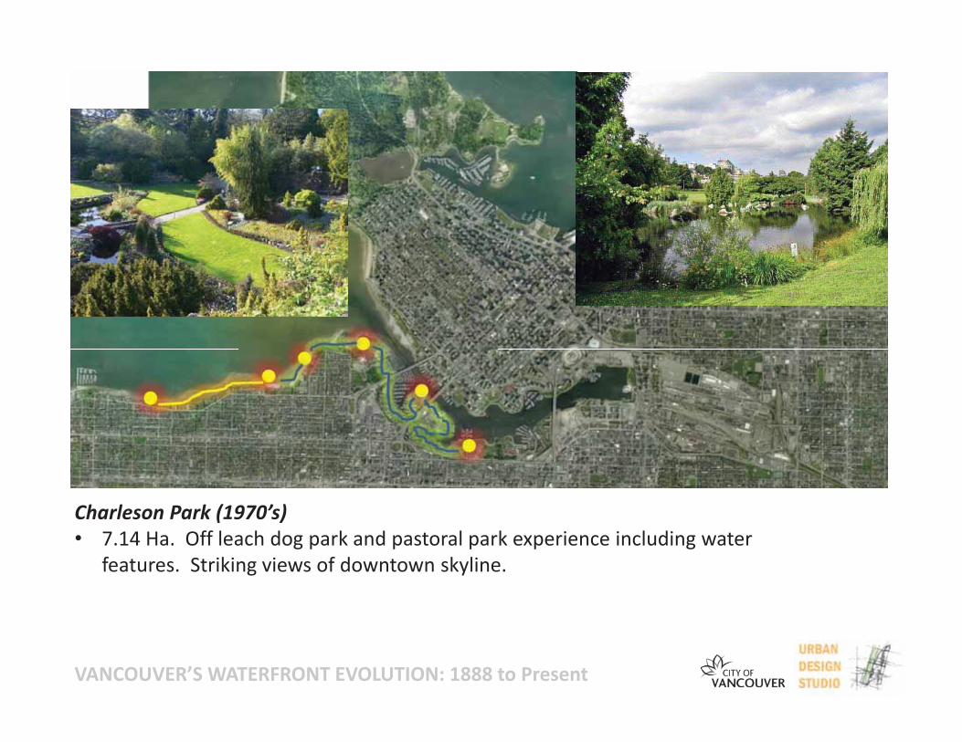
Charleson Park (1970’s)• 7.14 Ha. Off leach dog park and pastoral park experience including water
features. Striking views of downtown skyline.
VANCOUVER’S WATERFRONT EVOLUTION: 1888 to Present
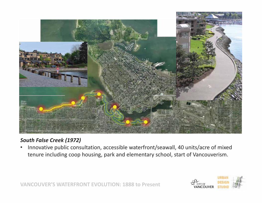
South False Creek (1972)• Innovative public consultation, accessible waterfront/seawall, 40 units/acre of mixed
tenure including coop housing, park and elementary school, start of Vancouverism.
VANCOUVER’S WATERFRONT EVOLUTION: 1888 to Present
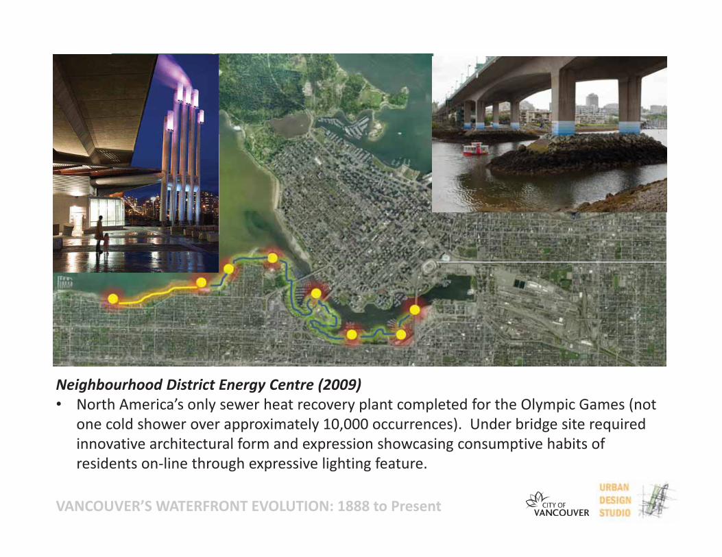
Neighbourhood District Energy Centre (2009)• North America’s only sewer heat recovery plant completed for the Olympic Games (not
one cold shower over approximately 10,000 occurrences). Under bridge site requiredinnovative architectural form and expression showcasing consumptive habits ofresidents on line through expressive lighting feature.
VANCOUVER’S WATERFRONT EVOLUTION: 1888 to Present
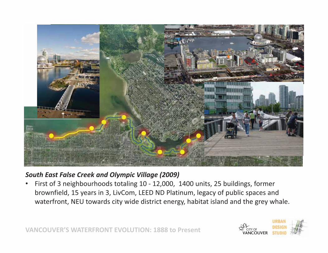
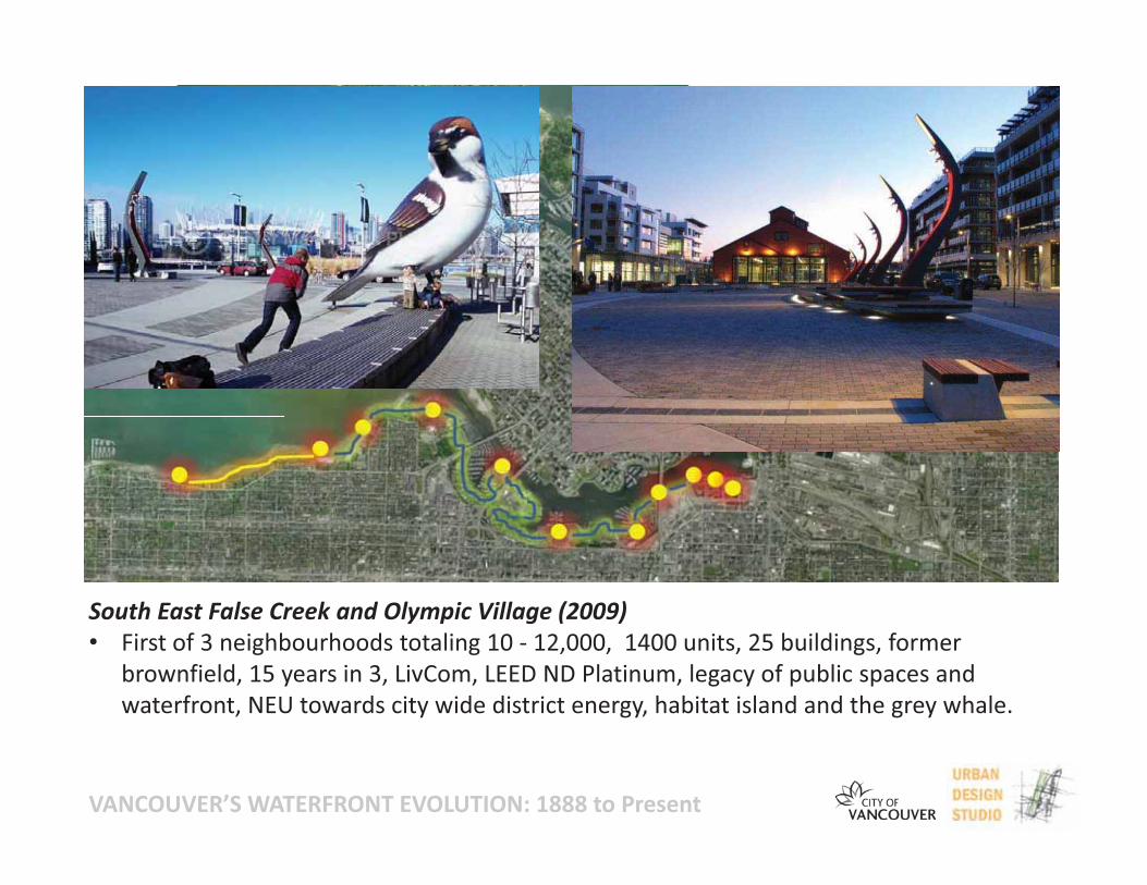
South East False Creek and Olympic Village (2009)• First of 3 neighbourhoods totaling 10 12,000, 1400 units, 25 buildings, former
brownfield, 15 years in 3, LivCom, LEED ND Platinum, legacy of public spaces andwaterfront, NEU towards city wide district energy, habitat island and the grey whale.
VANCOUVER’S WATERFRONT EVOLUTION: 1888 to Present
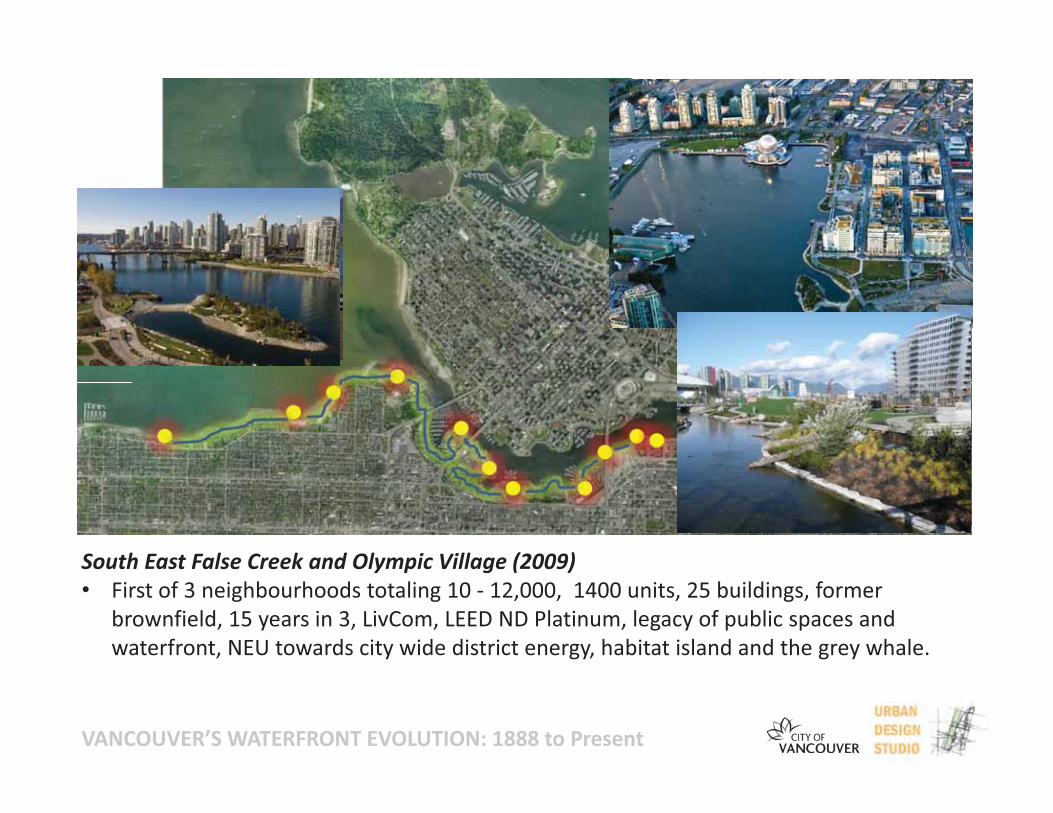
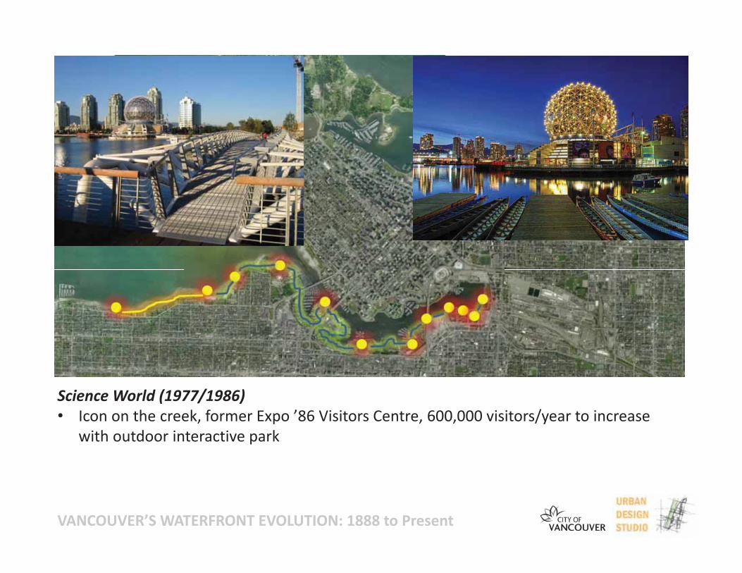
Science World (1977/1986)• Icon on the creek, former Expo ’86 Visitors Centre, 600,000 visitors/year to increase
with outdoor interactive park
VANCOUVER’S WATERFRONT EVOLUTION: 1888 to Present
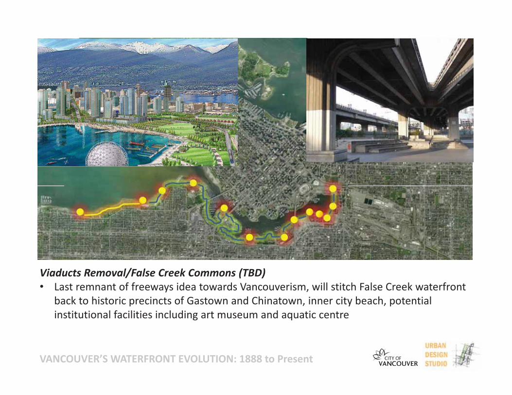
Viaducts Removal/False Creek Commons (TBD)• Last remnant of freeways idea towards Vancouverism, will stitch False Creek waterfront
back to historic precincts of Gastown and Chinatown, inner city beach, potentialinstitutional facilities including art museum and aquatic centre
VANCOUVER’S WATERFRONT EVOLUTION: 1888 to Present
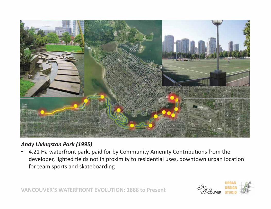
Andy Livingston Park (1995)• 4.21 Ha waterfront park, paid for by Community Amenity Contributions from the
developer, lighted fields not in proximity to residential uses, downtown urban locationfor team sports and skateboarding
VANCOUVER’S WATERFRONT EVOLUTION: 1888 to Present
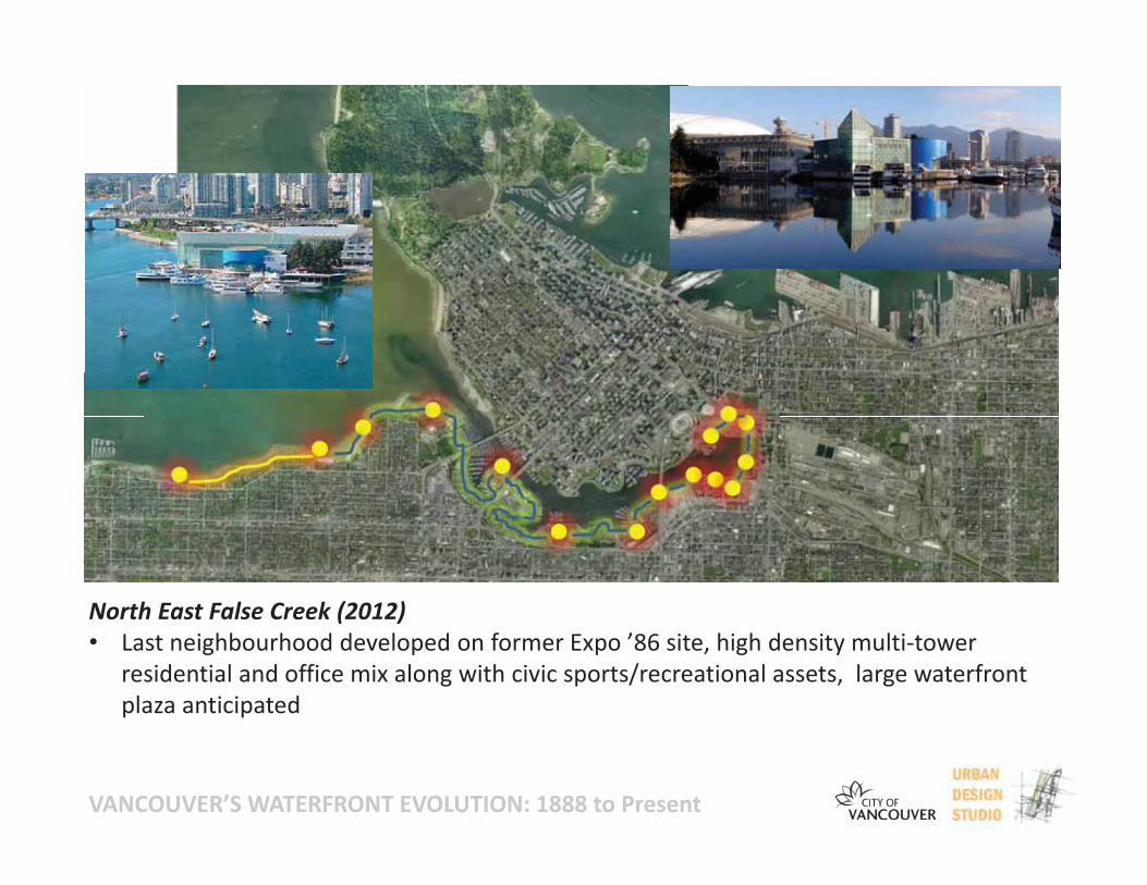
North East False Creek (2012)• Last neighbourhood developed on former Expo ’86 site, high density multi tower
residential and office mix along with civic sports/recreational assets, large waterfrontplaza anticipated
VANCOUVER’S WATERFRONT EVOLUTION: 1888 to Present
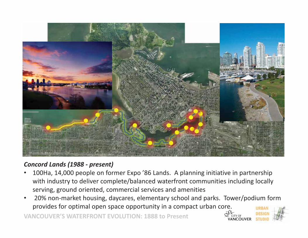
Concord Lands (1988 present)• 100Ha, 14,000 people on former Expo ’86 Lands. A planning initiative in partnership
with industry to deliver complete/balanced waterfront communities including locallyserving, ground oriented, commercial services and amenities
• 20% non market housing, daycares, elementary school and parks. Tower/podium formprovides for optimal open space opportunity in a compact urban core.
VANCOUVER’S WATERFRONT EVOLUTION: 1888 to Present
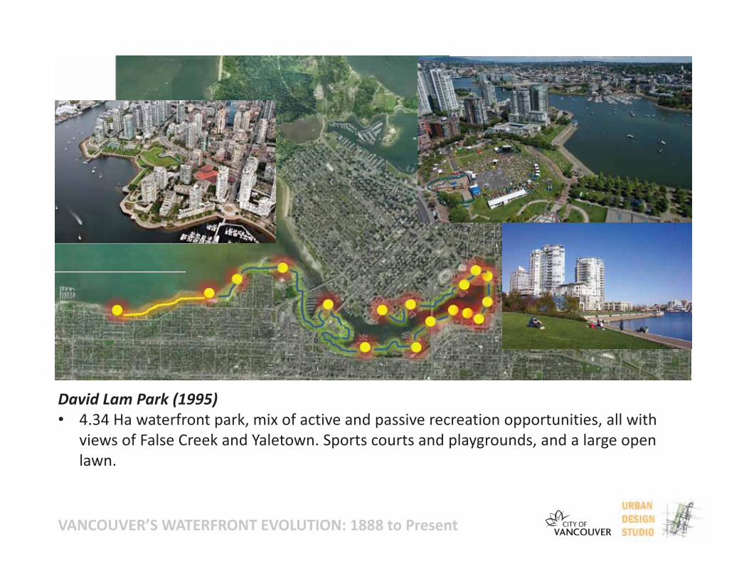
David Lam Park (1995)• 4.34 Ha waterfront park, mix of active and passive recreation opportunities, all with
views of False Creek and Yaletown. Sports courts and playgrounds, and a large openlawn.
VANCOUVER’S WATERFRONT EVOLUTION: 1888 to Present
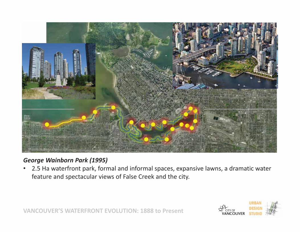
George Wainborn Park (1995)• 2.5 Ha waterfront park, formal and informal spaces, expansive lawns, a dramatic water
feature and spectacular views of False Creek and the city.
VANCOUVER’S WATERFRONT EVOLUTION: 1888 to Present
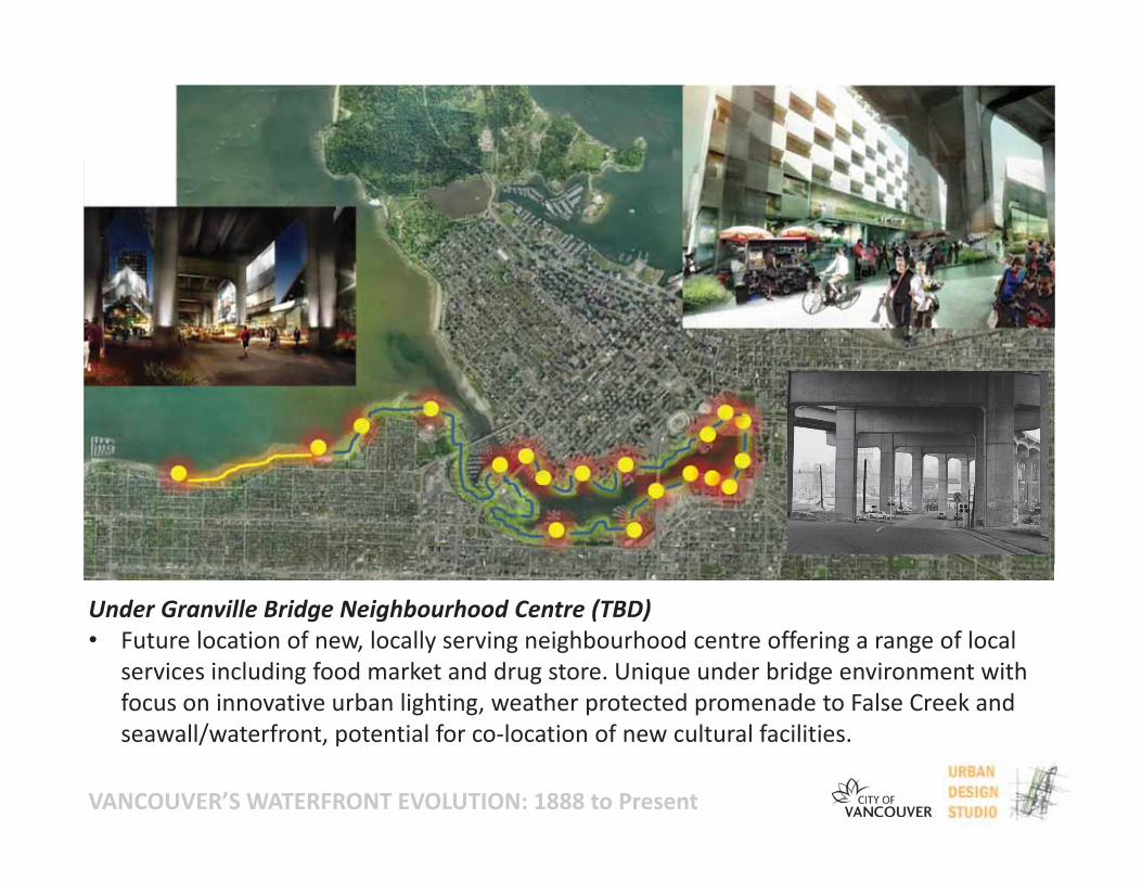
Under Granville Bridge Neighbourhood Centre (TBD)• Future location of new, locally serving neighbourhood centre offering a range of local
services including food market and drug store. Unique under bridge environment withfocus on innovative urban lighting, weather protected promenade to False Creek andseawall/waterfront, potential for co location of new cultural facilities.
VANCOUVER’S WATERFRONT EVOLUTION: 1888 to Present
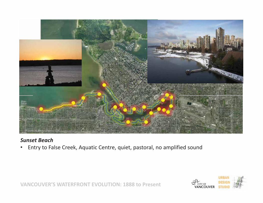
Sunset Beach• Entry to False Creek, Aquatic Centre, quiet, pastoral, no amplified sound
VANCOUVER’S WATERFRONT EVOLUTION: 1888 to Present
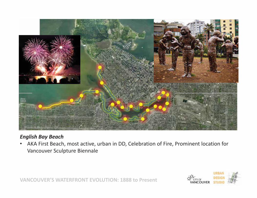
English Bay Beach• AKA First Beach, most active, urban in DD, Celebration of Fire, Prominent location for
Vancouver Sculpture Biennale
VANCOUVER’S WATERFRONT EVOLUTION: 1888 to Present
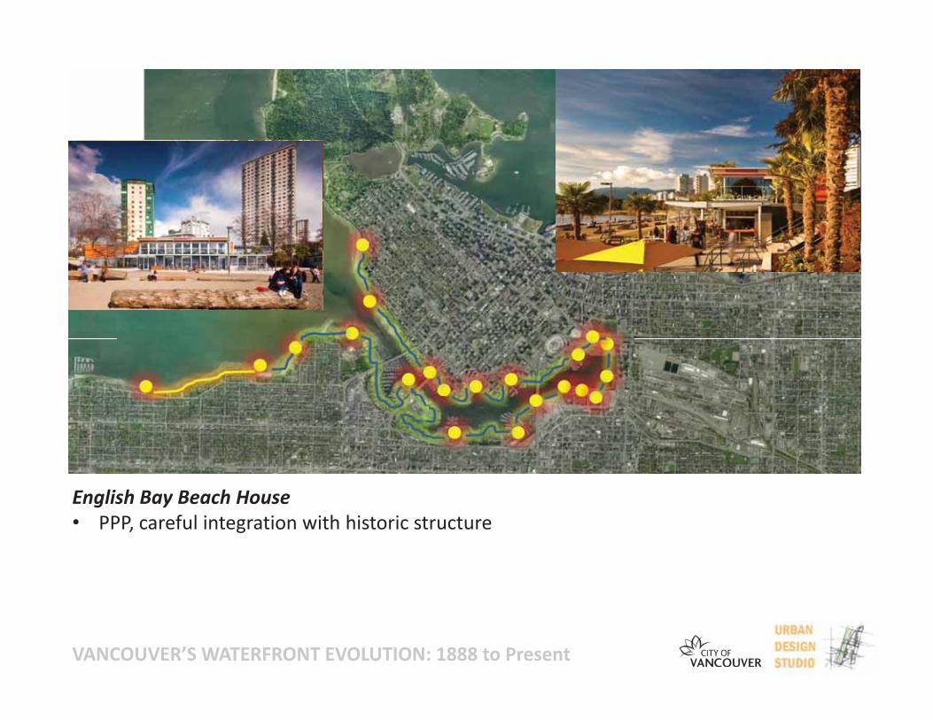
English Bay Beach House• PPP, careful integration with historic structure
VANCOUVER’S WATERFRONT EVOLUTION: 1888 to Present
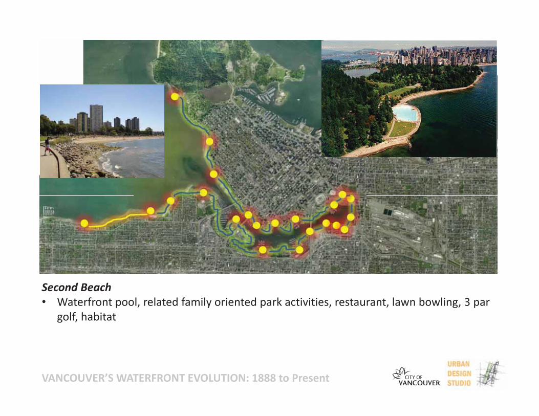
Second Beach• Waterfront pool, related family oriented park activities, restaurant, lawn bowling, 3 par
golf, habitat

VANCOUVER’S WATERFRONT EVOLUTION: 1888 to Present
Second Beach Pool• Original tidal filled concrete pool location, heated/fresh water, 80m length, family
oriented, more waterfront pool locations under consideration
VANCOUVER’S WATERFRONT EVOLUTION: 1888 to Present
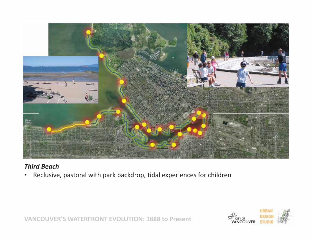
Third Beach• Reclusive, pastoral with park backdrop, tidal experiences for children
VANCOUVER’S WATERFRONT EVOLUTION: 1888 to Present
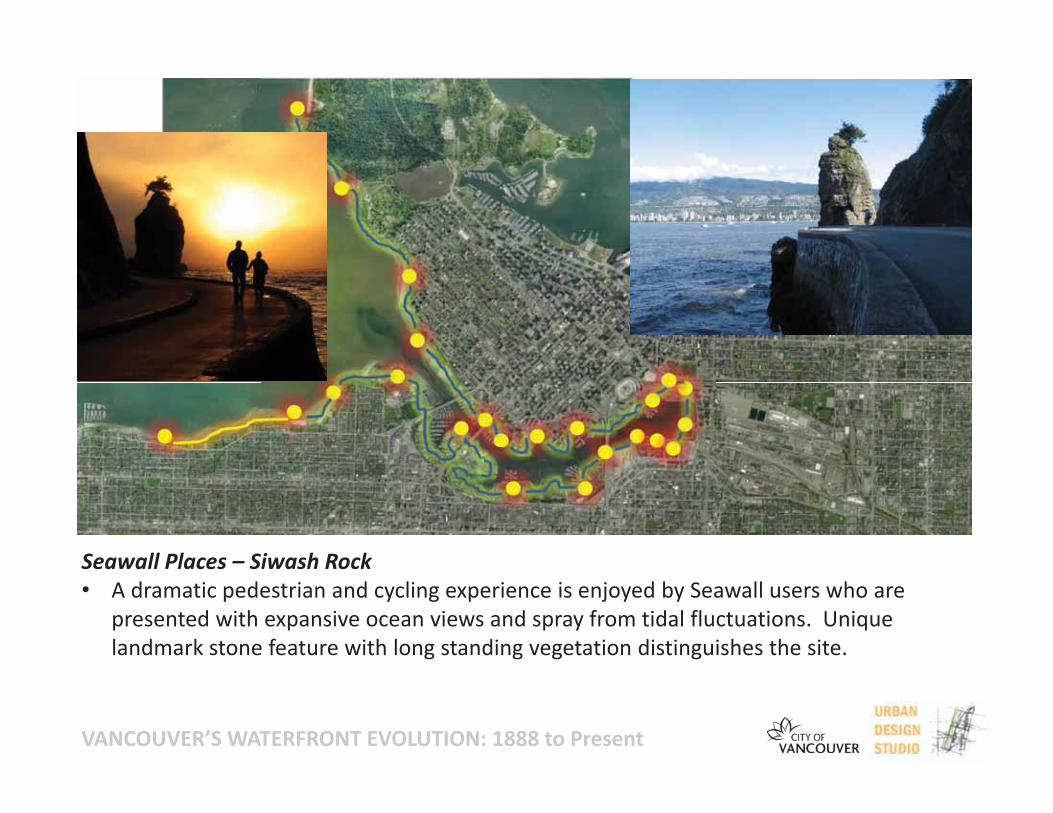
Seawall Places – Siwash Rock• A dramatic pedestrian and cycling experience is enjoyed by Seawall users who are
presented with expansive ocean views and spray from tidal fluctuations. Uniquelandmark stone feature with long standing vegetation distinguishes the site.
VANCOUVER’S WATERFRONT EVOLUTION: 1888 to Present
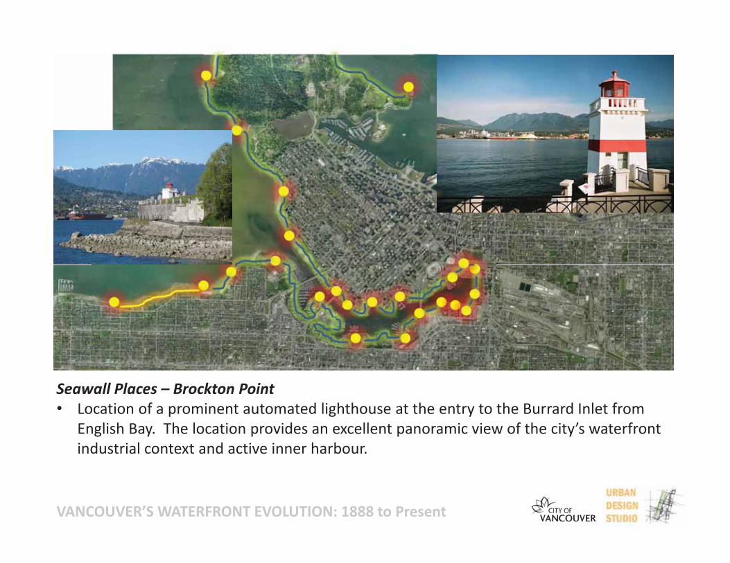
Seawall Places – Brockton Point• Location of a prominent automated lighthouse at the entry to the Burrard Inlet from
English Bay. The location provides an excellent panoramic view of the city’s waterfrontindustrial context and active inner harbour.
VANCOUVER’S WATERFRONT EVOLUTION: 1888 to Present
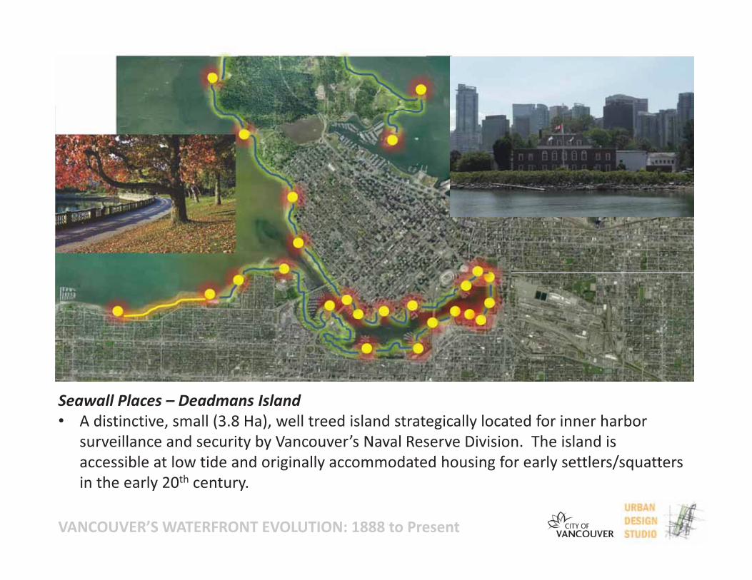
Seawall Places – Deadmans Island• A distinctive, small (3.8 Ha), well treed island strategically located for inner harbor
surveillance and security by Vancouver’s Naval Reserve Division. The island isaccessible at low tide and originally accommodated housing for early settlers/squattersin the early 20th century.
VANCOUVER’S WATERFRONT EVOLUTION: 1888 to Present
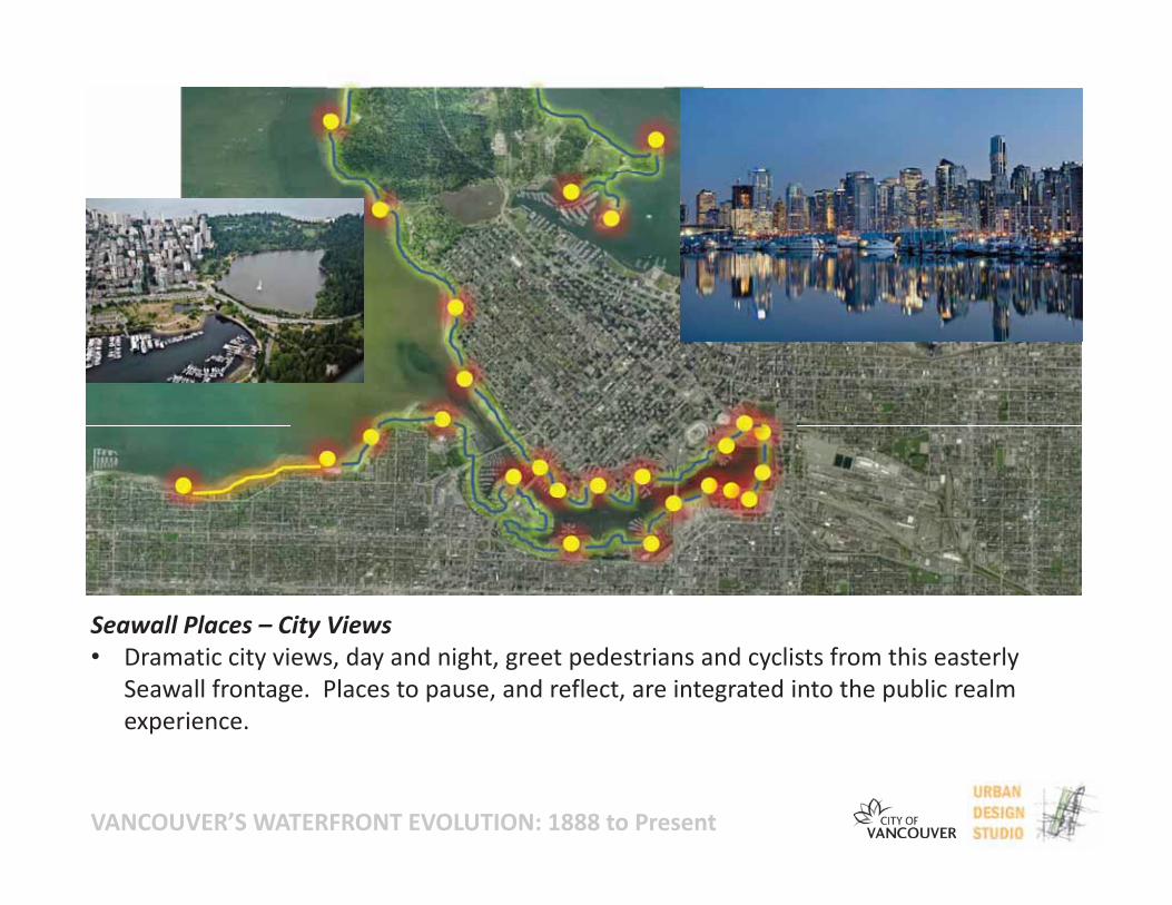
Seawall Places – City Views• Dramatic city views, day and night, greet pedestrians and cyclists from this easterly
Seawall frontage. Places to pause, and reflect, are integrated into the public realmexperience.
VANCOUVER’S WATERFRONT EVOLUTION: 1888 to Present
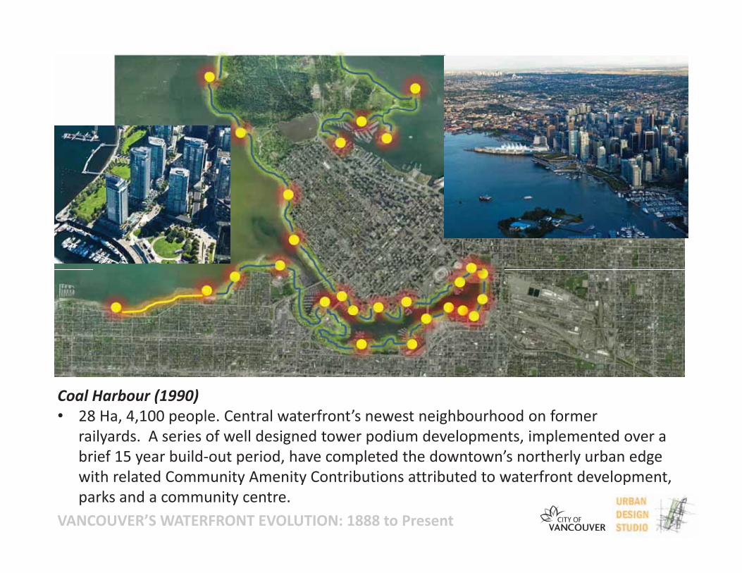
Coal Harbour (1990)• 28 Ha, 4,100 people. Central waterfront’s newest neighbourhood on former
railyards. A series of well designed tower podium developments, implemented over abrief 15 year build out period, have completed the downtown’s northerly urban edgewith related Community Amenity Contributions attributed to waterfront development,parks and a community centre.
VANCOUVER’S WATERFRONT EVOLUTION: 1888 to Present
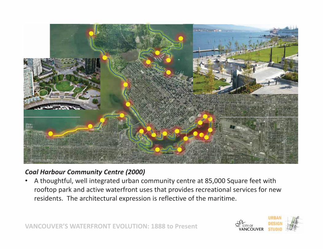
Coal Harbour Community Centre (2000)• A thoughtful, well integrated urban community centre at 85,000 Square feet with
rooftop park and active waterfront uses that provides recreational services for newresidents. The architectural expression is reflective of the maritime.
VANCOUVER’S WATERFRONT EVOLUTION: 1888 to Present
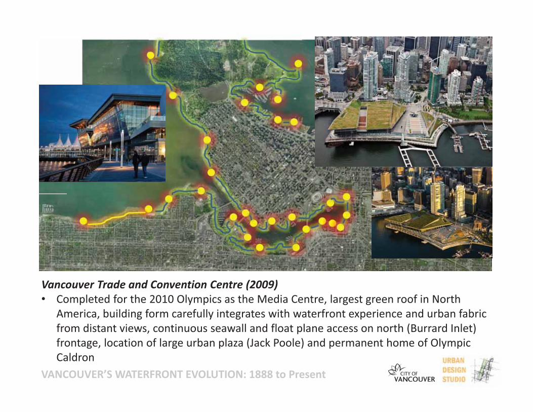
Vancouver Trade and Convention Centre (2009)• Completed for the 2010 Olympics as the Media Centre, largest green roof in North
America, building form carefully integrates with waterfront experience and urban fabricfrom distant views, continuous seawall and float plane access on north (Burrard Inlet)frontage, location of large urban plaza (Jack Poole) and permanent home of OlympicCaldron
VANCOUVER’S WATERFRONT EVOLUTION: 1888 to Present
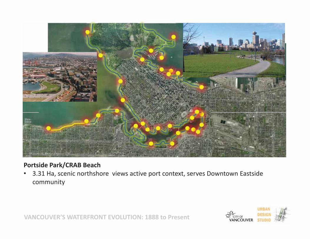
Portside Park/CRAB Beach• 3.31 Ha, scenic northshore views active port context, serves Downtown Eastside
community

VANCOUVER’S WATERFRONT EVOLUTION: 1888 to Present
Future Waterfront/Pedestrian Network Work Opportunities For DTES/False Creek Flats• Active planning work underway
VANCOUVER’S WATERFRONT EVOLUTION: 1888 to PresentTHANK YOU!


