NATURAL SCIENCES SECTOR BIENNIAL REPORT
UNESCO REGIONAL OFFICE FOR EASTERN AFRICA
Implementation Period: 2018 – 2019
APRIL 2020
Sector Staff
Dr. Jayakumar Ramasamy, Senior Programme Specialist
Dr. Samuel Tetteh Partey, Programme Specialist
Dr. Alice Auma Ochanda, National Programme Officer
Mr. John Ngatia, Research Assistant
Ms. Xinhong Li, Sponsored Trainee
Natural Sciences
Sector
TABLE OF CONTENTS
EXECUTIVE SUMMARY ..................................................................................................... 1
1. BACKGROUND AND INTRODUCTION .................................................................................. 2
2. SCIENCE POLICY AND CAPACITY BUILDING ......................................................................... 2
2.1 Activities ....................................................................................................................................................... 2
2.1.1 Science, Technology and Innovation (STI) ........................................................................................ 2
(a) Development of a Guidebook for the Preparation of STI for SDGs Roadmap .............................. 3
(b) Development of a Regional STI Policy for the East African Community (EAC) ............................. 3
(c) Forum for African Women Vice Chancellors ................................................................................... 4
2.1.2 Gender and Science............................................................................................................................ 5
(a) The Celebration of the International Day of Women and Girls in Science ..................................... 5
(b) Unlocking the potential of Girls in Science, Technology, Mathematics and Engineering for a
Sustainable Future for all ....................................................................................................................... 6
2.1.3 Local and Indigenous Knowledge Systems ....................................................................................... 7
(a) SANDWATCH: Adapting to Climate Change and Educating for Sustainable Development ........... 7
2.2 Lessons Learned ......................................................................................................................................... 7
2.3 Challenges .................................................................................................................................................... 8
2.4 Opportunities ............................................................................................................................................... 8
3. ECOLOGICAL AND EARTH SCIENCES (MAB and IGGP) ........................................................... 10
3.1 Activities ..................................................................................................................................................... 10
3.1.1 Man and Biosphere Programme ...................................................................................................... 10
(a) Biosphere Reserves in Mauritius ................................................................................................... 10
(b) Biosphere Reserves in Seychelles ................................................................................................. 11
(c) Biosphere Reserve nomination in Comoros .................................................................................. 11
(d) Biosphere Reserve nomination in Rwanda.................................................................................... 12
(e) National Training on Biodiversity in Rwanda ................................................................................. 12
3.1.2 Earth Sciences Programme .............................................................................................................. 13
(a) AfricaArray 2018 ............................................................................................................................. 13
(b) AfricaArray 2019 ............................................................................................................................. 14
(c) Advanced Training Course on “Geological Mapping and Mineral Exploration’’ held in Daejeon,
Republic of Korea ................................................................................................................................. 14
(d) Geopark Kenya ............................................................................................................................... 15
(e) Special Issue: Impacts of mining and mineral processing on the environment and human
health in Africa ...................................................................................................................................... 16
(f) Mapping and assessing environmental hazards of abandoned mines in Sub Saharan African
Countries ............................................................................................................................................... 17
3.1.3 Disaster Risk Reduction ................................................................................................................... 18
(a) Disaster Risk Reduction: A platform for the Seismic Hazard Evaluation in the East African Rift
System .................................................................................................................................................. 18
(b) African Risk Methods School - Focus on Geophysical & Hydrological Urban Risks, Hazards &
Vulnerabilities ....................................................................................................................................... 19
3.2 Lessons Learned ....................................................................................................................................... 20
3.3. Challenges ................................................................................................................................................. 20
3.4 Opportunities ............................................................................................................................................. 20
4. INTERGOVERNMENTAL HYDROLOGICAL PROGRAMME .......................................................... 21
4.1 Activities ..................................................................................................................................................... 21
4.1.1 An iRain App for Eastern African Countries..................................................................................... 21
4.1.2 Seventh Africa Water Week .............................................................................................................. 23
4.1.3 Groundwater Map of Africa (WHYMAP and Its Current status of groundwater resources mapping
in Africa) ..................................................................................................................................................... 24
4.1.4 Regional Training on Integrating Groundwater Management within River Basins in Sub-Saharan
Africa ........................................................................................................................................................... 25
4.1.5 International Training on Ecohydrology in Tanzania ....................................................................... 26
4.1.6 Eastern Africa Regional training workshop on Climate Risk Informed Decision Analysis ............ 27
4.1.7 East African Regional Workshop on Water-Energy-Food security (WEF) Nexus - Joint
collaboration between UNESCO, GIZ and Strathmore University ............................................................ 28
4.1.8 East African Regional Capacity Building Workshop on Drought Monitoring and Forecasting ...... 29
4.1.9 Mobile applications launched to promote rainwater harvesting and water education in Africa ... 30
4.1.10 Groundwater National Training Rwanda ........................................................................................ 31
4.1.11 Seventh International Hydrological Programme (IHP) Africa Regional Steering Committee
Meeting ....................................................................................................................................................... 32
4.2 Lessons Learned……………………………………………………………………………………. 34
4.3 Challenges .................................................................................................................................................. 34
4.4 Opportunities ............................................................................................................................................. 35
5. PUBLICATIONS .......................................................................................................... 36
6. SMARTPHONE APPLICATION .......................................................................................... 36
1
EXECUTIVE SUMMARY
The Natural Science Sector at the UNESCO Regional Office in Nairobi, supports 13 Member States in Eastern
Africa and the adjacent Indian Ocean Islands to address formidable development challenges such as climate
change, destruction of natural resources, biodiversity loss, water scarcity, food insecurity, natural hazards and
disasters etc. These challenges are addressed through the design and implementation of activities that cover
diverse fields: freshwater resource management, geodiversity conservation, natural disaster reduction,
capacity building in science, technology and innovation (STI) and Science, Technology, Engineering and
Mathematics (STEM) Education. The implementation of activities is supported by the mobilization of resources
and effective partnership with our extensive national and international networks. In this report, we highlight
significant results, lessons learnt, challenges and opportunities emanating from activities implemented
between 2018 and 2019. Few of the notable results from our activities include - the development of a regional
STI policy for the East African Community; the mentorship of over 2000 secondary school girls across 43
counties in Kenya through UNESCO’S Girls’ mentorship program in STEM; the enabling of policy decisions and
institutions through capacity building in disaster risk reduction, management of biosphere reserves and
groundwater management; the development of mobile applications on rainwater harvesting and water
education. Experiences over the last biennium also point to the need to mobilize more resources, strengthen
partnership, improve visibility and communication of results and design activities in response to the new UN
reforms.
2
1. BACKGROUND AND INTRODUCTION
Eastern Africa faces daunting development challenges - climate change, destruction of natural resources,
biodiversity loss, water scarcity, food insecurity, natural hazards and disasters, r ising human population etc.
In order to sustainably develop, these challenges would have to be addressed by using science-evidenced
technologies, innovations and policies. The Natural Sciences Sector of UNESCO supports Member States to
appropriately package and apply technological innovations and polices that foster sustainable development.
The Natural Science Sector of the UNESCO Regional Office in Nairobi serves as a Multi-Sectoral Regional
Office responsible for 13 Member States in Eastern Africa and the adjacent Indian Ocean Islands. Countries
covered include: Comoros, Djibouti, Ethiopia, Eritrea, Kenya, Madagascar, Mauritius, Rwanda, Seychelles,
Tanzania, Somalia, South Sudan and Uganda. The Sector design and implements its activities in relation to the
International Science Programmes (ISP) of UNESCO: Intergovernmental Hydrological Programme (IHP); Man
and the Biosphere Programme (MAB); International Geoscience and Geoparks Programme (IGGP); and
International Basic Sciences Programme (IBSP). For activities pertaining to IHP; Ecological and Earth Sciences;
and Disaster Risk Reduction, this office has a coordination role for all sub-Saharan African countries with other
Regional Offices. The Science Policy and Capacity Building programme caters for its regional countries in
addition to handling the African Network of Scientific and Technological Institutions (ANSTI).
Between 2018 and 2019, a number of activities were conducted to spearhead the advances and application of
science in confronting development challenges in Eastern Africa. The following are the cluster of activities
implemented by the office under the ISP.
• Science Policy and Capacity Building (IBSP)
• Ecological and Earth Sciences (MAB and IGGP)
• Water Science (IHP)
The objective of this report is to highlight key achievements and lessons learnt from the activities implemented
during the 2018/2019 biennium.
2. SCIENCE POLICY AND CAPACITY BUILDING
2.1 Activities
2.1.1 Science, Technology and Innovation (STI)
African countries already acknowledge the critical roles that Science, Technology, and Innovation (STI) could
play in their pursuit of global and continental development plans such as the UN Agenda 2030 Sustainable
Development Goals as well as the aspirations of the African Union’s Agenda 2063. Between 2018 and 2019,
the UNESCO Regional Office for Eastern Africa Office in Nairobi provided Member States with guidance in
developing or revising their national STI policies; promoting the development of science governance structures
and mechanisms; and fostering closer linkages between Technical and Vocational Education and Training
(TVET), universities and industry within its longstanding University−Industry Partnerships programme. The
sub-sections below give a narrative of major activities and their outcomes.
3
(a) Development of a Guidebook for the Preparation of STI for SDGs Roadmap
A Guidebook developed by UNESCO and multiple stakeholders to provide a framework for using roadmaps as
a policy tool to harness Science, Technology and Innovation (STI) as means to achieve the Sustainable
Development Goals
The 2030 Agenda for Sustainable Development, unanimously adopted by developing and developed countries,
reaffirmed STI as key means of its implementation and launched the Technology Facilitation Mechanism (TFM)
to support the 17 Sustainable Development Goals (SDGs). The TFM is composed of the collaborative Multi-
Stakeholder Forum on STI for the SDGs (STI Forum), Online Platform, and the United Nations Inter-Agency
Task Team on STI for the SDGs (IATT- STI) together with a group of 10 high-level representatives from civil
society, the private sector and the scientific community (10-Member Group).
An Experts’ Group Meeting (EGM) on Science, Technology and Innovation (STI) Roadmaps for the Sustainable
Development Goals (SDGs) held in Nairobi contributed to advancing the piloting phase of the roadmaps and
making recommendations for the finalization of a Guidebook on Development of STI roadmaps.
A sub-working group of the IATT launched a draft of a resource on preparing “STI for SDG” roadmaps. The
guidebook is aimed at national and local governments,
agencies and institutions that seek to use roadmaps as a
policy tool, and takes a focus on the design stage as
crucial for effective implementation and monitoring. The
guidebook – currently in “draft for consultation” form –
articulates STI roadmaps as being at the intersection of
three areas: 1) a country’s national development plan; 2)
an STI plan; and 3) an SDGs plan. It notes that an STI for
SDGs roadmap can be either a standalone document or
integrated into other planning tools. The draft guidebook
is structured with chapters dedicated to step-by-step
guidance for the development and implementation of STI
for SDGs Roadmaps, international partnerships to
facilitate effective design and implementation, and recommendations for the international community.
The guidebook is meant to a provide a framework and common language and step by step advice for the
practical policymaking and communication purposes. The Guidebook is addressed to interested national and
local governments, agencies and institutions that wish to use roadmaps as a policy tool to harness STI as
means to achieve SDGs. It can also be of interest to the stakeholders taking part in the dialogue that is an
essential part of the whole process of design, implementation, monitoring and adjustment of STI for SDGs
Roadmaps and to the wider public that wants to advance global and national SDG agendas and observe the
progress. The guidebook focuses on the design stage of the Roadmaps, while showing that the design
underpins effective implementation and monitoring.
(b) Development of a Regional STI Policy for the East African Community (EAC)
To achieve socio-economic development and regional integration as enshrined in the Vision 2050 of the East
African Community (EAC), the East African Science and Technology Commission (EASTECO) in collaboration
with UNESCO and other partners developed the Science, Technology and Innovation Policy for adoption by
the EAC.

4
Following the aspirations and priority areas of the Vision 2050 of the East African Community (EAC) and in
consonance with actions towards the African Union’s Agenda 2063, the UN Agenda 2030 Sustainable
Development Goals and the STI Strategy for Africa (STISA-2024), the East African Science and Technology
Commission (EASTECO) in collaboration with key stakeholders including UNESCO developed the STI Policy for
adoption by EAC Member States. The final drafted policy was validated in a workshop organized from 15 th to
16th October 2019 in Arusha, Tanzania under the auspices of UNESCO.
The EAC Regional STI is expected to ensure that universities are enhanced to be centres of excellence for
investments in education, technical competencies and training, particularly in science technology and
education. Essential elements will be to update data on STI, policy making and strategic planning. UNESCO
Institute for Statistics can provide statistics and gender
disaggregated country specific statistics on STEM for the
region. The policy is anchored on the following pillars: i)
Capacity building for skills and STI Infrastructure; ii)
Research, Innovation and Entrepreneurship; iii) Resource
mobilization, partnerships and collaborations; and iv)
Enabling environment. On the other hand, the priority
(sector) areas for the East African Regional Policy for
Science, Technology and Innovation (STI) are: (1)
Agriculture and Food; (2) Health and Life Sciences; (3)
Human Resource Development/ Education; (4)
Infrastructure; (5) Energy; (6) ICT and Big Data (7)
Industrialization and Trade; (8) Environment and Natural
Resources Management; (9) Climate Change; (10) Traditional and Indigenous Knowledge; and (11) Space
Science and Technology.
With the existence of an inclusive and gender responsive STI policy for the EAC region, UNESCO is planning
to expand and pilot the Global Observatory Science Policy Network (GO-SPIN) at both national and regional
levels. GO-SPIN aims to fill this information gap by providing key information on STI governing bodies, legal
frameworks, policy instruments and long-term series of indicators for evidence-based policy analysis, design
and foresight studies. GO-SPIN is an online, open access platform for decision-makers, knowledge- brokers,
specialists and general-public, with a complete set of various information on STI policies.
(c) Forum for African Women Vice Chancellors
With gender as a global priority, UNESCO along with DAAD and JICA supported the organization of the second
Forum for African Women Vice Chancellors (FAWoVC) on October 21, 2018 in Nairobi. The preeminent
leadership and net-working event with a continental reach was founded in 2016 as a way of helping women
surmount the prevailing societal and cultural barriers to women leadership in Africa.
Specific objectives that informed the founding of the Forum include: understanding leadership and
management of universities in Africa; mentoring of female senior staff members in Universities and Research
Institutions; exploring impact of Women Networks in supporting women leaders in Higher Education and
sharing of experiences and bench-marking with peers from other parts of the World. Under the theme of
Aligning African Universities to Accelerate the Attainment of Transformation Agenda 2063, the Nairobi forum
which attracted over 30 participants was held as a side event of the RUFORUM Biennial Conference. FAWoVC
that started out with 10 women vice chancellors now has close to 40 members drawn from universities in
Kenya, Uganda, Nigeria, South Africa, Malawi, Sudan, Cameroon, Tanzania, South Sudan, Ghana, Liberia,
Botswana and Algeria.
5
Out of the 1,500 universities in the continent, only 40 are headed by female vice chancellors. The figures don’t
hold well beyond African boarders too. Globally, only 34 of the top 200 universities, have women at the helm.
Often times, even the most knowledge women in Africa don’t make it to the decision-making table simply
because of their gender. Those who manage to break the glass ceiling in various professional fields have,
therefore, had to deal with an inexhaustible list of personal and patriarchal laden challenges, prevalent in Africa.
Identified bottlenecks to women advancement in academics include balancing career with motherhood, lack
of funding, a prevailing gender bias and few mentors. The Nairobi meet therefore provided the participants an
opportunity to share experiences and chalk new ways of bringing female voices to bear on Africa’s
development.
2.1.2 Gender and Science
Globally, women account for a minority of the world's researchers. Data from UNESCO Institute for Statistics
shows that girls in Science, Technology, Mathematics and Engineering (STEM) represent only 35 % of STEM
students in higher education, and, as their studies progress, girls leave STEM in disproportionate numbers.
Social, cultural and gender norms continue to hold girls back. This is a major concern due to the continued
decline, lack of interest and low enrolment of young people (particularly girls) in STEM courses at University
level. In Kenya for instance, only 9 % of women are engineers. At the UNESCO Regional Office in Nairobi,
various programs and activities aimed at increasing the participation of women in science are implemented.
The sub-sections below give a narrative of major activities and their outcomes for the 2018/2019 biennium.
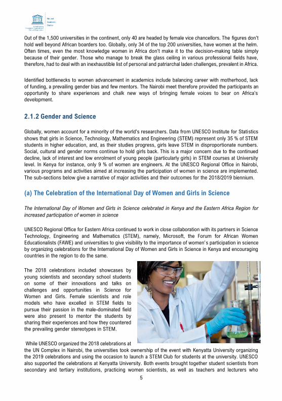
(a) The Celebration of the International Day of Women and Girls in Science
The International Day of Women and Girls in Science celebrated in Kenya and the Eastern Africa Region for
increased participation of women in science
UNESCO Regional Office for Eastern Africa continued to work in close collaboration with its partners in Science
Technology, Engineering and Mathematics (STEM), namely, Microsoft, the Forum for African Women
Educationalists (FAWE) and universities to give visibility to the importance of women’s participation in science
by organizing celebrations for the International Day of Women and Girls in Science in Kenya and encouraging
countries in the region to do the same.
The 2018 celebrations included showcases by
young scientists and secondary school students
on some of their innovations and talks on
challenges and opportunities in Science for
Women and Girls. Female scientists and role
models who have excelled in STEM fields to
pursue their passion in the male-dominated field
were also present to mentor the students by
sharing their experiences and how they countered
the prevailing gender stereotypes in STEM.
While UNESCO organized the 2018 celebrations at
the UN Complex in Nairobi, the universities took ownership of the event with Kenyatta University organizing
the 2019 celebrations and using the occasion to launch a STEM Club for students at the university. UNESCO
also supported the celebrations at Kenyatta University. Both events brought together student scientists from
secondary and tertiary institutions, practicing women scientists, as well as teachers and lecturers who
6
contribute to making the difference in girls’ participation in Science, Technology, Engineering and Mathematics
(STEM). The celebrations at Kenyatta University involved the presence of the University Vice-Chancellor and
other senior managers of the University in the celebrations and launch of the University STEM Club.
Following UNESCO’s guidance, the Ministry of Education in Rwanda, FAWE Rwanda Chapter, Rwanda Women
in Science, Engineering (RAWISE), and African Institute for Mathematical Sciences (AIMS) also organized
celebrations for the International Day of women and Girls in Science 2019 in Kigali, Rwanda. The occasion
was used to recognize Rwanda’s first female scientist to get a PhD in Physics and to have round table
discussions on reasons for women’s low participation in STEM in the country.
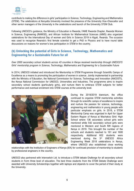
(b) Unlocking the potential of Girls in Science, Technology, Mathematics and
Engineering for a Sustainable Future for all
Over 2000 secondary school students across 43 counties in Kenya received mentorship through UNESCO’S
Girls’ mentorship program in Science, Technology, Mathematics and Engineering for a Susta inable Future
In 2014, UNESCO initiated and introduced the Mentorship in STEM Programme through Scientific Camps of
Excellence as a means to promoting the participation of women in science. Jointly implemented in partnership
with the Ministry of Education, the National Commission for Science, Technology and Innovation (NACOSTI),
the Kenya National Commission for UNESCO, Universities and Industries. The programme aims to inspire
secondary school students (particularly girls), and nurture them to embrace STEM subjects for better
performance and eventual enrolment into STEM courses at the university level.
During the 2018/2019 biennium, the office
continued to organize STEM mentorship activities
through its scientific camps of excellence to inspire
and nurture the passion for science, technology,
engineering and mathematics in young people with
particular emphasis on girls. In 2018, a STEM
Mentorship Camp was organized in April for Upper
Eastern Region of Kenya at Machakos Girls' High
School where 136 secondary school girls were
mentored while 542 secondary school girls were
mentored in Western and South Rift regions of
Kenya in 2019. This brought the number of the
schools and students reached to 161 and 1600
respectively. Additional 602 students were
mentored during the 3rd UNESCO Africa
Engineering Week 2018 celebrations in Kenya,
where UNESCO also established close working
relationships with the Institution of Engineers of Kenya (IEK) for continued provision of mentorship to students
by professional engineers in the country.
UNESCO also partnered with Interswitch Ltd. to introduce a STEM debate Challenge for all secondary school
students in Form three level of education. The best three students from the STEM Debate Challenge were
awarded with University Scholarships together with laptops and stipends to cover the period of their study at
the University.
7
2.1.3 Local and Indigenous Knowledge Systems
The UNESCO Local and Indigenous Knowledge Systems (LINKS) programme acts to support the inclusion of
local and indigenous knowledge in science education, biodiversity conservation and climate change adaptation.
Guided by the 2007 UN Declaration on the Rights of Indigenous People, UNESCO is also engaging with
indigenous communities to elaborate a UNESCO-wide policy to ensure that all its programmes address the
specific needs and rights of indigenous people.
(a) SANDWATCH: Adapting to Climate Change and Educating for Sustainable
Development
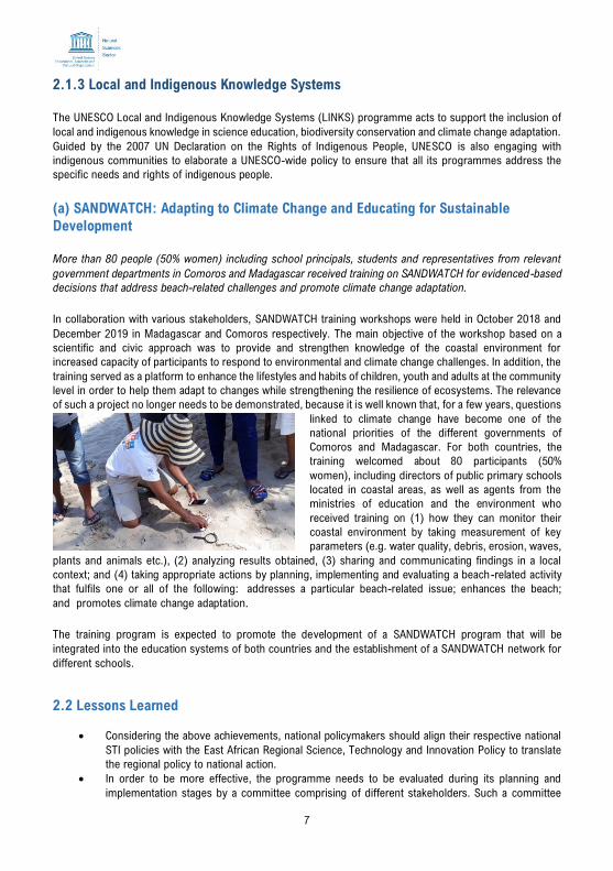
More than 80 people (50% women) including school principals, students and representatives from relevant
government departments in Comoros and Madagascar received training on SANDWATCH for evidenced-based
decisions that address beach-related challenges and promote climate change adaptation.
In collaboration with various stakeholders, SANDWATCH training workshops were held in October 2018 and
December 2019 in Madagascar and Comoros respectively. The main objective of the workshop based on a
scientific and civic approach was to provide and strengthen knowledge of the coastal environment for
increased capacity of participants to respond to environmental and climate change challenges. In addition, the
training served as a platform to enhance the lifestyles and habits of children, youth and adults at the community
level in order to help them adapt to changes while strengthening the resilience of ecosystems. The relevance
of such a project no longer needs to be demonstrated, because it is well known that, for a few years, questions
linked to climate change have become one of the
national priorities of the different governments of
Comoros and Madagascar. For both countries, the
training welcomed about 80 participants (50%
women), including directors of public primary schools
located in coastal areas, as well as agents from the
ministries of education and the environment who
received training on (1) how they can monitor their
coastal environment by taking measurement of key
parameters (e.g. water quality, debris, erosion, waves,
plants and animals etc.), (2) analyzing results obtained, (3) sharing and communicating findings in a local
context; and (4) taking appropriate actions by planning, implementing and evaluating a beach-related activity
that fulfils one or all of the following: addresses a particular beach-related issue; enhances the beach;
and promotes climate change adaptation.
The training program is expected to promote the development of a SANDWATCH program that will be
integrated into the education systems of both countries and the establishment of a SANDWATCH network for
different schools.
2.2 Lessons Learned
• Considering the above achievements, national policymakers should align their respective national
STI policies with the East African Regional Science, Technology and Innovation Policy to translate
the regional policy to national action.
• In order to be more effective, the programme needs to be evaluated during its planning and
implementation stages by a committee comprising of different stakeholders. Such a committee
8
would potentially subject the planned activities to rigorous review in the developmental stage and
later oversee the integration of project-specific results into the programme.
• The involvement of the national institutions and their ownership of the programme is critical for its
success. Moreover, UNESCO can tap into the financial resources of the National Commissions for
the success of its national activities;
• Overcoming the gender stereotypes and ensuring attitude change is a long-term activity, which
needs the full commitment of all the stakeholders.
2.3 Challenges
• Mobilizing funding for a regional initiative of STI is also getting difficult as we have very much
limited donors for such regional priorities.
• Limited capacities and resources (human, technology and funding) for STI initiatives in general.
• The region needs to address three critical challenges to resolve how science, technology and
innovation can enable development in the region. First there is need to bridge the existing gap
through access to technologies between and within the individual countries.
• To reduce the technology gap, member countries need to invest in researching on ways to expand
information infrastructure, and reduce the cost of service, especially for internet access. Further,
there are very few platforms for sharing experiences, between individual countries in the region as
well as with the development partners, of what technology works and what does not.
• Moreover, to promote inclusive innovation within individual countries, there is need to enact
national policies for innovation capacity that make it possible to reduce inequality through labor
and employment opportunities for all.
• There is also the underfinancing of innovation efforts. Financing innovation is key in promoting
technological change, which supports structural diversification and reduces the dependence of
countries and economies on commodity boom/bust cycles. As such, there is need to develop
structural avenues for mobilizing such financial resources for technological development.
• There are insufficient STI partnerships in sectors of public importance including education, natural
resources management, health among others. There is need to further develop these collaborations
and alliances through strengthening existing STI partnerships and developing new ones,
particularly South-South collaborations.
• The Government has very high expectations of UNESCO but the financial resources are limited and
do not allow us to reach out to more students as they would wish us to do with the STEM
programme.
2.4 Opportunities
• The two multi-stakeholder activities have provided a favorable environment and a great opportunity
for a multi-sectoral approach to solving the regions’ pressing STI challenges. This approach
provides a bold, integrative, transformative and creative approach to spur towards an innovation-
led knowledge-based economy, sustainable job creation and improve the quality of life for citizens
of the individual countries.
• The challenge of underfinancing of STI efforts in the region provides an opportunity for partnership
between academia, the private and the public sector at different levels including policy development
and implementation of activities. Additionally, this presents the STI programme with a chance for
working with individual specific national institution to empower them in management of research
while ensuring effective coordination of research.
• The interest of partners such as Microsoft to train students in coding and robotics during the
UNESCO STEM mentorship camps is a good opportunity for UNESCO to increase the interest of
female students in science.
9
• The offer by Eutelsat to connect schools that have participated in the UNESCO mentorship
programme to internet will enhance participation of girls in STEM through a more interactive
teaching and learning of the science subjects.
10
3. ECOLOGICAL AND EARTH SCIENCES (MAB and IGGP)
The burgeoning challenges posed by climate change, biodiversity loss, sea level rise and natural hazards and
disasters call for pragmatic measures to drive the environmental sustainability agenda and strengthen the
disaster risk reduction and preventive approaches of vulnerable Member States. Programmes and projects
under the Ecological and Earth sciences are designed to address the aforementioned challenges. The
programmes and projects implemented under Ecological and Earth Sciences include: Man and the Biosphere
Programme (MAB) and the International Geoscience & Geoparks Programme (IGGP).
The sub-sections below give a narrative of major activities and their outcomes for the 2018/2019 biennium.
3.1 Activities
3.1.1 Man and Biosphere Programme
(a) Biosphere Reserves in Mauritius
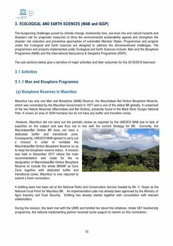
Mauritius has only one Man and Biosphere (MAB) Reserve, the Macchabee/ Bel Ombre Biosphere Reserve,
which was nominated by the Mauritian Government in 1977 and is one of the oldest BR globally. It comprised
of the two Nature Reserves (Macchabee and Bel Ombre), presently found in the Black River Gorges National
Park. It covers an area of 3594 hectares but do not have any buffer and transition zones.
However, Mauritius did not carry out the periodic review as required by the UNESCO MAB due to lack of
expertise on the subject and was thus not in line with the current Strategy for BR. Currently, the
Macchabee/Bel Ombre BR does not have a
dedicated buffer and transitional zone.
Consequently, UNESCO MAB agreed to carry out
a mission in order to revitalize the
Macchabee/Bel Ombre Biosphere Reserve so as
to keep the biosphere reserve status. A mission
was held in December 2017 where the main
recommendation was made for the re
designation of Macchabee/Bel Ombre Biosphere
Reserve to include the whole BRGNP as Core
Zone together with dedicated buffer and
transitional zones. Mauritius is now required to
submit a fresh nomination.
A drafting team has been set at the National Parks and Conservation Service headed by Mr. V. Gopal as the
National Focal Point for Mauritius BR. An implementation plan has already been approved by the Ministry of
Agro Industry and Food Security. Drafting has already started together with consultation with relevant
stakeholders.
During the mission, the team met with the UNRC and briefed her about the initiatives. Under GEF biodiversity
programme, the national implementing partner received some support to rework on this nomination.
11
(b) Biosphere Reserves in Seychelles
We organized our first meeting with the President of UNESCO National Commission for Seychelles and Minister
for Education during which she agreed to initiate the process for formulating MAB National Committee for
Seychelles. She instructed the Ministry of Environment, Energy and Climate Change to work with the
authorities by calling all relevant stakeholders, Ministries, departments, community group organizations and
National Commission to take the necessary action to establish the committee based on the cabinet decision.
The National Commission for UNESCO shall work with UNESCO MAB Secretariat to formalize the committee
and the Nairobi office will do the needful to make it part of Africa.
Principle Secretary of Environment appreciated the helping hand of UNESCO in establishing MAB Nationa l
Committee and further deliberations on possible nomination of biosphere reserve sites from Seychelles.
Followed by the meeting with the PS, the Ministry of Environment organized a stakeholder consultation meeting
with all relevant Ministries, community groups, national and international NGO. UNESCO made a presentation
on what constitutes a biosphere reserve and the formalities to be followed for the nomination of a reserve,
the benefits of nominating the MAB National Committee etc. There was lively discussion among the stakeholder
ministries and community groups with UNESCO on biosphere reserves most of the community group
interested to know what the new restrictions for community movement are once the site is declared as a
biosphere reserve. Basically, we clarified that this nomination is not for full protection, but it gives the
opportunity for community to take the ownership and how best both sides of the conservation and socio-
economic activities can co-exist.
Various stakeholders suggested
about three to four sites for
consideration out of which two
natural heritage sites were
suggested for a short field visit to
inspect the marine national park
close to Mahe Island.
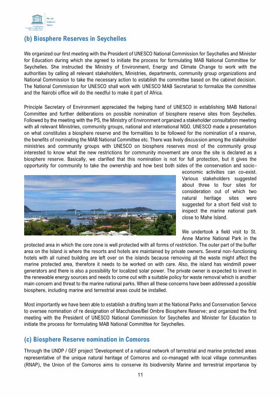
We undertook a field visit to St.
Anne Marine National Park in the
protected area in which the core zone is well protected with all forms of restriction. The outer part of the buffer
area on the Island is where the resorts and hotels are maintained by private owners. Several non-functioning
hotels with all ruined building are left over on the islands because removing all the waste might affect the
marine protected area, therefore it needs to be worked on with care. Also, the island has windmill power
generators and there is also a possibility for localized solar power. The private owner is expected to invest in
the renewable energy sources and needs to come out with a suitable policy for waste removal which is another
main concern and threat to the marine national parks. When all these concerns have been addressed a possible
biosphere, including marine and terrestrial areas could be installed.
Most importantly we have been able to establish a drafting team at the National Parks and Conservation Service
to oversee nomination of re designation of Macchabee/Bel Ombre Biosphere Reserve; and organized the first
meeting with the President of UNESCO National Commission for Seychelles and Minister for Education to
initiate the process for formulating MAB National Committee for Seychelles.
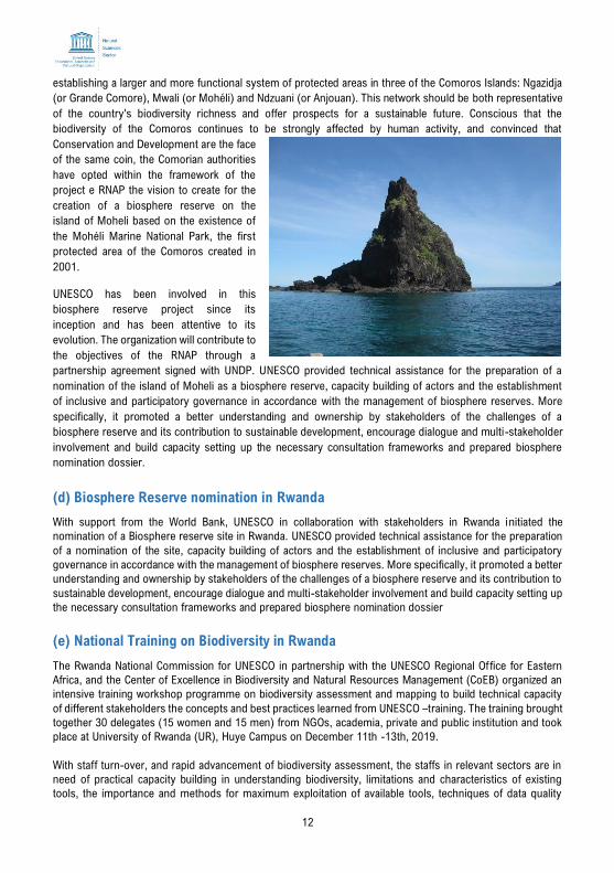
(c) Biosphere Reserve nomination in Comoros
Through the UNDP / GEF project 'Development of a national network of terrestrial and marine protected areas
representative of the unique natural heritage of Comoros and co-managed with local village communities
(RNAP), the Union of the Comoros aims to conserve its biodiversity Marine and terrestrial importance by
12
establishing a larger and more functional system of protected areas in three of the Comoros Islands: Ngazidja
(or Grande Comore), Mwali (or Mohéli) and Ndzuani (or Anjouan). This network should be both representative
of the country's biodiversity richness and offer prospects for a sustainable future. Conscious that the
biodiversity of the Comoros continues to be strongly affected by human activity, and convinced that
Conservation and Development are the face
of the same coin, the Comorian authorities
have opted within the framework of the
project e RNAP the vision to create for the
creation of a biosphere reserve on the
island of Moheli based on the existence of
the Mohéli Marine National Park, the first
protected area of the Comoros created in
2001.
UNESCO has been involved in this
biosphere reserve project since its
inception and has been attentive to its
evolution. The organization will contribute to
the objectives of the RNAP through a
partnership agreement signed with UNDP. UNESCO provided technical assistance for the preparation of a
nomination of the island of Moheli as a biosphere reserve, capacity building of actors and the establishment
of inclusive and participatory governance in accordance with the management of biosphere reserves. More
specifically, it promoted a better understanding and ownership by stakeholders of the challenges of a
biosphere reserve and its contribution to sustainable development, encourage dialogue and multi-stakeholder
involvement and build capacity setting up the necessary consultation frameworks and prepared biosphere
nomination dossier.
(d) Biosphere Reserve nomination in Rwanda
With support from the World Bank, UNESCO in collaboration with stakeholders in Rwanda initiated the
nomination of a Biosphere reserve site in Rwanda. UNESCO provided technical assistance for the preparation
of a nomination of the site, capacity building of actors and the establishment of inclusive and participatory
governance in accordance with the management of biosphere reserves. More specifically, it promoted a better
understanding and ownership by stakeholders of the challenges of a biosphere reserve and its contribution to
sustainable development, encourage dialogue and multi-stakeholder involvement and build capacity setting up
the necessary consultation frameworks and prepared biosphere nomination dossier
(e) National Training on Biodiversity in Rwanda
The Rwanda National Commission for UNESCO in partnership with the UNESCO Regional Office for Eastern
Africa, and the Center of Excellence in Biodiversity and Natural Resources Management (CoEB) organized an
intensive training workshop programme on biodiversity assessment and mapping to build technical capacity
of different stakeholders the concepts and best practices learned from UNESCO –training. The training brought
together 30 delegates (15 women and 15 men) from NGOs, academia, private and public institution and took
place at University of Rwanda (UR), Huye Campus on December 11th -13th, 2019.
With staff turn-over, and rapid advancement of biodiversity assessment, the staffs in relevant sectors are in
need of practical capacity building in understanding biodiversity, limitations and characteristics of existing
tools, the importance and methods for maximum exploitation of available tools, techniques of data quality
13
control, and basic methods of data presentation and interpretation. This will fill gaps in understanding among
staffs spanning field technicians to modelers who use and interpret biodiversity data.
Prof Beth Kaplin heading the Center of Excellence in Biodiversity and Natural Resources Management (CoEB)
who emphasized that people have to know their relationship with the environment and therefore encouraged
trainees to bring positive changes, join forces and knowledge to preserve and protect biodiversity
3.1.2 Earth Sciences Programme
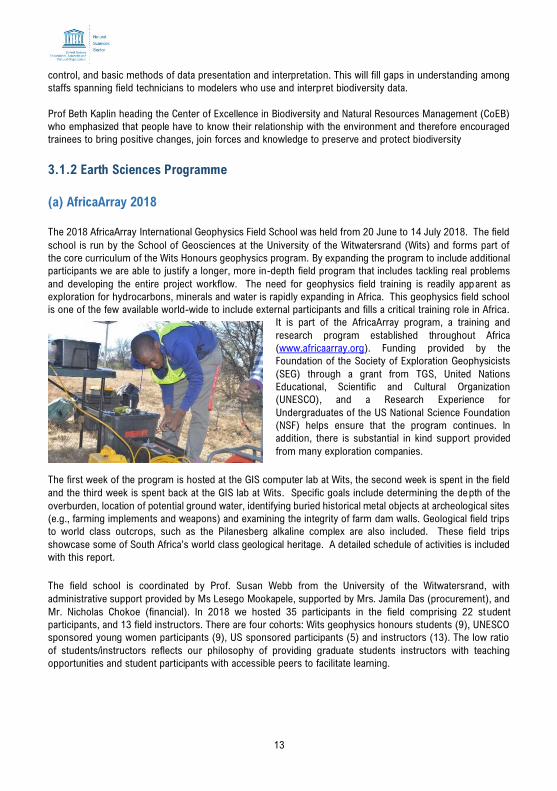
(a) AfricaArray 2018
The 2018 AfricaArray International Geophysics Field School was held from 20 June to 14 July 2018. The field
school is run by the School of Geosciences at the University of the Witwatersrand (Wits) and forms part of
the core curriculum of the Wits Honours geophysics program. By expanding the program to include additional
participants we are able to justify a longer, more in-depth field program that includes tackling real problems
and developing the entire project workflow. The need for geophysics field training is readily apparent as
exploration for hydrocarbons, minerals and water is rapidly expanding in Africa. This geophysics field school
is one of the few available world-wide to include external participants and fills a critical training role in Africa.
It is part of the AfricaArray program, a training and
research program established throughout Africa
(www.africaarray.org). Funding provided by the
Foundation of the Society of Exploration Geophysicists
(SEG) through a grant from TGS, United Nations
Educational, Scientific and Cultural Organization
(UNESCO), and a Research Experience for
Undergraduates of the US National Science Foundation
(NSF) helps ensure that the program continues. In
addition, there is substantial in kind support provided
from many exploration companies.
The first week of the program is hosted at the GIS computer lab at Wits, the second week is spent in the field
and the third week is spent back at the GIS lab at Wits. Specific goals include determining the depth of the
overburden, location of potential ground water, identifying buried historical metal objects at archeological sites
(e.g., farming implements and weapons) and examining the integrity of farm dam walls. Geological field trips
to world class outcrops, such as the Pilanesberg alkaline complex are also included. These field trips
showcase some of South Africa’s world class geological heritage. A detailed schedule of activities is included
with this report.
The field school is coordinated by Prof. Susan Webb from the University of the Witwatersrand, with
administrative support provided by Ms Lesego Mookapele, supported by Mrs. Jamila Das (procurement), and
Mr. Nicholas Chokoe (financial). In 2018 we hosted 35 participants in the field comprising 22 student
participants, and 13 field instructors. There are four cohorts: Wits geophysics honours students (9), UNESCO
sponsored young women participants (9), US sponsored participants (5) and instructors (13). The low ratio
of students/instructors reflects our philosophy of providing graduate students instructors with teaching
opportunities and student participants with accessible peers to facilitate learning.
14
(b) AfricaArray 2019
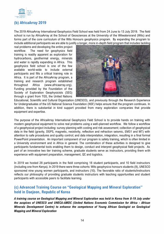
The 2019 AfricaArray International Geophysics Field School was held from 24 June to 13 July 2019. The field
school is run by AfricaArray at the School of Geosciences at the University of the Witwatersrand (Wits) and
forms part of the core curriculum of the Wits Honours geophysics program. By expanding the program to
include additional participants we are able to justify a longer, more in-depth field program that includes tackling
real problems and developing the entire project
workflow. The need for geophysics field
training is readily apparent as exploration for
hydrocarbons, geothermal energy, minerals
and water is rapidly expanding in Africa. This
geophysics field school is one of the few
available world-wide to include external
participants and fills a critical training role in
Africa. It is part of the AfricaArray program, a
training and research program established
throughout Africa (www.africaarray.org).
Funding provided by the Foundation of the
Society of Exploration Geophysicists (SEG)
through a grant from TGS, the United Nations
Educational, Scientific and Cultural Organization (UNESCO), and previously through the Research Experience
for Undergraduates of the US National Science Foundation (NSF) helps ensure that the program continues. In
addition, there is substantial in kind support provided from many exploration companies that provide
equipment and expertise.
The purpose of the AfricaArray International Geophysics Field School is to provide hands on training with
modern geophysical equipment to solve real problems using a well-planned workflow. We follow a workflow
of a geophysical project including: survey planning with costing and risk assessment; collection of geophysical
data in the field (gravity, DGPS, magnetic, resistivity, reflection and refraction seismic, EM31 and MT) with
attention to safe procedures and quality control; and data interpretation, integration, resulting in a final formal
PowerPoint presentation. An important component of our program is safety training, which is often limited in
a University environment and in Africa in general. The combination of these activities is designed to give
participants fundamental tools enabling them to design, conduct and interpret geophysical field projects. As
part of an innovative two tier training scheme, graduate students serve as instructors, providing them with
experience with equipment preparation, management, QC and logistics.
In 2019 we hosted 28 participants in the field comprising 18 student participants, and 10 field instructors
(including one from Kenya). In 2019 there were three cohorts: Wits geophysics honours students (9), UNESCO
sponsored nine young women participants, and instructors (10). The favorable ratio of students/instructors
reflects our philosophy of providing graduate students instructors with teaching opportunities and student
participants with accessible peers to facilitate learning.
(c) Advanced Training Course on “Geological Mapping and Mineral Exploration’’
held in Daejeon, Republic of Korea
A training course on Geological Mapping and Mineral Exploration was held in Korea from 8-19 July under
the auspices of UNESCO and UNECA-AMDC (United Nations Economic Commission for Africa - African
Minerals Development Centre) to enhance the competence of Young African Geologist on Geological
Mapping and Mineral Exploration
15
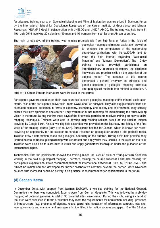
An advanced training course on Geological Mapping and Mineral Exploration was organized in Daejeon, Korea
by the International School for Geoscience Resources of the Korean Institute of Geoscience and Mineral
Resources (KIGAM/IS-Geo) in collaboration with UNESCO and UNECA-AMDC. The training was held from 8-
19th July 2019 involving 20 scientists (10 men and 10 women) from sub-Saharan African countries.
The main of objective of the training was to raise professionals from Sub-Saharan Africa in the fields of
geological mapping and mineral exploration as well as
to enhance the competence of the cooperating
countries/organizations with Korea/KIGAM and to
meet the high interest regarding “Geological
Mapping” and “Mineral Exploration”. The 12-day
training course provided participants an
interdisciplinary approach to explore the academic
knowledge and practical skills on the expertise of the
subject matter. The contents of this course
comprised a general overview on principles and
genetic concepts of geological mapping technique
and geophysical methods into mineral exploration. A
total of 11 Korean/Foreign instructors were involved in the course.
Participants gave presentation on their own countries’ current geological mapping and/or mineral exploration
status. Each of the participants delivered in-depth SWOT and Gap analyses. They also suggested solutions and
estimated expected outcomes in terms of economy, technology and society and environment. They actively
shared their own opinions to one another. They worked on future roadmap for implementing the Africa Mining
Vision in the future. During the first three days of the first week, participants received training on how to utilize
mapping techniques. Trainees were able to develop map-reading abilities based on the satellite images
provided by Google Earth. Also, a two-day field excursion was provided on the Thursday and Friday of the first
week of the training course (July 11th to 12th). Participants headed for Seosan, which is known for rocks,
providing an opportunity for the trainees to conduct research on geologic structures of the periodic rocks.
Trainees drew a deformation shape and geological boundary on the outcrop. Through this field practice, they
learned how to compose geological map with clinometer and apply what they learned in the class on the field.
Trainees were also able to learn how to utilize and apply geometrical techniques under the guidance of the
international expert.
Testimonies from the participants showed the training raised the level of skills of Young African Scientists
working in the field of geological mapping. Therefore, making the course successful and also meeting the
participants’ expectations. It was recommended that the international network of UNESCO, UNECA-AMCD and
KIGAM be maintained and developed for further collaborative activities beyond the border. More advanced
courses with increased hands-on activity, field practice, is recommended for consideration in the future.
(d) Geopark Kenya
In December 2018, with support from German NATCOM, a two-day training for the National Geopark
Committee members was conducted. Experts were from German Geoparks. This was followed by a six-day
mapping of potential geosites. A total of 33 potential sites were visited. During the visits, using a checklist,
the sites were assessed in terms of whether they meet the requirements for nomination including presence
of infrastructure (e.g. presence of signage, roads, guard rails, education of information centres) , local site-
level governance and management arrangements, identified information sources and gaps. 13 of the 33 sites
16
visited were shortlisted to be part of the proposed Geopark. A meeting was held with the County Government
(including the Deputy Governor and some elected leaders).
One of the main issues we noted is the need to fast track development of the requisite infrastructure including
signage/panels, roads, capacity building for local tour guides and collating information (from grey literature
etc.) in preparedness for the nomination. Funding is an issue and in as much as we continue engaging the
County Government (still pursuing and consulting with them to secure their full commitments on needed
interventions) there is the need to explore alternative funding mechanisms to enable us address some of these
issues.
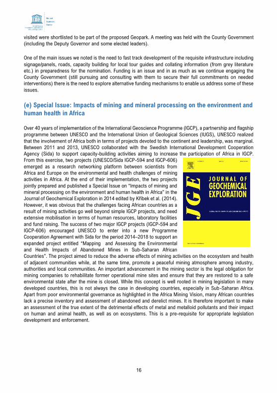
(e) Special Issue: Impacts of mining and mineral processing on the environment and
human health in Africa
Over 40 years of implementation of the International Geoscience Programme (IGCP), a partnership and flagship
programme between UNESCO and the International Union of Geological Sciences (IUGS), UNESCO realized
that the involvement of Africa both in terms of projects devoted to the continent and leadership, was marginal.
Between 2011 and 2013, UNESCO collaborated with the Swedish International Development Cooperation
Agency (Sida) to support capacity-building activities aiming to increase the participation of Africa in IGCP.
From this exercise, two projects (UNESCO/Sida IGCP-594 and IGCP-606)
emerged as a research networking platform between scientists from
Africa and Europe on the environmental and health challenges of mining
activities in Africa. At the end of their implementation, the two projects
jointly prepared and published a Special Issue on “Impacts of mining and
mineral processing on the environment and human health in Africa” in the
Journal of Geochemical Exploration in 2014 edited by Kříbek et al. (2014).
However, it was obvious that the challenges facing African countries as a
result of mining activities go well beyond simple IGCP projects, and need
extensive mobilisation in terms of human resources, laboratory facilities
and fund raising. The success of two major IGCP projects (IGCP-594 and
IGCP-606) encouraged UNESCO to enter into a new Programme
Cooperation Agreement with Sida for the period 2014–2018 to support an
expanded project entitled “Mapping and Assessing the Environmental
and Health Impacts of Abandoned Mines in Sub-Saharan African
Countries”. The project aimed to reduce the adverse effects of mining activities on the ecosystem and health
of adjacent communities while, at the same time, promote a peaceful mining atmosphere among industry,
authorities and local communities. An important advancement in the mining sector is the legal obligation for
mining companies to rehabilitate former operational mine sites and ensure that they are restored to a safe
environmental state after the mine is closed. While this concept is well rooted in mining legislation in many
developed countries, this is not always the case in developing countries, especially in Sub-Saharan Africa.
Apart from poor environmental governance as highlighted in the Africa Mining Vision, many African countries
lack a precise inventory and assessment of abandoned and derelict mines. It is therefore important to make
an assessment of the true extent of the detrimental effects of metal and metalloid pollutants and their impact
on human and animal health, as well as on ecosystems. This is a pre-requisite for appropriate legislation
development and enforcement.
17
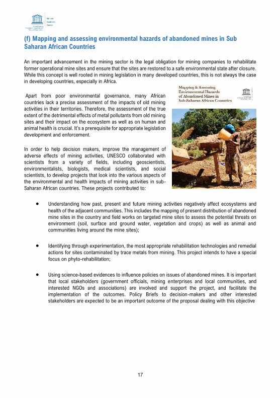
(f) Mapping and assessing environmental hazards of abandoned mines in Sub
Saharan African Countries
An important advancement in the mining sector is the legal obligation for mining companies to rehabilitate
former operational mine sites and ensure that the sites are restored to a safe environmental state after closure.
While this concept is well rooted in mining legislation in many developed countries, this is not always the case
in developing countries, especially in Africa.
Apart from poor environmental governance, many African
countries lack a precise assessment of the impacts of old mining
activities in their territories. Therefore, the assessment of the true
extent of the detrimental effects of metal pollutants from old mining
sites and their impact on the ecosystem as well as on human and
animal health is crucial. It’s a prerequisite for appropriate legislation
development and enforcement.
In order to help decision makers, improve the management of
adverse effects of mining activities, UNESCO collaborated with
scientists from a variety of fields, including geoscientists,
environmentalists, biologists, medical scientists, and social
scientists, to develop projects that look into the various aspects of
the environmental and health impacts of mining activities in sub-
Saharan African countries. These projects contributed to:
• Understanding how past, present and future mining activities negatively affect ecosystems and
health of the adjacent communities. This includes the mapping of present distribution of abandoned
mine sites in the country and field works on targeted mine sites to assess the potential threats on
environment (soil, surface and ground water, vegetation and crops) as well as animal and
communities living around the mine sites);
• Identifying through experimentation, the most appropriate rehabilitation technologies and remedial
actions for sites contaminated by trace metals from mining. This project intends to have a special
focus on phyto-rehabilitation;
• Using science-based evidences to influence policies on issues of abandoned mines. It is important
that local stakeholders (government officials, mining enterprises and local communities, and
interested NGOs and associations) are involved and support the project, and facilitate the
implementation of the outcomes. Policy Briefs to decision-makers and other interested
stakeholders are expected to be an important outcome of the proposal dealing with this objective

18
3.1.3 Disaster Risk Reduction
(a) Disaster Risk Reduction: A platform for the Seismic Hazard Evaluation in the East
African Rift System
The International Geoscience Programme (GCP), Working Group met in Dar-Es-Salaam, Tanzania, to discuss
the possibility of integrating the Global Monitoring of Environment and Security (GMES) programme in the
frame of the African Union and European Union agreement.
For the seismic hazard assessment, the seismotectonic characteristics of the Kenya and Ethiopia sections of
the East African Rift System rely on the 3 – 5 mm/yr rates of active deformation and on the seismogenic
structures previously identified in the Seismotectonic Map of Africa (IGCP-601 project; Meghraoui et al., 2016).
Among characteristic earthquakes with surface ruptures, a study was conducted on the seismic source
parameters of the 25 August 1906 earthquake (Mw 6.5) near Ginir, and the 6 January 1928 Subukia valley
earthquake (Mw 7.0; Ambraseys, 1991; Ayele and Kulhanek, 2000). The previous Global Seismic Hazard
Assessment Program (GSHAP) model, including part of the African region, was based upon classical
probabilistic seismic hazard assessment (PSHA) principles (Giardini et al., 1999).
Recently, conventional PSHA has come under serious criticism for evident failures of sound evaluations (Stein
et al., 2012; Kossobokov and Nekrasova, 2012; Wyss et al., 2012). In current case the working group tested
the application of a scenario-based deterministic and PSHA approach applied to the East African Rift System
(EARS; Ksentini & Romdhane, 2014). Although the earthquake recurrence period for large earthquakes (with
Mw > 6.5) is poorly known for the study area, the International Geoscience Programme (GCP) Working Group
observed that the occurrence of a 1928 earthquake size at ~150 km distance from the recently grown Nairobi
urban region would generate 0.3 to 0.4g ground acceleration.
For this reason, the GCP Working Group met in Dar-Es-Salaam, in October 2018, to discuss the possibility of
integrating the Global Monitoring of Environment and Security (GMES) programme, in the framework of the
African Union and the European Union agreement. The
GMES information was launched in July 2018 and the
Working Group looks forward for a call in order to submit
the SEISMOSHAF proposal.
The constitution of a robust database is the main
component for the Deterministic Hybrid Seismic Hazard
Assessment (DHA) and Probabilistic Hybrid Seismic
Hazard Assessment (PSHA). Six topics were addressed,
concerning the Earthquake catalogue compilation and
updating, analysis and homogenization, the
Morphotectonic/remote-sensing data compilation and
analysis, the Compilation of active-fault database and
seismic source characteristics, the compilation and updating of geodetic data for study region, the compilation
of crustal structure models and the attenuation relationships and Ground Motion Prediction Equations.
The Working Group considered the work programme of PhD students (e.g., the contribution of Sophie
Kipkwony) as a priority in the objectives of the IGCP-659 programmes. The proposed work will have to
concentrate on seismic micro-zonation hazard studies within the capital cities of Nairobi (Kenya) and Addis
Ababa (Ethiopia). The programme aims at studying the seismic source characteristics, local site effects
(seismic ground response), subsurface characterization, seismic hazard and risk analysis (SHA and SRA).
19
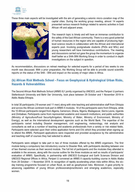
These three main aspects will be investigated with the aim of generating a seismic micro-zonation map of the
capital cities. During the working group meeting, almost 14 experts
presented various research findings related to seismic activities in East
African rift and adjacent areas.
The research topic is timely and will have an immense contribution to
the safety of the East African community. There is a very good potential
of human resources in the region who are capable of producing high-
level science results in collaboration with the African and international
experts pool. Involving postgraduate students (PhDs and MSc) and
young researchers will have tremendous contributions. The meeting
and discussions carried out gave the group the momentum to organize
itself better as a SHA-SRA Working Group in order to conduct in depth
investigations on the subject in question.
As recommendation, discussions on retreat meetings for selected experts for a period of two weeks to one
month was discussed. With a prior preparation, the Working Group will be able to provide sound scientific
reports on the status of the SHA - SRA and impact on the society of major cities in Africa.
(b) African Risk Methods School - Focus on Geophysical & Hydrological Urban Risks,
Hazards & Vulnerabilities
The Second African Risk Methods School (ARMS II)1 jointly organised by UNESCO, and the Periperi U partners
Stellenbosch University and Bahir Dar University, took place between 28 October and 1 November 2019 in
Addis Ababa Ethiopia.
In total 30 participants (19 women and 11 men) along with nine teaching and administrative staff from Ethiopia
and across the African continent took part in ARMS II modules. 18 of the participants were from Ethiopia, while
the 10 African participants ranged from Algeria, Cameroon, Ghana, Nigeria, Madagascar, Sierra Leone, Uganda
and Zimbabwe. Participants came from represented academic and research institutions, and public authorities
(Ministry of Agriculture/Food Security/Irrigation, Ministry of Water, Ministry of Environment, Ministry of
Energy), as well as the international development agencies such as the World Bank. The expertise of the
participants varied including Disaster management, civil engineering, meteorology, risk analysts and
consultants as well as a number of teaching and academic professionals from a variety or risk related fields.
Participants were selected upon their online application forms and CVs which they provided when signing up
to attend the ARMS. Participant applications were inspected and provided acceptance by the administrative
and teaching staff of courses they had selected to attend.
Participants were obliged to take part in two of three modules offered by the ARMS organisers. The first
module being a compulsory two introductory course to Disaster Risk, with participants deciding between one
of two themed courses as their second module. The full list of participants and the modules they attended is
available in the annexes, along with the course outline for the three modules as well as results of participants’
evaluation of ARMS. Specifically, in partnership with UNESCO Ecological and Earth Sciences Division and
UNESCO Regional Offices in Africa, Periperi U convened an ARMS II capacity-building course in Addis Ababa
from 28 October – 1 November 2019. In recognition of rapidly accelerating urban risks within Africa, the six-
day training programme focused on urban flood, as well as geophysical risks. Moreover, it gave priority to
advancing capabilities of young African professionals/practitioners and emerging academics, especially
women.
20
3.2 Lessons Learned
In relation to the activities and achievements, the key lessons learned are:
• Evaluation of Biosphere reserves is still very relevant and essential to decision-making for effective
management of existing protected areas and for the expansion of the BR networks.
• There is need to invest in improving collective action capacity on the biosphere reserve evaluation
within individual countries in the region
3.3. Challenges
Despite an increasing the number of protected areas in the region, biodiversity continues to decline
dramatically, in part due to limited resources to maintain these areas as strictly protected and/or to enforce
relevant legal frameworks. Further, although several surveys on reducing biodiversity loss have been
conducted in the region, there are still large data and knowledge gaps on trends on drivers of species and
habitat erosion. Finally, there is inconsistent and untimely evaluation of biosphere reserves in the region
mainly due to challenges in obtaining sufficient funding as well as lack of technical expertise to conduct the
evaluation.
3.4 Opportunities
There is need to align the current protected area networks within the region to account for climate change.
This current situation presents an opportunity for developed countries to partner with the region to invest in
developing climate-resilient societies within and beyond the biosphere reserves. Such partnerships would
potentially focus on empowering institutions involved in operation of Biosphere Reserves to build up internal
capacity to deliver internationally agreed mandates.
21
4. INTERGOVERNMENTAL HYDROLOGICAL PROGRAMME
The Intergovernmental Hydrological Programme (IHP) stimulates and encourages hydrological research and
assists Member States in research and training activities. Its eighth phase focuses on six thematic areas,
namely, water-related disasters and hydrological changes; groundwater in a changing environment; addressing
water scarcity and quality; water and human settlements of the future; ecohydrology, engineering harmony
for a sustainable world; and water education, key to water security.
4.1 Activities
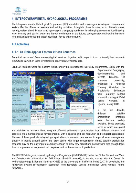
4.1.1 An iRain App for Eastern African Countries
Technical personnel from meteorological services together with experts from university/and research
institutions trained on iRain for improved observation of rainfall data.
UNESCO Regional Office for Eastern Africa, under the International Hydrology Programme, jointly with the
Department of Geography,
Geo-informatics and
Climate Sciences of
Makerere University,
organized a Regional
Training Workshop on
Precipitation Estimation
from Remotely Sensed
Information using Artificial
Neural Network, in
Uganda, in July 2018.
In the last decade,
different satellite
precipitation products
have become widely
available. These products,
some of which are global
and available in near-real time, integrate different estimates of precipitation from different sensors and
satellites into a homogeneous format product, with a specific grid cell resolution and temporal aggregation.
The use of these products in hydrologic applications has opened new venues to support water management
globally. In poorly gauged basins and large basins with larger concentration times, satellite precipitation
products may be the only input data timely enough to allow flow predictions downstream with enough lead -
time to implement management and response actions based on such predictions.
The UNESCO-Intergovernmental Hydrological Programme (UNESCO-IHP) under the Global Network on Water
and Development Information for Arid Lands (G-WADI network), is working closely with the Center for
Hydrometeorology & Remote Sensing (CHRS) at the University of California, Irvine (UCI) in developing the
PERSIANN System (Precipitation Estimation from Remotely Sensed Information using Artificial Neural
Networks).
22
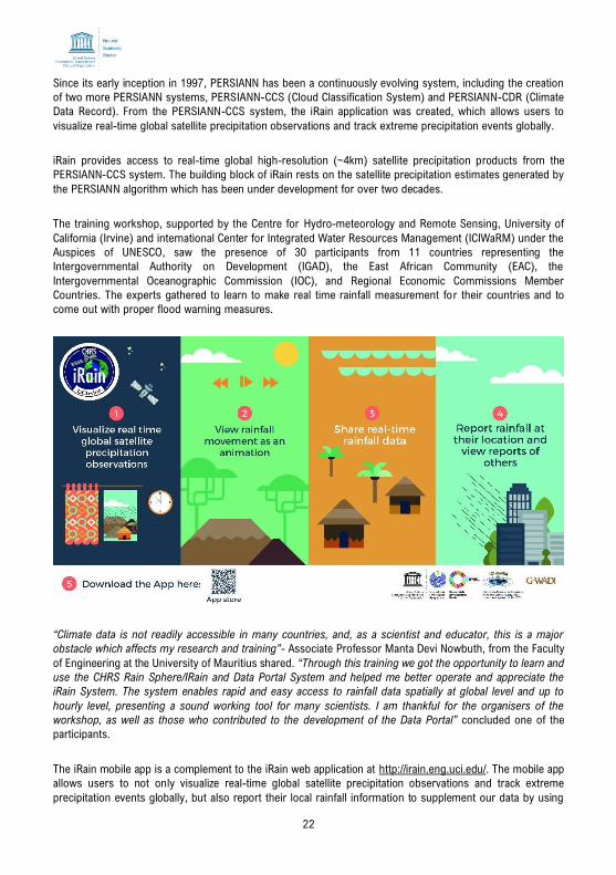
Since its early inception in 1997, PERSIANN has been a continuously evolving system, including the creation
of two more PERSIANN systems, PERSIANN-CCS (Cloud Classification System) and PERSIANN-CDR (Climate
Data Record). From the PERSIANN-CCS system, the iRain application was created, which allows users to
visualize real-time global satellite precipitation observations and track extreme precipitation events globally.
iRain provides access to real-time global high-resolution (~4km) satellite precipitation products from the
PERSIANN-CCS system. The building block of iRain rests on the satellite precipitation estimates generated by
the PERSIANN algorithm which has been under development for over two decades.
The training workshop, supported by the Centre for Hydro-meteorology and Remote Sensing, University of
California (Irvine) and international Center for Integrated Water Resources Management (ICIWaRM) under the
Auspices of UNESCO, saw the presence of 30 participants from 11 countries representing the
Intergovernmental Authority on Development (IGAD), the East African Community (EAC), the
Intergovernmental Oceanographic Commission (IOC), and Regional Economic Commissions Member
Countries. The experts gathered to learn to make real time rainfall measurement for their countries and to
come out with proper flood warning measures.
“Climate data is not readily accessible in many countries, and, as a scientist and educator, this is a major
obstacle which affects my research and training”- Associate Professor Manta Devi Nowbuth, from the Faculty
of Engineering at the University of Mauritius shared. “Through this training we got the opportunity to learn and
use the CHRS Rain Sphere/IRain and Data Portal System and helped me better operate and appreciate the
iRain System. The system enables rapid and easy access to rainfall data spatially at global level and up to
hourly level, presenting a sound working tool for many scientists. I am thankful for the organisers of the
workshop, as well as those who contributed to the development of the Data Portal” concluded one of the
participants.
The iRain mobile app is a complement to the iRain web application at http://irain.eng.uci.edu/. The mobile app
allows users to not only visualize real-time global satellite precipitation observations and track extreme
precipitation events globally, but also report their local rainfall information to supplement our data by using
23
the crowdsourcing functionality of the app. A useful feature of iRain is real-time rainfall observation data, which
can easily be shared through social networks, i.e. Facebook, Twitter. In addition, rainfall events can be viewed
as an animation to observe their change over time, as an accumulation of rain or as a time lapse. Precise
measurement of rainfall at a given point can be observed by zooming in to the app.
Eastern Africa is a region facing multiple challenges when it comes to flood and drought management. Building
capacity at regional level to reduce effects of disasters is fundamental for sustainable development. Until now,
insufficient attention has been put on developing technical capacity across the region for improved knowledge
in the use of remote sensing technologies for rainfall estimation. The training specifically focused on technical
personnel from meteorological/hydrological services as well as scientist from training and research
institutions. The technical personnel from meteorological services together with experts from university/ and
research institutions joined to analyse the data from their countries. The experts were introduced to the
theoretical background, followed by methodology to use the various operation in the iRain system on how to
extract the rainfall information. A series of case studies using rainfall data and PERSIANN-CCS systems were
also carried out, along with a short-session with students of Makerere University on using the iRain app
function also taking place. Ensuring of knowledge at the technical level is communicated upwards to decision
makers while horizontally across sectors is essential for mainstreaming of any hydrological extreme event.
Therefore, any technical activity should go hand-in-hand with institutional capacity development at the policy
level.
4.1.2 Seventh Africa Water Week
Africa Water week, themed: "Toward Achieving Water Security and Safety Managed Sanitation for Africa" was
held in Gabon from 29 October to 2 November 2018 to discuss and seek solutions to Africa's water resources
and sanitation challenges. The Africa Groundwater Map and Rainwater Harvesting Calculator and outreach
materials for Pan Africa were also presented.
The African Ministers' Council on Water (AMCOW) was formed in 2002 in Abuja Nigeria, primarily to promote
cooperation, security, social and economic development and poverty eradication among member states
through the effective management of the continent’s water resources and provision of water supply services.
In 2008, at the 11th ordinary session of the Africa Union (AU) Assembly in Sharm el-Sheikh, Heads of State
and Government of the AU agreed on commitments to accelerate the achievement of water and sanitation
goals in Africa and mandated AMCOW to develop and follow up an implementation strategy for these
commitments. AMCOW has also being accorded the status of a Specialised Committee for Water and Sanitation
in the African Union.
The Africa Water Week (aww) was convened by the African Ministers Council on Water (AMCOW) in
conjunction with the African Union Commission and organized with other development partners. It represented
a political commitment at the highest level with over 1000 participants from governments, regional institutions,
international partners, the private sector, the scientific community, civil society, and the media from all over
the world, and in particular Africa, meeting to discuss and collectively seek solutions to Africa’s water
resources, and sanitation challenges. It is now held biennially in keeping with the decision of the AMCOW to
institutionalize AWW in order to build momentum on achieving the Sustainable Development Goals (SDGs)
related to water security and sanitation by 2030, and the 2025 Africa Water Vision as well as crystalizing the
way to actualizing Africa’s Agenda 2063.
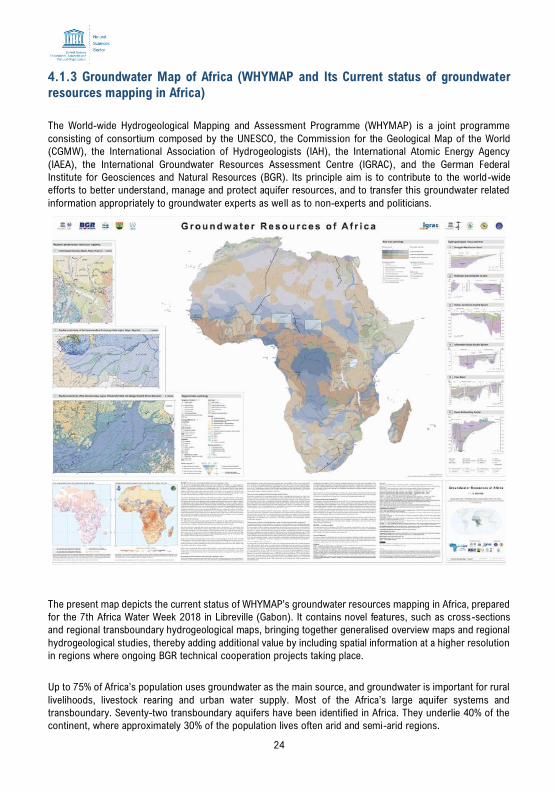
24
4.1.3 Groundwater Map of Africa (WHYMAP and Its Current status of groundwater
resources mapping in Africa)
The World-wide Hydrogeological Mapping and Assessment Programme (WHYMAP) is a joint programme
consisting of consortium composed by the UNESCO, the Commission for the Geological Map of the World
(CGMW), the International Association of Hydrogeologists (IAH), the International Atomic Energy Agency
(IAEA), the International Groundwater Resources Assessment Centre (IGRAC), and the German Federal
Institute for Geosciences and Natural Resources (BGR). Its principle aim is to contribute to the world-wide
efforts to better understand, manage and protect aquifer resources, and to transfer this groundwater related
information appropriately to groundwater experts as well as to non-experts and politicians.
The present map depicts the current status of WHYMAP’s groundwater resources mapping in Africa, prepared
for the 7th Africa Water Week 2018 in Libreville (Gabon). It contains novel features, such as cross-sections
and regional transboundary hydrogeological maps, bringing together generalised overview maps and regional
hydrogeological studies, thereby adding additional value by including spatial information at a higher resolution
in regions where ongoing BGR technical cooperation projects taking place.
Up to 75% of Africa’s population uses groundwater as the main source, and groundwater is important for rural
livelihoods, livestock rearing and urban water supply. Most of the Africa’s large aquifer systems and
transboundary. Seventy-two transboundary aquifers have been identified in Africa. They underlie 40% of the
continent, where approximately 30% of the population lives often arid and semi-arid regions.
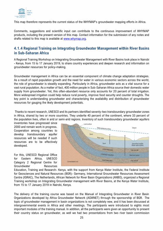
25
This map therefore represents the current status of the WHYMAP’s groundwater mapping efforts in Africa.
Comments, suggestions and scientific input can contribute to the continuous improvement of WHYMAP
products, including the present version of this map. Contact information for the submission of any notes and
drafts related to this map is available at www.whymap.org.
4.1.4 Regional Training on Integrating Groundwater Management within River Basins
in Sub-Saharan Africa
A Regional Training Workshop on Integrating Groundwater Management with River Basins took place in Nairobi
- Kenya, from 15 to 17 January 2019, to share country experiences and deepen research and information on
groundwater resources for policy-making.
Groundwater management in Africa can be an essential component of climate change adaptation strategies.
As a result of rapid population growth and the need for water in various economic sectors across the world,
the role of groundwater is steadily expanding. Particularly in Africa, groundwater acts as a vital source for a
vast rural population. As a matter of fact, 400 million people in Sub-Saharan Africa source their domestic water
supply from groundwater. Yet, this often-abundant resource only accounts for 20 percent of total irrigation.
More widespread irrigation could help reduce rural poverty, improve food security and counter droughts. The
key point is understanding groundwater and characterizing the availability and distribution of groundwater
resources for gauging the likely development potentials.
Thanks to recent research, UNESCO and its partners identified seventy-two transboundary groundwater zones
in Africa, shared by two or more countries. They underlie 40 percent of the continent, where 33 percent of
the population lives, often in arid or semi-arid regions. Inventory of such transboundary groundwater aquifers
inventories have progressed since
2000 and remain work in progress.
Cooperation among countries to
develop transboundary aquifer
resources will be needed if such
resources are to be effectively
developed.
For this, UNESCO Regional Office
for Eastern Africa, UNESCO
Category 2 Regional Centre for
Groundwater Resources
Education, Training and Research- Kenya, with the support from Kenya Water Institute, the Federal Institute
for Geosciences and Natural Resources (BGR)- Germany, International Groundwater Resources Assessment
Centre (IGRAC), The Netherlands, African Network for River Basin Organizations (ANBO), organized a Regional
Training workshop on Integrating Groundwater management with River Basins, at the Kenya Water Institute,
from 15 to 17 January 2019 in Nairobi, Kenya.
The delivery of the training course was based on the Manual of Integrating Groundwater in River Basin
Organizations developed by Africa Groundwater Network (AGWNET) through the sponsorship of BGR. The
topic of groundwater management in basin organizations is not completely new, and it has been discussed at
intergovernmental events in Africa and other meetings. The participants were introduced to eights most
important modules of the training manual. In addition, all the participants were given an opportunity to present
their country status on groundwater, as well we had two presentations from two river basin commission
26
introducing their basin authorities and activities related to groundwater. The resources persons brought
exercises on all the modules which was discussed during the training and participants were involved in solving
the problems brought out during the exercises. This training ensured that the knowledge at the technical level
is communicated upwards to decision makers and horizontally across sectors is essential for main-streaming
for any hydrogeological mapping and assessment of groundwater, and so any technical activity should go
hand-in-hand with institutional capacity development at the policy level.
On the side line of this training workshop, UNESCO Category 2 Centres: International Groundwater Resources
Assessment Centre (IGRAC), The Netherlands, the Regional Centre for Groundwater Resources Education,
Training and Research in Africa (RCGW), Kenya signed a formal Memorandum of Understating (MoU) in
expanding the cooperation on Groundwater research and capacity building activities. Both institutes agreed to
work jointly with UNESCO to generate further projects on groundwater resources and transboundary
groundwater mapping in Africa.
4.1.5 International Training on Ecohydrology in Tanzania
UNESCO Offices in Nairobi and Dar es Salaam jointly with IHP Secretariat in Paris supported UNESCO Chair in
Ecohydrology and Transboundary Water Management of Sokoine University of Agriculture in organising the
International Training on Ecohydrology at Solomon Mahlangu College of Science and Education (SMCoSE) in
Mazimbu, Morogoro, in Tanzania during 29th April to 3rd May 2019.
The beneficiaries of this training were BSc. and MSc holder in Environmental Sciences and Management,
Marine Biology & Limnology; Environmental Engineering, Forestry and Wildlife, Education (Geography / Biology
/ Mathematics) and those
with basic knowledge on
ecology/environmental
economics and/or water
related sciences.
The aim of training was to
equip trainees with detailed
knowledge, critical
understanding, strategies
and the tools required to take
an interdisciplinary approach
towards Ecohydrology, biotechnology practices and valuation of ecosystem services.
The training helped to equip trainees with knowledge on environmental and natural resource economics
applied in the valuation of ecosystem services and provide examples of Ecohydrological biotechnology
solutions implemented in practical case studies in other parts of the African Continent and Europe.
Trainees were also imparted with theoretical and methodological debates in Ecohydrology and environmental
conservation to better understand the complex emergence of water resources problems, ecosystem
degradation and their implications for human-nature relations and how to deal with them in practice for
ecological sustainability and societal needs.
A total number of twenty (20) trainees attended this training which include 10 female and male each and
instructors came from Portugal, Malaysia, Ethiopia and Tanzania.
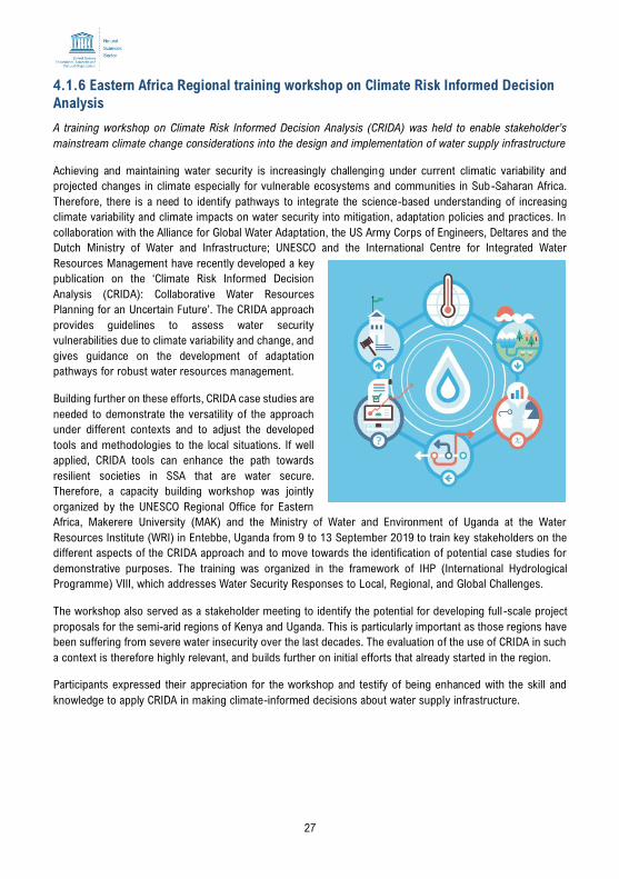
27
4.1.6 Eastern Africa Regional training workshop on Climate Risk Informed Decision
Analysis
A training workshop on Climate Risk Informed Decision Analysis (CRIDA) was held to enable stakeholder’s
mainstream climate change considerations into the design and implementation of water supply infrastructure
Achieving and maintaining water security is increasingly challenging under current climatic variability and
projected changes in climate especially for vulnerable ecosystems and communities in Sub-Saharan Africa.
Therefore, there is a need to identify pathways to integrate the science-based understanding of increasing
climate variability and climate impacts on water security into mitigation, adaptation policies and practices. In
collaboration with the Alliance for Global Water Adaptation, the US Army Corps of Engineers, Deltares and the
Dutch Ministry of Water and Infrastructure; UNESCO and the International Centre for Integrated Water
Resources Management have recently developed a key
publication on the ‘Climate Risk Informed Decision
Analysis (CRIDA): Collaborative Water Resources
Planning for an Uncertain Future’. The CRIDA approach
provides guidelines to assess water security
vulnerabilities due to climate variability and change, and
gives guidance on the development of adaptation
pathways for robust water resources management.
Building further on these efforts, CRIDA case studies are
needed to demonstrate the versatility of the approach
under different contexts and to adjust the developed
tools and methodologies to the local situations. If well
applied, CRIDA tools can enhance the path towards
resilient societies in SSA that are water secure.
Therefore, a capacity building workshop was jointly
organized by the UNESCO Regional Office for Eastern
Africa, Makerere University (MAK) and the Ministry of Water and Environment of Uganda at the Water
Resources Institute (WRI) in Entebbe, Uganda from 9 to 13 September 2019 to train key stakeholders on the
different aspects of the CRIDA approach and to move towards the identification of potential case studies for
demonstrative purposes. The training was organized in the framework of IHP (International Hydrological
Programme) VIII, which addresses Water Security Responses to Local, Regional, and Global Challenges.
The workshop also served as a stakeholder meeting to identify the potential for developing full -scale project
proposals for the semi-arid regions of Kenya and Uganda. This is particularly important as those regions have
been suffering from severe water insecurity over the last decades. The evaluation of the use of CRIDA in such
a context is therefore highly relevant, and builds further on initial efforts that already started in the region.
Participants expressed their appreciation for the workshop and testify of being enhanced with the skill and
knowledge to apply CRIDA in making climate-informed decisions about water supply infrastructure.
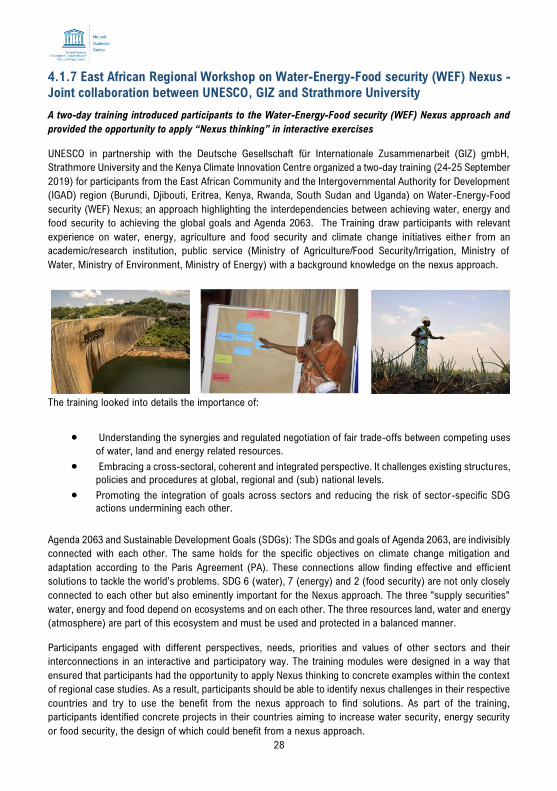
28
4.1.7 East African Regional Workshop on Water-Energy-Food security (WEF) Nexus -
Joint collaboration between UNESCO, GIZ and Strathmore University
A two-day training introduced participants to the Water-Energy-Food security (WEF) Nexus approach and
provided the opportunity to apply “Nexus thinking” in interactive exercises
UNESCO in partnership with the Deutsche Gesellschaft für Internationale Zusammenarbeit (GIZ) gmbH,
Strathmore University and the Kenya Climate Innovation Centre organized a two-day training (24-25 September
2019) for participants from the East African Community and the Intergovernmental Authority for Development
(IGAD) region (Burundi, Djibouti, Eritrea, Kenya, Rwanda, South Sudan and Uganda) on Water-Energy-Food
security (WEF) Nexus; an approach highlighting the interdependencies between achieving water, energy and
food security to achieving the global goals and Agenda 2063. The Training draw participants with relevant
experience on water, energy, agriculture and food security and climate change initiatives either from an
academic/research institution, public service (Ministry of Agriculture/Food Security/Irrigation, Ministry of
Water, Ministry of Environment, Ministry of Energy) with a background knowledge on the nexus approach.
The training looked into details the importance of:
• Understanding the synergies and regulated negotiation of fair trade-offs between competing uses
of water, land and energy related resources.
• Embracing a cross-sectoral, coherent and integrated perspective. It challenges existing structures,
policies and procedures at global, regional and (sub) national levels.
• Promoting the integration of goals across sectors and reducing the risk of sector-specific SDG
actions undermining each other.
Agenda 2063 and Sustainable Development Goals (SDGs): The SDGs and goals of Agenda 2063, are indivisibly
connected with each other. The same holds for the specific objectives on climate change mitigation and
adaptation according to the Paris Agreement (PA). These connections allow finding effective and effic ient
solutions to tackle the world’s problems. SDG 6 (water), 7 (energy) and 2 (food security) are not only closely
connected to each other but also eminently important for the Nexus approach. The three "supply securities"
water, energy and food depend on ecosystems and on each other. The three resources land, water and energy
(atmosphere) are part of this ecosystem and must be used and protected in a balanced manner.
Participants engaged with different perspectives, needs, priorities and values of other sectors and their
interconnections in an interactive and participatory way. The training modules were designed in a way that
ensured that participants had the opportunity to apply Nexus thinking to concrete examples within the context
of regional case studies. As a result, participants should be able to identify nexus challenges in their respective
countries and try to use the benefit from the nexus approach to find solutions. As part of the training,
participants identified concrete projects in their countries aiming to increase water security, energy security
or food security, the design of which could benefit from a nexus approach.
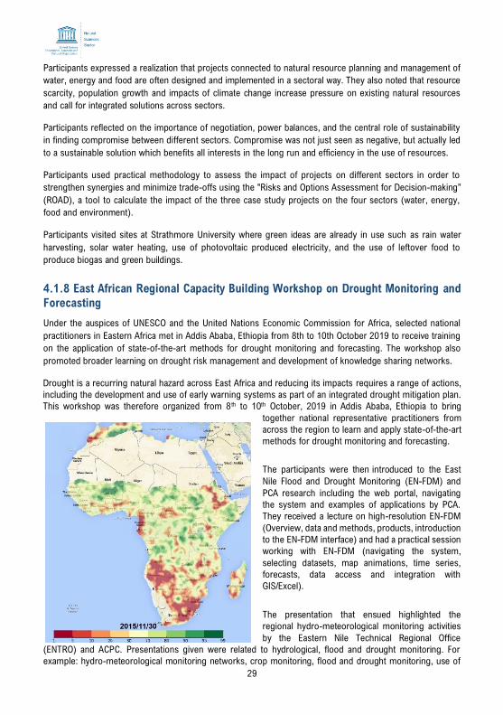
29
Participants expressed a realization that projects connected to natural resource planning and management of
water, energy and food are often designed and implemented in a sectoral way. They also noted that resource
scarcity, population growth and impacts of climate change increase pressure on existing natural resources
and call for integrated solutions across sectors.
Participants reflected on the importance of negotiation, power balances, and the central role of sustainability
in finding compromise between different sectors. Compromise was not just seen as negative, but actually led
to a sustainable solution which benefits all interests in the long run and efficiency in the use of resources.
Participants used practical methodology to assess the impact of projects on different sectors in order to
strengthen synergies and minimize trade-offs using the "Risks and Options Assessment for Decision-making”
(ROAD), a tool to calculate the impact of the three case study projects on the four sectors (water, energy,
food and environment).
Participants visited sites at Strathmore University where green ideas are already in use such as rain water
harvesting, solar water heating, use of photovoltaic produced electricity, and the use of leftover food to
produce biogas and green buildings.
4.1.8 East African Regional Capacity Building Workshop on Drought Monitoring and
Forecasting
Under the auspices of UNESCO and the United Nations Economic Commission for Africa, selected national
practitioners in Eastern Africa met in Addis Ababa, Ethiopia from 8th to 10th October 2019 to receive training
on the application of state-of-the-art methods for drought monitoring and forecasting. The workshop also
promoted broader learning on drought risk management and development of knowledge sharing networks.
Drought is a recurring natural hazard across East Africa and reducing its impacts requires a range of actions,
including the development and use of early warning systems as part of an integrated drought mitigation plan.
This workshop was therefore organized from 8 th to 10th October, 2019 in Addis Ababa, Ethiopia to bring
together national representative practitioners from
across the region to learn and apply state-of-the-art
methods for drought monitoring and forecasting.
The participants were then introduced to the East
Nile Flood and Drought Monitoring (EN-FDM) and
PCA research including the web portal, navigating
the system and examples of applications by PCA.
They received a lecture on high-resolution EN-FDM
(Overview, data and methods, products, introduction
to the EN-FDM interface) and had a practical session
working with EN-FDM (navigating the system,
selecting datasets, map animations, time series,
forecasts, data access and integration with
GIS/Excel).
The presentation that ensued highlighted the
regional hydro-meteorological monitoring activities
by the Eastern Nile Technical Regional Office
(ENTRO) and ACPC. Presentations given were related to hydrological, flood and drought monitoring. For
example: hydro-meteorological monitoring networks, crop monitoring, flood and drought monitoring, use of
30
short-term and seasonal forecasts, data sources, etc. What data are used for monitoring? What long-term
climate data exist? How are they collected and how are they used?
The final presentation of the session introduced to Soil Moisture (SM) Remote Sensing (RS) through a lecture
covering definitions, sensors, retrieval methods, data products and uses, limitations. This was followed by a
practical session involving: working with remote sensing platforms to collate soil moisture data [Downloading
and processing SM data, basic analyses].
Participants received training on the African Flood and Drought Monitor (AFDM). The AFDM is a powerful and
versatile web-based tool that can monitor and predict periods of flooding and drought by providing up-to-date
data for more than 20 different meteorological and hydrological variables, as well as allowing the user to
visualize and download region-specific data.
In addition, they were introduced to Water Balance (WB) Application through a lecture covering: definitions,
WB calculations with RS, uncertainties; and practical on estimating the water balance (Simple analyses of the
water balance, estimating potential recharge, comparing dry and wet years).
This was followed by a lecture on Drought Analysis (covering concepts and methods, drought terminology,
characteristics, indices, drought risk, drought monitoring) and went through a practical session on conducting
drought analysis with the EN-FDM (i.e. drought identification, working with multiple data products and indices,
estimating impact on agriculture).
Finally, the participants worked in groups implementing workshop learning for case study catchment (i.e.
extract EN-FDM time series for catchments, drought analysis in Excel, compare with spatial data).
Participants continued to work in groups implementing workshop learning for case study catchment (i.e.
extract EN-FDM time series for catchments, drought analysis in Excel, compare with spatial data). There
were discussions on the utility and appropriateness of the system to water resources management and early
warning in the region. Can it be used to provide useful warning on drought conditions? How does it interface
with existing methods? Quick survey of expectations before the workshop started, and whether these were
met afterwards.
Participants discussed what improvements were needed to be made to the system (upgrades, missing
processes, data sources, forecasting). Other interesting matters arising included:
• Possible development of new products and training for future editions.
• System updates on site or at PCA?
• How do monitor users wish to communicate with Princeton?
• Approaches for incorporating validation/observations in the system?
4.1.9 Mobile applications launched to promote rainwater harvesting and water
education in Africa
Two mobile applications – ‘Rainwater harvesting for Africa’ and ‘Know water’ developed under the
International Hydrological Programme (IHP) of UNESCO in collaboration with various organizations were
launched during the Seventh IHP Africa Steering Committee meeting in Praia, Cape Verde on 1 st October
31
2019 to foster large-scale adoption of rainwater harvesting and improve knowledge on water use among
high school students.
Africa has a combined population of over 1 billion people and represents about 16% of the global population.
Its water resources are estimated to be nearly 9% of the world’s freshwater resources. However, these
resources are unevenly distributed, with the six most water-rich countries in Central and Western Africa
holding 54% of the continent’s total resources and the 27 most water-poor countries holding only 7%.
Sustainable socioeconomic progress is therefore seldom possible without adequate development of water
resources to support food production, industry, the environment and other human needs. In Africa, the uneven
and unpredictable nature of water resources and climate change has determined the human condition and
lifestyles of nomadism, migrations and displacement of people. Under the current realities of climate change
and rising population in Africa, the need to adopt climate-smart solutions and sustainable water resources
management practices is more crucial and urgent.
In response to this, the African Water Vision for 2025 outlines a number of innovative approaches to develop
the full potential of Africa’s water resources for sustainable growth in the region’s economic and social
development. Rainwater harvesting (RWH) and water education form a major component of this vision. In this
vein, UNESCO in partnership with various stakeholders developed a smart phone application for RWH and
water education to promote large-scale adoption of RWH in local climate change adaptation programmes and
strategies and improve water knowledge among high school students.
The RWH App is currently available on android. UNESCO is working on an iOS version of the RWH App. There
is also a dedicated website for it. This smartphone application is available in three languages:
English/French/Swahili. This application contains rainwater calculator, where anyone can calculate how much
water they can harvest in a given geographical location in an interactive mode by providing the necessary
details. This application has more than 3500 rainfall records from all countries in Africa. Moreover, UNESCO
produced advocacy videos (on 14 different topics) in animation format. The calculator works offline but the
videos need internet connection.
The Know Water App is on both Android and iOS versions. It has four levels with 25 questions per leve l
designed to enable edutainment for high school students and interest groups.
4.1.10 Groundwater National Training Rwanda
The Rwanda National Commission for UNESCO in partnership with the UNESCO Regional Office for Eastern
Africa, Rwanda National Committee for the Intergovernmental Hydrological Program organized an intensive
training workshop programme on integrated groundwater resources management. The training brought
together thrity delegates (20 Women and 10 Men) from NGOs, academia, private and public institution and
took place at University of Rwanda (UR), Huye Campus on December 11 th -13th, 2019.
The objective of this training was to provide hands-on training on hydrology and groundwater in order to
enhance the technical capacity of the participants from different sectors on the concepts and best practices
learned from UNESCO trainings. Prof. Philip Cotton, the vice-chancellor of the University of Rwanda (UR)
emphasized that people must know their relationship with the environment and therefore encouraged trainees
to bring positive changes, join forces and knowledge to preserve and protect biodiversity and adequate water
management.
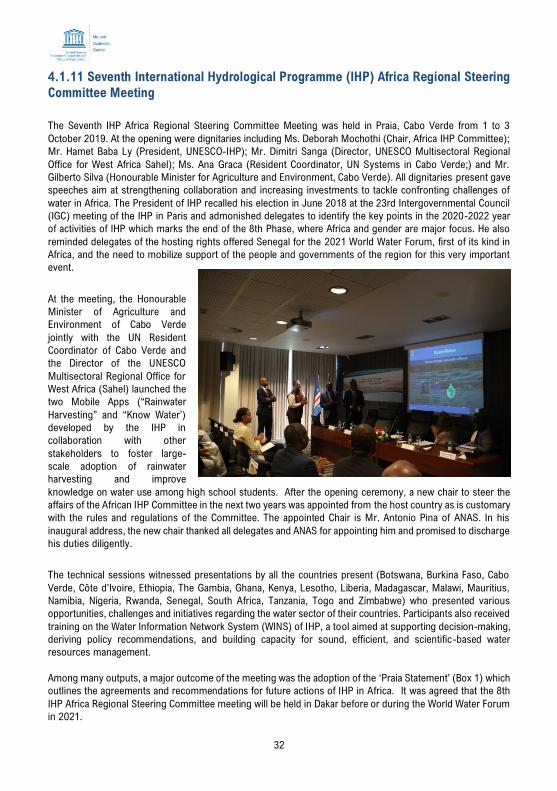
32
4.1.11 Seventh International Hydrological Programme (IHP) Africa Regional Steering
Committee Meeting
The Seventh IHP Africa Regional Steering Committee Meeting was held in Praia, Cabo Verde from 1 to 3
October 2019. At the opening were dignitaries including Ms. Deborah Mochothi (Chair, Africa IHP Committee);
Mr. Hamet Baba Ly (President, UNESCO-IHP); Mr. Dimitri Sanga (Director, UNESCO Multisectoral Regional
Office for West Africa Sahel); Ms. Ana Graca (Resident Coordinator, UN Systems in Cabo Verde;) and Mr.
Gilberto Silva (Honourable Minister for Agriculture and Environment, Cabo Verde). All dignitaries present gave
speeches aim at strengthening collaboration and increasing investments to tackle confronting challenges of
water in Africa. The President of IHP recalled his election in June 2018 at the 23rd Intergovernmental Council
(IGC) meeting of the IHP in Paris and admonished delegates to identify the key points in the 2020-2022 year
of activities of IHP which marks the end of the 8th Phase, where Africa and gender are major focus. He also
reminded delegates of the hosting rights offered Senegal for the 2021 World Water Forum, first of its kind in
Africa, and the need to mobilize support of the people and governments of the region for this very important
event.
At the meeting, the Honourable
Minister of Agriculture and
Environment of Cabo Verde
jointly with the UN Resident
Coordinator of Cabo Verde and
the Director of the UNESCO
Multisectoral Regional Office for
West Africa (Sahel) launched the
two Mobile Apps (“Rainwater
Harvesting” and “Know Water’)
developed by the IHP in
collaboration with other
stakeholders to foster large-
scale adoption of rainwater
harvesting and improve
knowledge on water use among high school students. After the opening ceremony, a new chair to steer the
affairs of the African IHP Committee in the next two years was appointed from the host country as is customary
with the rules and regulations of the Committee. The appointed Chair is Mr. Antonio Pina of ANAS. In his
inaugural address, the new chair thanked all delegates and ANAS for appointing him and promised to discharge
his duties diligently.
The technical sessions witnessed presentations by all the countries present (Botswana, Burkina Faso, Cabo
Verde, Côte d'Ivoire, Ethiopia, The Gambia, Ghana, Kenya, Lesotho, Liberia, Madagascar, Malawi, Mauritius,
Namibia, Nigeria, Rwanda, Senegal, South Africa, Tanzania, Togo and Zimbabwe) who presented various
opportunities, challenges and initiatives regarding the water sector of their countries. Participants also received
training on the Water Information Network System (WINS) of IHP, a tool aimed at supporting decision-making,
deriving policy recommendations, and building capacity for sound, efficient, and scientific-based water
resources management.
Among many outputs, a major outcome of the meeting was the adoption of the ‘Praia Statement’ (Box 1) which
outlines the agreements and recommendations for future actions of IHP in Africa. It was agreed that the 8th
IHP Africa Regional Steering Committee meeting will be held in Dakar before or during the World Water Forum
in 2021.
33
Box 1: Praia Statement - The 7th IHP Africa Regional Steering Committee Meeting, BAI Center,
Praia, Cabo Verde, 1-3 October 2019 In Praia, 60 (30 Cabo Verde and 30 International) representatives of the International Hydrological Programme (IHP) National
Committees, focal points and observers from Sub-Saharan African Countries as well as various experts from the Government of
Cabo Verde and representatives of UNESCO Offices (Dakar, Nairobi, IHP Secretariat, and Bamako) met, discussed on IHP activities
under 2017-2019, proposals and priorities for 2020-2021 and proposed IHP IX themes. The country representatives presented
country reports. The Honorable Minister for Agriculture and Environment, Mr. Gilberto Silva launched two smartphone applications
(Know Water and Rainwater Harvesting for Africa) developed by UNESCO Secretariat. Discussions were held on IHP Phase IX and
demonstration of the Water Information Network System (WINS) of the IHP and changes in the constitutions etc.
Resulting from an intensive and interactive process, the participants:
Extended special thanks and appreciation to the host of the meeting, the Government and people of Cabo Verde; they also extended
their appreciation to the Ministry of Agriculture and Environment of Cabo Verde for its logistical support in hosting the meeting.
Underlined the urgent need for knowledge exchange and transfer of information as well as the sharing of experiences on Water
Resources Management among member countries through their National Committees, relevant national partners, and water
resource managers through exchange of experiences;
Supported the idea of:
• establishing National IHP Committees in countries where they do not exist;
• each National IHP Committee developing their own operating strategies outlining visions, objectives, institutional
representation, partnership, resource mobilization strategies, definition of programmatic areas in relation to national and
regional priorities, communication and visibility, knowledge and information sharing etc.;
• each National IHP Committee improving linkage with National Commissions for UNESCO (NATCOM) through clear
Memorandum of Understanding;
• improving South-south cooperation and developing joint projects;
• develop a platform for knowledge sharing and learning; and
• each National IHP Committee improving communication and visibility of their activities through the development of
communication tools/platforms. E.g. brochures/newsletters, dedicated websites if possible, social media page (Facebook,
Twitter, WhatsApp); policy briefs, working papers, Info Notes, blogs etc.
Called upon the IHP Secretariat to enhance its technical support to the member states in establishing IHP National Committees and
step up efforts to ensure periodic monitoring and evaluation;
Called upon the IHP National Committees and Secretariat to further strengthen its partnership with other related bilateral and
multilateral organizations and institutions in the fields of water resources management and sustainable development in order to
explore the possibility of regional projects and technical cooperation;
Called upon governments of member states to support their IHP National Committees and adequately fund them to meet
international obligations.
Called upon the IHP Secretariat, Paris to mobilize additional funding for capacity building workshops, network meetings and other
activities of IHP from all member countries, private sector and development partners;
Committed Member States to develop and enhance sub-regional transboundary cooperation among each other on surface and
ground water management;
Agreed to encourage greater participation of water resource managers and gender and youth mainstreaming in IHP National
Committee meetings;
Venue of 8th IHP Africa Steering Committee meeting:
It was decided that the next IHP Africa Steering Committee meeting will be held in Dakar during 2021 along with the World Water
Forum.
There has been a request from the members to IHP Secretariat to update regularly a list of events related to water resources
management and other main priorities of IHP and circulate to all members and experts in Africa on regular basis.
All the IHP National Committees are requested to provide the details of their activities to Regional Offices and IHP Secretar iat in
order to share with all other IHP National Committees.
Thursday, 3 October 2019
34
4.2. Lessons Learned
In relation to the activities and achievements, the key lessons learned are:
• About 75% of the African population relies on groundwater as its major source of drinking water. More
quantitative information regarding groundwater flow and storage is needed. Understanding the flow and
storage properties of groundwater in various aquifer systems is key to their sustainable development
and management. Groundwater monitoring systems should be established or expanded at country
and basin scales to assess how groundwater responds to abstraction and climate variability.
• With 90 percent of water in Africa falling within 63 international river basin catchments crossed by
multiple borders, water management in the region is inherently an international and cooperative
endeavour. Transboundary cooperation in water management is proved to be critical
• Even though Africa is the least emitter of greenhouse gases, it is worst impacted by climate change
mainly in water resources with recurrent flood and drought, changed rainfall distribution and drying-up
of rivers. These effects have devastating impacts on ecosystems and communities, ranging from
economic and social impacts to health and food insecurity. The improved estimation of rainfall and
weather patterns along with Climate Risk Informed Decision Analysis would prove to be essential for
Africa. The need to concentrate a lot of actions in IGAD countries and South Sudan particularly for the
execution of a rapid integrated assessment of water resources to define entry points for designing
interventions that deliver sustainable solutions for the management of water resources
• The urgent need for knowledge exchange and transfer of information as well as the sharing of
experiences on Water Resources Management among IHP member countries through their National
Committees, relevant national partners, and water resource managers through exchange of experiences;
• the need to ensure IHP committees improve communication and visibility of activities through the
development of communication tools/platforms. E.g. brochures/newsletters, dedicated websites if
possible, social media page (Facebook, Twitter; WhatsApp); policy briefs, working papers, Info Notes,
blogs etc.
4.2 Challenges
Whereas the International Hydrological Programme has recorded significant achievements in the region, there
are a couple of challenges that require to be resolved.
First, the importance of proper education and training in the field of groundwater hydrology is currently not
well embraced in the region’s academic institutions. For instance, fundamental courses on groundwater
quantity, quality and modelling are not offered at undergraduate or postgraduate levels in many
universities/institutes. It is therefore imperative that water managers, planners/decision makers, and local and
regional governments get empowered through continuous training to effectively address their regions’
groundwater needs.
Secondly, is the absence of long-term operational plans for groundwater development and management within
individual countries. The existing plans, if any, are mostly short-sighted and ad hoc in nature. Moreover,
scientifically sound, well-defined and action-oriented policies for the sustainable utilization of groundwater
resources are lacking in the region.
Although the IHP has continued to actively integrated the theme of climate change adaptation to its specific
projects / activities, much is still required to empower the member countries in reducing vulnerabilities and
building resilience. Most notably, climate adaptation planning is lacking at subnational levels. This is evident
since the capacity of sub-national governments to identify, prioritize, mainstream and implement adaptation
35
actions appears to be limited. Particularly in countries where decentralization is underway, more effort is
needed to enhance the ability of sub-national governments, communities and local institutions to take on their
devolved responsibilities. In other countries, greater emphasis may be placed on clarifying the roles and
responsibilities of different levels of government and establishing effective institutional arrangements.
Finally, there is an absence of monitoring and evaluation (M&E) systems within most countries in the
region. Presence of these systems would be vital in providing a platform to assess the effectiveness of current
investments in adaptation action by development partners. In addition, comprehensive M&E plans would be
handy in tracking progress in implementing adaptation policies, plans and programs and identifying gaps and
areas for improvement.
4.3 Opportunities
Whereas current decision-making processes, at both regional as well as national level, are inadequate in
managing the limited water resources, responding to climate change presents an opportunity to do things
differently. As such, there is a clear need for the IHP to continue organizing climate change adaptation-oriented
training courses for decision-makers and personnel involved in management of water resources. It is further
important to supporting member states in developing research, responsive tools and policy capacity to
increase climate change preparedness have positive impacts on management of hydrological resources in
general.
Lastly, significant investment is needed to establish, manage and utilize monitoring and evaluation systems.
This presents an opportunity for continued and intensified partnership between development assistance
agencies and the individual countries through the IHP programme.
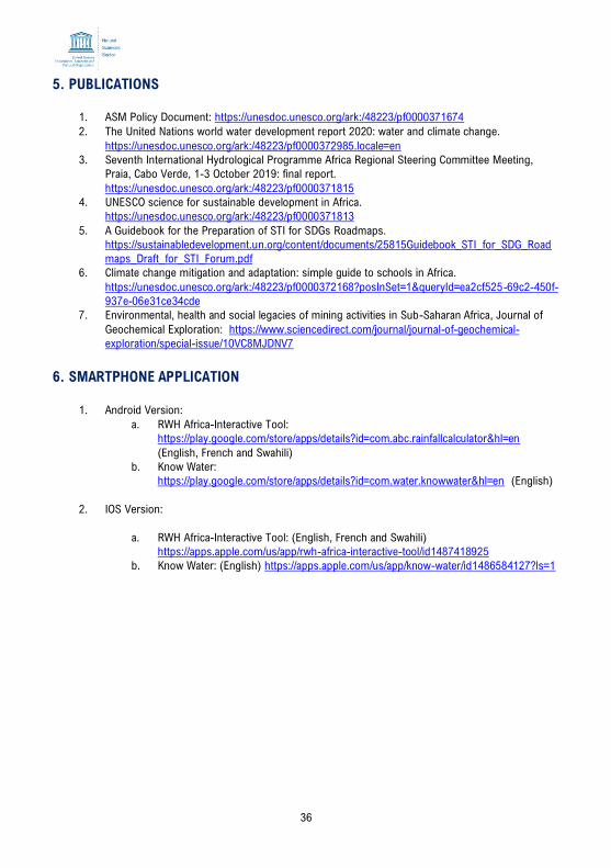
36
5. PUBLICATIONS
1. ASM Policy Document: https://unesdoc.unesco.org/ark:/48223/pf0000371674 2. The United Nations world water development report 2020: water and climate change.
https://unesdoc.unesco.org/ark:/48223/pf0000372985.locale=en
3. Seventh International Hydrological Programme Africa Regional Steering Committee Meeting,
Praia, Cabo Verde, 1-3 October 2019: final report.
https://unesdoc.unesco.org/ark:/48223/pf0000371815
4. UNESCO science for sustainable development in Africa.
https://unesdoc.unesco.org/ark:/48223/pf0000371813
5. A Guidebook for the Preparation of STI for SDGs Roadmaps.
https://sustainabledevelopment.un.org/content/documents/25815Guidebook_STI_for_SDG_Road
maps_Draft_for_STI_Forum.pdf
6. Climate change mitigation and adaptation: simple guide to schools in Africa.
https://unesdoc.unesco.org/ark:/48223/pf0000372168?posInSet=1&queryId=ea2cf525-69c2-450f-
937e-06e31ce34cde
7. Environmental, health and social legacies of mining activities in Sub-Saharan Africa, Journal of
Geochemical Exploration: https://www.sciencedirect.com/journal/journal-of-geochemical-
exploration/special-issue/10VC8MJDNV7
6. SMARTPHONE APPLICATION
1. Android Version:
a. RWH Africa-Interactive Tool:
https://play.google.com/store/apps/details?id=com.abc.rainfallcalculator&hl=en
(English, French and Swahili)
b. Know Water:
https://play.google.com/store/apps/details?id=com.water.knowwater&hl=en (English)
2. IOS Version:
a. RWH Africa-Interactive Tool: (English, French and Swahili)
https://apps.apple.com/us/app/rwh-africa-interactive-tool/id1487418925
b. Know Water: (English) https://apps.apple.com/us/app/know-water/id1486584127?ls=1
37
Natural Sciences Sector
UNESCO Regional Office for Eastern Africa
UN Gigiri Complex, P.O. Box 30592 – 00100,
Nairobi, Kenya
Tel: +254-(0)20-7622356; Email: [email protected]
https://en.unesco.org/node/315264


